High pressure close by means it will be mostly dry this week, though some northern and eastern areas may catch a shower. Chilly next few days, but the weekend looks to warm up.
Most places will see little or no rain for the rest of this week, thanks to high pressure in charge. The exception will be parts of Scotland, the northwest and eastern coasts further south – where we could see a few showers moving south over the next few days. It’s been a cold start to the week, thanks to unseasonably cold arctic air sweeping south, with temperatures yesterday and the next few days below the average for May with the flow still from the north, with a risk of overnight frost possible in places. Temperatures will recover by the end of the week and into the weekend, as we lose the chilly northerly flow and, away from northern Scotland, remaining mostly dry too until early next week at least.
For now, Tuesday’s got off to a cold start across many areas, some northern and western areas started with an early frost too. Most places are dry and bright or sunny too, blue skies across the southern half of Britain. There is more in the way of cloud spilling down across the north and this is bringing some rain and sleet into the north of Scotland, while further south some showers across Northern Ireland, NW England, SW and eastern Scotland.
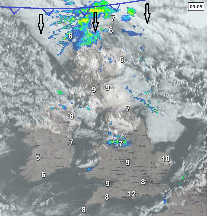
Parts of the northwest, north Wales and North Sea coastal areas will see scattered showers spread south through the morning, but much of the UK will stay dry and bright, after the blue skies to start in the south more in the way of cloud spreading down from the north by late morning.
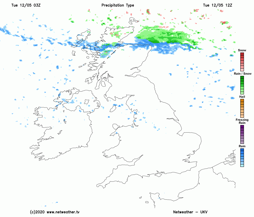
A band of rain, sleet and hill snow along a cold will arrive across north of Scotland this morning, before spreading south across Scotland during the afternoon. Even colder air following the cold front with brighter skies but also some wintry showers following. Afternoon highs in Aberdeen and Inverness reaching 5-7C at best. South of the rain and hill snow band moving south, variable amounts of cloud spilling south across Britain, giving a few showers in the west, some sunny spells for many but not the blue skies like this morning in the south. Afternoon highs reaching 11-13C, below average for early May, but with lighter winds than yesterday, it will feel a little warmer in the sun.
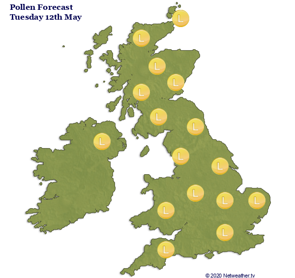
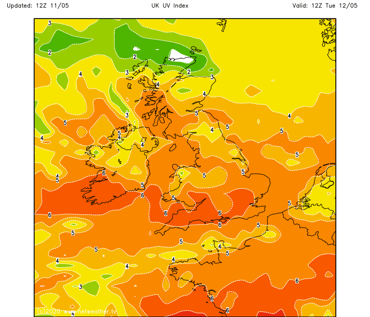
The colder air mean pollen levels won’t be so high, but don’t be fooled by the chilly air, the sun is strong now, so UV levels will be high in the south in the sun, even though it’s not warm.
A band of rain and hill sleet will continue south across northern, central and eastern England tonight, but fizzling out by the time it reaches SE England. A few wintry showers following across the northeast and maybe the odd shower near Irish Sea coasts, otherwise another cold and dry night under clearing skies, a rural frost developing in places inland – more particularly in sheltered northern and western areas.
.png)
Another chilly day on Wednesday, if anything, a little colder than today in the north and east thanks to a brisk northerly breeze – which will push in a few showers across eastern areas of England. Otherwise most places dry and bright or sunny with areas of cloud spreading south. The southwest seeing the highest temperatures, reaching 15C in Plymouth and Cardiff, elsewhere reaching 11-13C, but along eastern coastal areas reaching 7-10C at best thanks to a brisk northerly wind here.
As we head towards the end of the week, high pressure close to the west will keep much of the UK and Ireland dry and settled on Thursday and Friday – with variable amounts of cloud and some sunny spells. However, tighter isobars across the far north will bring a keen northwesterly breeze across Scotland – which will feed in more in the way of cloud and some showers at times off the Atlantic. Temperatures recovering into the mid teens on Friday for many will mean it least it will feel that bit warmer.
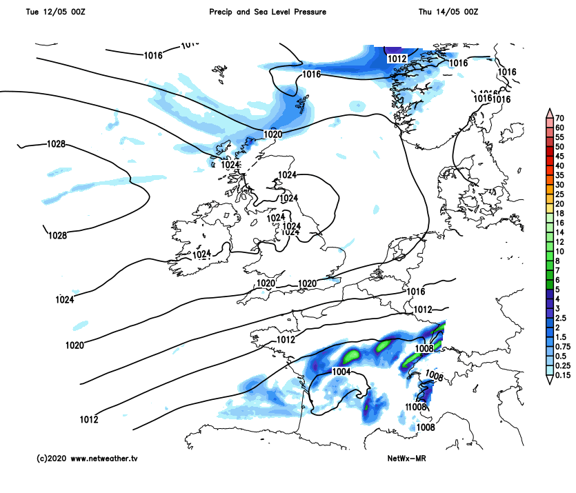
Staying mostly dry for England and Wales over the weekend, thanks to high pressure across the south, while turning a little warmer too, perhaps reaching the low 20s Celsius in places. Cloudier and breezier across Scotland and Northern Ireland, with some patchy rain or showers moving through at times.