Saturday mostly warm & sunny again, turning cooler from the north Sunday, with showers for central and northern areas. Cooler and unsettled for all next week, as low pressure takes over.
Friday saw another warm, dry and sunny day for most, top temperature of 23.2C at Porthmadog in Wales and N. Ireland saw its warmest day of the year so far – with Castlederg reaching 21.5C. Saturday will be another warm day away from the far north, dry and sunny for many. We will see a slow change from Sunday though, as a cold front slides southeast, bringing cooler conditions and showers across central and northern areas, warm sunshine still hanging on towards the southeast. But on Monday it will be cooler across most parts, with cloudier skies across the south, rain arriving across the south later in the day spreading across much of England and Wales on Tuesday, followed by further rain across most parts on Wednesday. So turning increasingly unsettled, cooler and breezier to end April, as low pressure takes over.
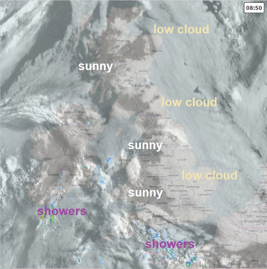
For now, it’s a grey and misty start to the weekend across eastern areas of Britain, thanks to an extensive bank of low cloud rolling west off the North Sea overnight. It’s been a sunnier start across the west and the low cloud in the east will burn back to North Sea coasts through the morning, leaving most areas to enjoy a sunny afternoon, though there will be more in the way of cloud than recently spilling across SW England and Wales – threatening to bring a few showers. Becoming cloudier with a few showers in the far northwest of Scotland later too. Staying dull and misty along eastern coasts.
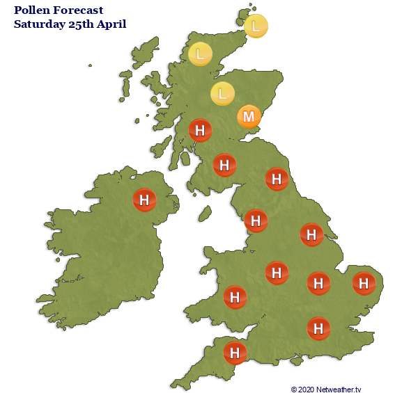
Another warm day generally, particularly with sunshine, temperatures reaching 18-20C inland across England, Wales, N. Ireland and the southern Scotland. Cooler around coasts – with high of 14-17C, the northern half of Scotland cooler still – reaching 12C at best. Pollen levels high from trees across much of England, Wales, N. Ireland and southern Scotland.
Mostly dry tonight, though cloudier with scattered showers for Wales and N. Ireland – perhaps drifting further east across parts of NW England and the north Midlands. Cloudier skies moving across northern Scotland – bringing a few showers. Southern Scotland along with much of southern and eastern England dry with clear skies – turning chilly towards the southeast, perhaps cold enough for a touch of frost in rural areas.
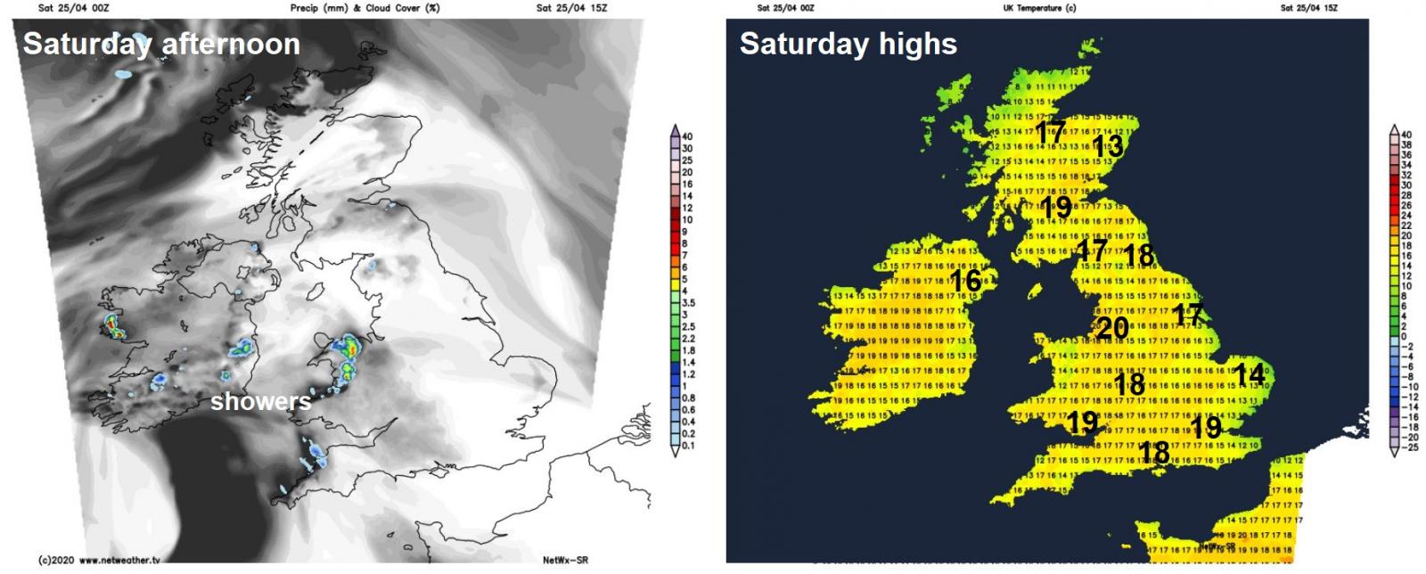
A cold front will slide southeast across the north during Sunday morning to lie across northern England and Ireland by early afternoon. This front will bring more in the way of cloud and some showers southeastwards across N. Ireland, Wales, Midlands and northern England – showers becoming locally heavy, with the odd rumble of thunder, in the afternoon. Drier and sunnier across southern and SE England along with East Anglia, also southern Scotland. Heavy showers with hail and thunder spreading in across northern Scotland. Warm across southern, central and eastern England – temperatures reaching 18-22C. Cold front introducing cooler air further north and west – with temperatures reaching 10-16C.
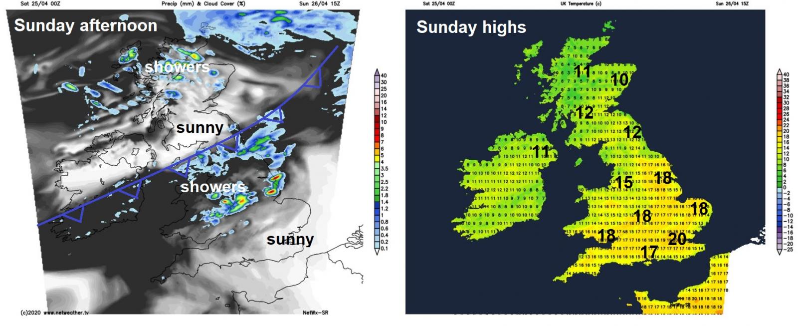
The cold front will slowly drift towards southern England on Monday, bringing a cloudy day across much of Wales, central, southern and eastern England – with the odd burst of rain or drizzle. Some warm sunny spells possible in the southeast though. An area of low pressure drifting in towards the southwest bringing outbreaks of heavier rain up from the southwest across southern England during the evening. Scotland, N. Ireland and northern England having a brighter and cooler day with a northerly breeze, further showers for northern Scotland, perhaps a few reaching the south. Warmth hanging on in the southeast -where some sunshine is possible with temperatures reaching 21C in London, otherwise a generally cooler day, temperatures reaching the low to mid-teens, perhaps high teens towards the south.
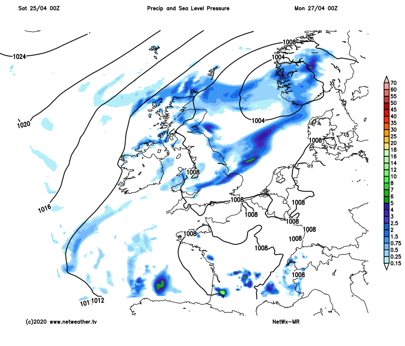
Turning cooler, breezier and more unsettled across all parts as we head deeper into next week, as high pressure that’s loitered and brought dry and fine weather for much of this month retreats and allows a succession of Atlantic low pressure systems to move in. Outbreaks of rain, locally heavy, spreading northeast across England and Wales on Tuesday. Drier and brighter with a few showers across Scotland and N. Ireland. Further outbreaks of rain, heavy at times, spreading northeast across most parts on Wednesday, windier too, followed by brighter weather but with showers on Thursday and Friday.