More dry weather and sunshine this week with high pressure nearby. The brisk east wind will continue to make it feel chilly but that eases midweek with changes for the weekend.
More dry, settled weather on the way this week. More sunshine still with a nippy easterly wind keeping temperatures low for eastern Britain with higher values in the west. On Sunday, Wester Ross in the NW Highlands saw the top temperature of 19.7C with Gosport in Hampshire not far behind at 19.5C
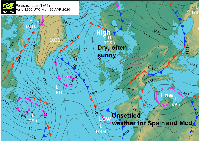
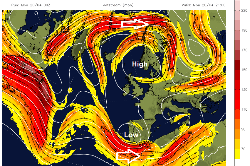
It’s Monday, ‘back to school’ for many, online. That edge to the wind continues. The bright sunshine can be deceiving. High pressure over Scandinavia has settled in and is blocking most of the Atlantic weather. The Jetstream has split far north with a huge meander and another portion stays well to the south of the UK enabling low pressures over Iberia and the Mediterranean. The weather for Portugal, Spain, S.France and Italy has been more unsettled
The easterly wind will be moderate to fresh today so quite a feature of the weather for Monday. There will be brisk winds through the English Channel with a bit more cloud extending from northern France to Cornwall. There will be a fresh NE wind for the Channel Islands and a small chance of a shower here later today. Temperatures for the UK will be around 15C. 11 or 12C for the east coast and parts of southern England up to 18 or 19C.

Again, there could be a touch of frost inland for NE Scotland with lighter winds and clear skies. At the other end of Britain, there will be more cloud and just the odd passing shower, but the dry theme dominates. You can see the line of cloud to the SW of the radar and visible satellite picture, that will bring the odd shower later.
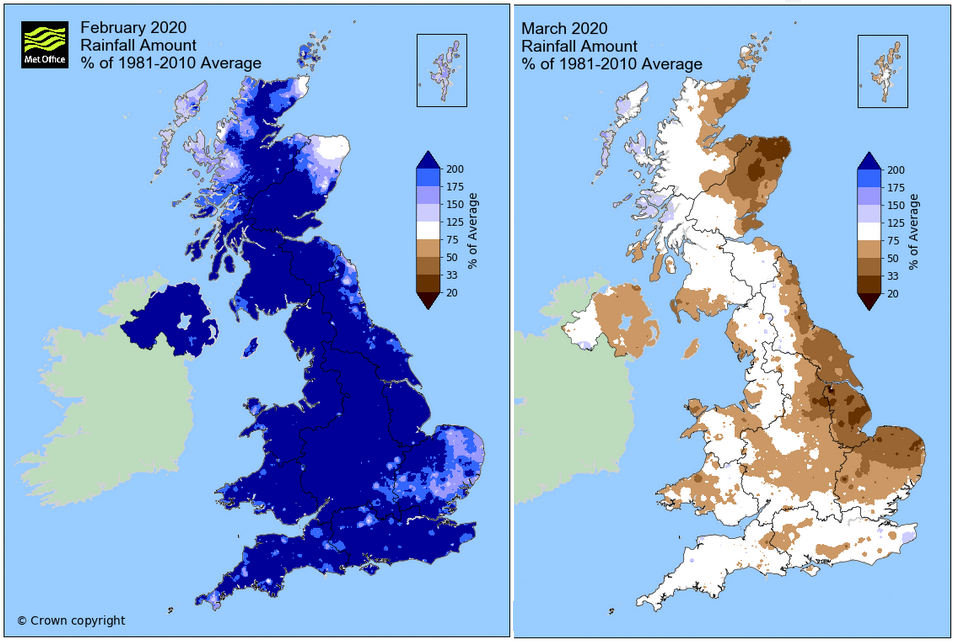
What a change from autumn and February, when there was seemingly never-ending rain and widespread flooding. Now the ground is drier, and gardeners are watering daily as the warm sunshine continues. For daily exercise, a mixture of sunglasses and jumper or coat is needed. Don’t forget your sunscreen once you’ve got your Vitamin D.
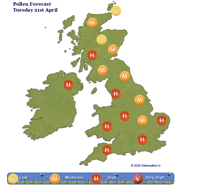
Tuesday will be similar, again the brisk nippy east wind with lee gusts for Wales and NW England. A small chance of a shower clipping Cornwall again but overall, it will be another dry, fine, sunny day. Tree pollen is high in places, responding to the warm sunshine.
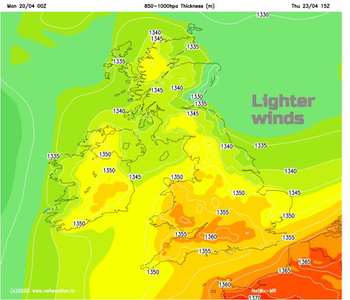
During Tuesday night a bit more cloud will flow in off the North Sea for northern Britain. As the low pressures in the Mediterranean shift, the winds ease slightly underneath the high over northern Europe. Through Wednesday temperatures lift a bit too, more areas in the high teens, even low twenties, although still cool for North Sea coasts.
By Thursday the winds will be light, and it will feel warmer for more of the UK, without that chilly breeze. There will be a little mist and fog early on.
There are signs of a shift on Friday, finally a westerly wind, although moving a high can often take a day or two extra. Still, light winds as the UK will be in a col, the area in between the main low and high pressures. This would make a lot of difference to eastern Scotland, NE and eastern England, East Anglia, Essex and Kent because this week’s nippy breeze will be frustrating as it lingers.
This gradual change means that the weekend looks more unsettled, with more cloud and a few showers. A west to SW wind, less sunshine and temperatures in the mid-teens. There might by Sunday be some rain in the north if a low pressure does manage to push in off the Atlantic.