


With high pressure close to the north of the UK over the next few days, most of the weather action is going to be further south, with low pressure getting involved and bringing some outbreaks of heavy, thundery rain.
With high pressure close to the north of the UK over the next few days, most of the weather action is going to be further south, with low pressure getting involved and bringing some outbreaks of heavy, thundery rain.
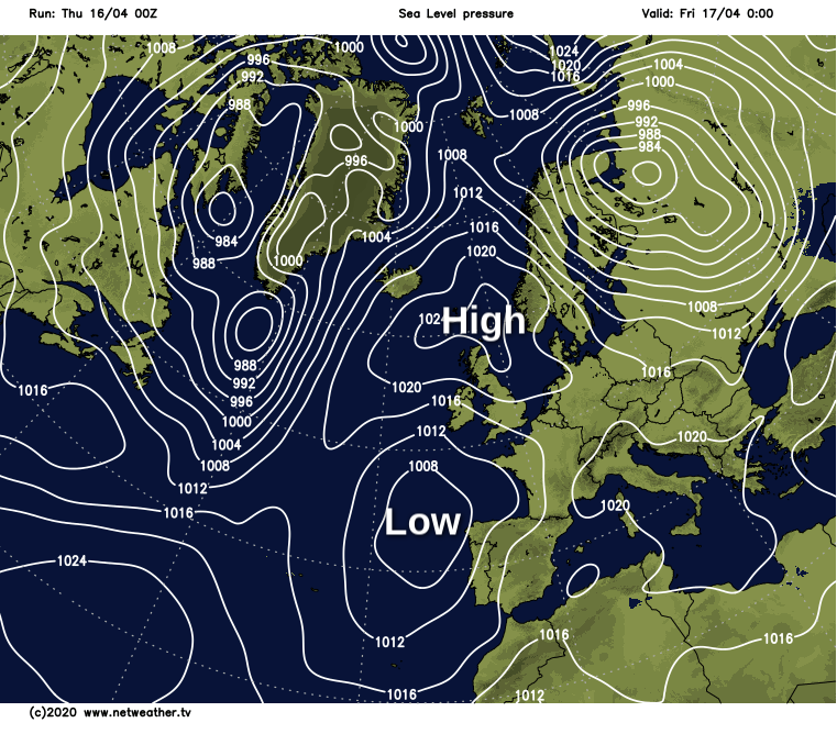
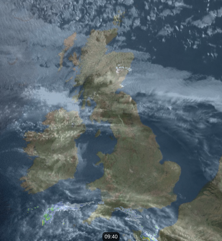
The first signs of that change have already turned up this morning, with a few showers affecting southwestern England. They'll not amount to a great deal today, but tomorrow and into the weekend there'll be some more widespread wet weather moving its way north. There is also a small amount of light rain affecting parts of northern Scotland today, that's thanks to a very weak cold front making a slow move down from the north. For most, it'll stay dry though, with more cloud, the only sign that it's nearby.
 View the live radar and satellite here.
Eastern Scotland and northeast England will be the cloudiest spots today, with an onshore breeze bringing it in from the North Sea. Elsewhere though, there'll be some good sunny spells, with the warmest temperatures in southern and central areas, where 18-21c will be typical. That east coast will be far cooler though, with some parts struggling to make double-figures.
This evening and the first part of the night, one or two showers may break out in southern England, but for everyone else, it stays dry with a touch of frost possible for parts of Scotland and Northern England. Later in the night and into the early hours is when the action in the south starts to get going though, with a band of heavy, thundery downpours moving north, with some showers also breaking out ahead of it.
During the day, the rain will become more showery as it heads up into the Midlands and Wales, fading away as it reaches into the southern part of Northern England. Behind that band will be another batch of heavy showers with some thunderstorms potentially mixed in, all pushing north and merging into longer spells of rain at times. Away from all that, it's a quiet day again with some sunny spells away from that still cloudy, chilly east coast.
The outbreaks of heavy rain will continue overnight and into Saturday in parts of southern and central England, along with Wales. Low pressure will stay in the vicinity throughout the weekend, so although there perhaps won't be quite such widespread wet weather, there'll still be some sharp showers and thunderstorms to contend with at times. Between them, there'll be some sunny spells though, with temperatures reaching the teens or even low twenties. The northern half of the country will enjoy the best of the sunshine though, although that east coast will still be colder with low cloud drifting inland at times.


