


Snow showers whistling by as April starts in chilly winds, gales for the far north. A change by the weekend as the wind goes around to the south.
In truth, the high pressure over the north Atlantic is beginning to slide southwards. So it’s protection of the UK, from various low pressures which have moved over Iceland to Scandinavia, is fading.
Through the rest of the “working” week, a cold front will push down from the north, everywhere will feel colder with snow showers for Scotland before the winds turn to a southerly direction for the weekend. The high moves eastwards and in a more south-westerly flow our UK weather turns warmer briefly.
Today
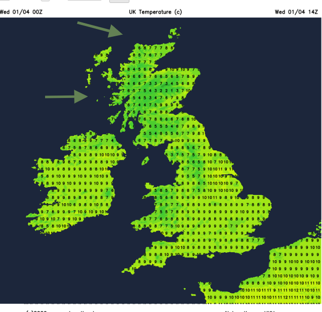
This morning there is still a coolness in the air with very light winds for much of England and Wales. A light to moderate NW wind for Northern Ireland and southern Scotland this morning but the westerly winds over northern Scotland will freshen today adding to the nip in the air. Temperatures today will be around 7 to 10C. There is a lot of cloud about today, brief sunny spells will still be warm.
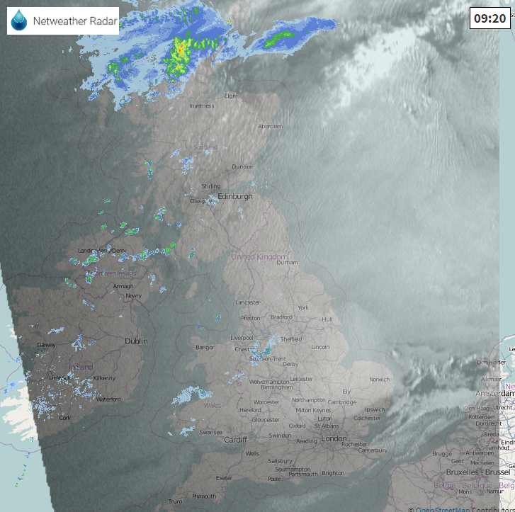
One or two showers will continue this morning for Northern Ireland, Wales and northwest England with a more defined line of showery rain is already showing on the radar over the far NW of Scotland. This line, the cold front, will bring rain southwards over Scotland today, very patchy for eastern areas, just with more cloud. Dry for many this evening
Strong westerly winds for the North Isles overnight with gales, even severe gales. Rain showers begin to appear from the NW early on Thursday as wintry showers are blown over the far north of Scotland. Heavier snow showers whizz by during Thursday morning when it will feel cold in the wild winds which head over Grampian. The northern half of the UK will have a fresh NW wind making it feel cooler, lighter further south with fair conditions and just a few rain showers. A line of showers looks to move south over Northern Ireland in the morning, then NW England into N. Wales by the afternoon.
Clear, brighter skies behind the shower line with the cold NW winds easing down later on Thursday with still a few lingering snow showers for NE Scotland with more by Friday morning from the far NW.
So, a wintry picture for northern Scotland and a definite chill for most of the UK in the wind but snow still elusive for most.
By Friday morning, most of the UK will be fine and sunny. The last of Thursday rain shower line will be over SW England, the very slow cold front with more cloud and the last of the mild air. The rest of the UK will have a chilly start, frost in the north with very light winds.
Many areas will have a fair day on Friday, the odd rain shower from the west but still a cold breeze Pressure is rising over the UK and this forces a warm front past Northern Ireland and western Scotland. So, rain and cloud here
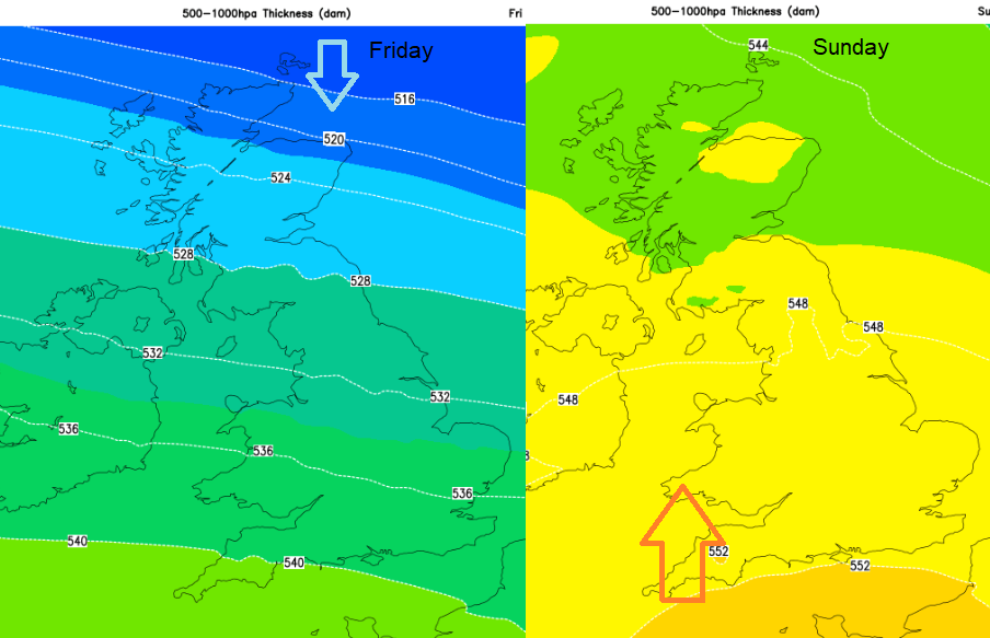
By the weekend it will be windy, with a flow from the south and in that warm air we will see temperatures in the high teens, possibly low twenties and sunshine. Remember your sunscreen if you are out in the garden or your one exercise per day, once you’ve got your Vitamin D.


