If you are wondering when the frost risk will go, ready to plant out then be aware it's another waiting game with a chilly wind this weekend.
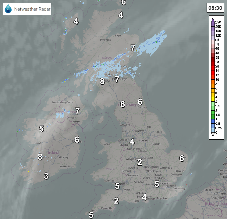
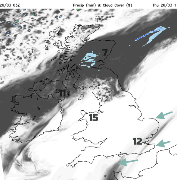
We continue in our settled spell of weather with high pressure extending from Russia across to a new area over the Atlantic. In the middle of that a frontal band still lingers, bringing more cloud and patchy rain which you can see on the radar extends from eastern Scotland across to Co. Fermanagh.
Where skies are clearer it has been cold overnight with temperatures below freezing. Soon enough it will be pleasant and sunny for much of England and Wales, up to 14 or 15 in the west but around 12C for most. However, there will be a cool east to NE breeze off the North Sea and this will make eastern counties feel colder. For Northern Ireland Co Down should reach 12C with more brightness, same for Dumfries and Galloway. The frontal band fragments a bit and so will allow brightness, even a few showers for SW Scotland.
Across central and northeast, it will be cooler at around 8C with more cloud but sunny in the far north with light winds. Not much changes overnight. Temperatures 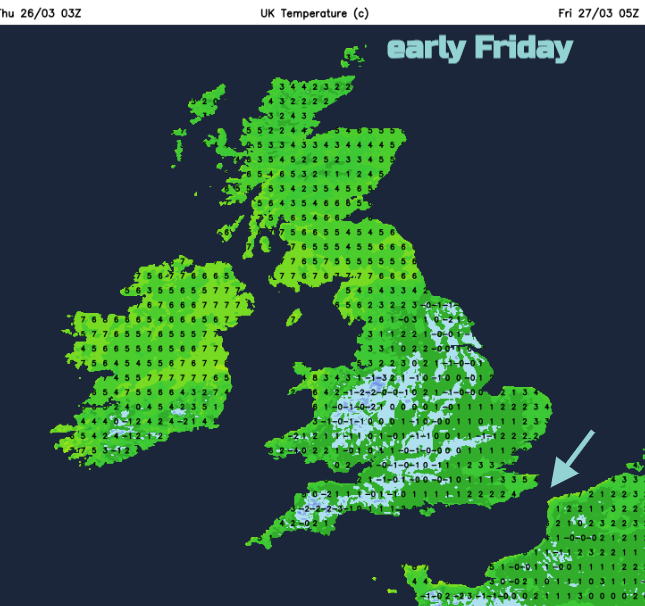
After a calm start, the NE wind begins to pick up on Friday. Little else changes, the frontal cloud is still lingering, small patches of light rain but elsewhere is fine and sunny. However, the flow is from a colder direction so you will need to be in a suntrap to enjoy the March sunshine because in the breeze there will be a growing chill. By Saturday there will be a moderate to fresh NE wind, noticeable for North Sea coasts. Overall, there will still be a lot of fair, bright weather, dry for most but this wind will bring in some showers.
These showers will be well scattered, many places won’t see any, but they will be wintry. Some still as rain but also sleet, hail and snow flurries moving by. Just to make the point that the weekend air is coming down from the polar regions
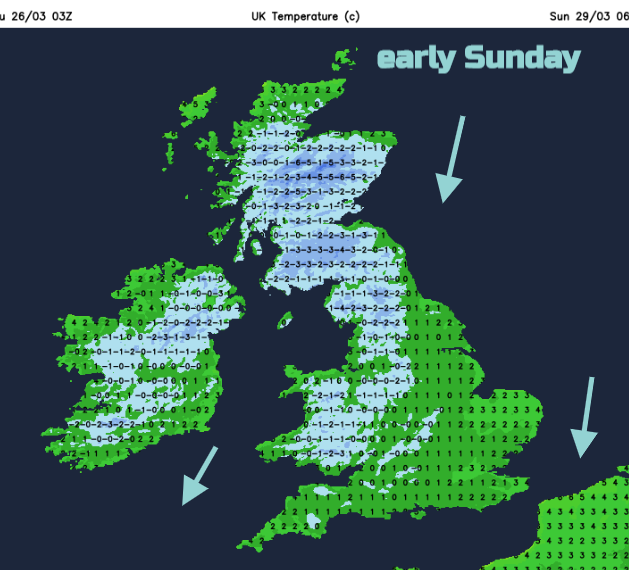
The winds back more to the north by Sunday with perhaps a few heavier showers or more organised lines of showers mainly but not exclusively for Scotland and eastern England. This pattern continues til the end of the month. Cold nights with frost. A chilly breeze bringing a scattering of showers but bright sunny spells in between.
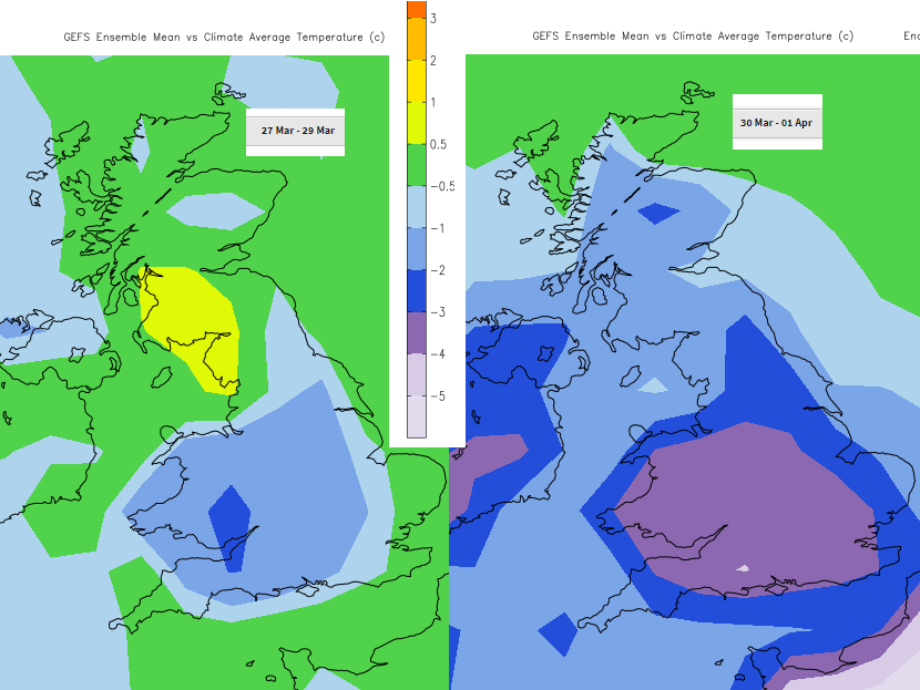
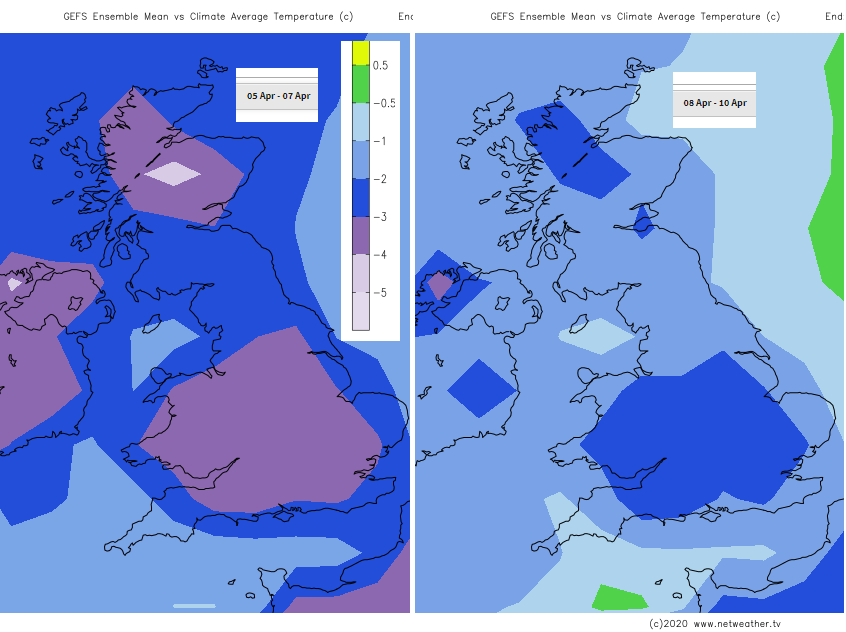
This colder than average theme continues into early April. If you are looking to plant out seedlings or put bits in an unheated greenhouse the outlook is for more cold nights and a risk of frost for the next week at least. The high lingers to the NW and then west of the UK. With signs of a deep low over Scandinavia in early April that will only strengthen the cold flow coming down from the Arctic for the UK. If you are waiting for a shift, it might take until Easter, at least, but that’s life at the moment.