


A mostly fine & sunny Mother's Day, staying mostly dry and settled next week as high pressure remains in charge, though turning a little milder from Tuesday. Risk of rain in the far north.

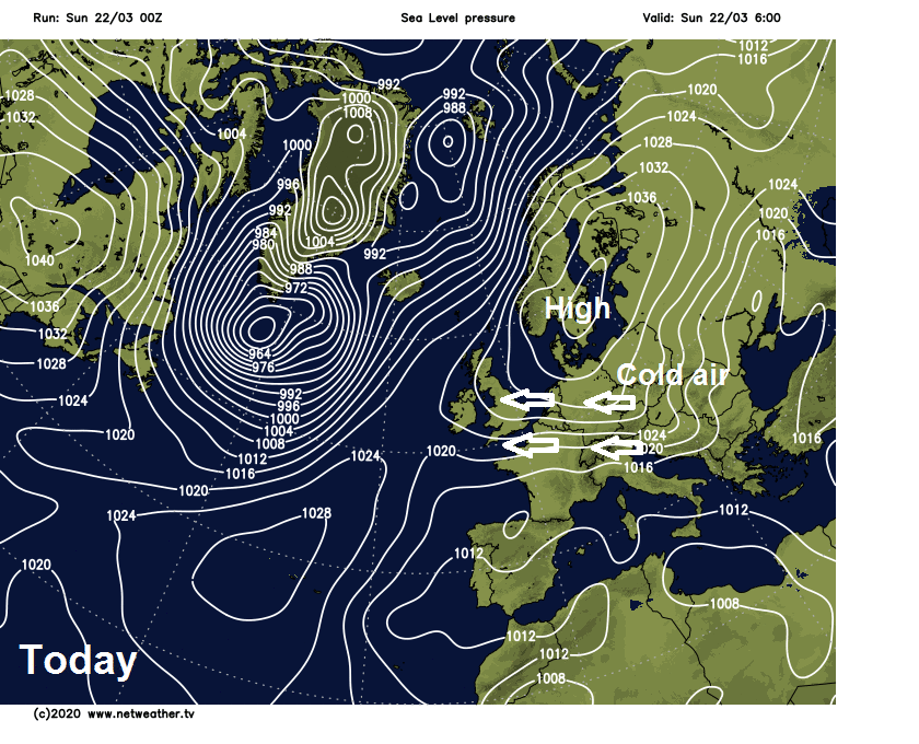
High pressure is in charge of our weather for Mothering Sunday, bringing mostly fine, dry and sunny weather with higher pressure looking set to remain in control throughout next week too, bringing further mostly fine and dry weather. High pressure is centred over Scandinavia at the moment, continuing to pull in a chilly easterly breeze. However, as the week wears on, the centre of the blocking high pressure system will sink south across Eastern Europe, so the flow will switch to come from a milder southerly direction. It won’t be dry everywhere though, with a front trying to push in from the Atlantic stalling across the far northwest over the next few days, as it bumps into high pressure to the east. This will mean Northern Ireland, northern and western Scotland will be prone to thicker cloud and patchy rain at times through much of the week.
For now, those up early enough, a beautiful sunrise on a mostly clear but cold start to Mothering Sunday, with the dawn chorus of birds quite noticeable now too. Temperatures widely in low single figures at dawn, locally close to freezing, across the West Midlands along with central and southern Scotland temperatures have dipped below freezing – so a touch of frost in places.
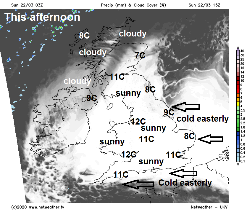
Today will be another mostly fine and dry day, with plenty of sunshine. A brisk and chilly easterly or southeasterly breeze continuing across the south and east, but out of the breeze it will feel pleasant in the sunshine for those doing some gardening or going for a walk. The exception will be across the far north and northwest of Scotland, which will be cloudier, with perhaps some patchy light rain or drizzle affecting the Northern and Western Isles. Temperatures this afternoon reaching 9-12C generally, away from eastern coastal areas of England and Scotland – where the onshore breeze will keep temperatures pegged back to 7-8C.
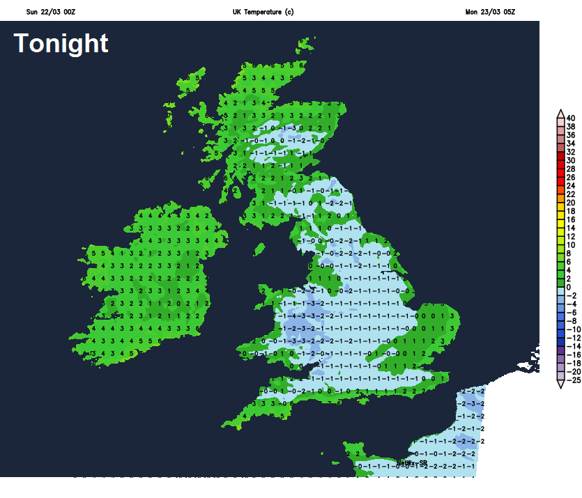
Sunday night temperatures will quickly drop thanks to clear skies and a cool, dry continental flow. So temperatures widely falling close to freezing inland, bringing a widespread frost, locally falling below freezing bringing a hard frost in a few spots – particularly across sheltered rural northern and western areas. The exception will be across the far north and northwest of Scotland where cloud will keep temperatures up at around 6-7C, with rain and a strengthening wind affecting the Western Isles.
Monday
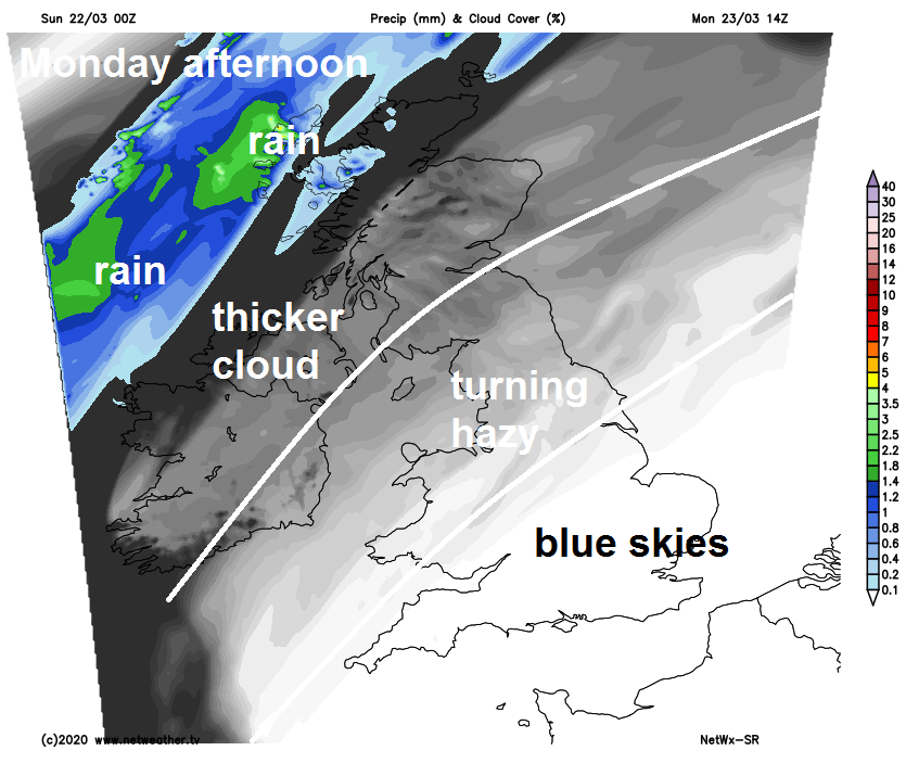
So a cold and frosty start for many on Monday – which will turn out into another mostly dry day with plenty of sunshine across England and Wales, though turning hazy across the north and west. However, there will be more in the way of thicker cloud for Northern Ireland, northern and western Scotland – with spells of rain affecting the far northwest of Scotland and the Northern Isles. A strong wind in the far northwest too, with gales developing. Temperatures reaching 9-11C generally.
Tuesday pretty much a repeat of Monday for England and Wales, another cold and frosty start for many leading into another fine day with plenty of sunshine on offer. More in the way of cloud across Scotland and Northern Ireland, thicker cloud bringing persistent and perhaps heavy rain across NW Scotland and the Northern Isles, with some patchy light rain or drizzle possible further south over Scotland and Northern Ireland. Windy in the far northwest too, further south the flow switching to come from a southerly direction, so a little bit milder across England and Wales, reaching 11-13C, across Scotland and Northern Ireland 9-11C.
Wednesday looks to see a weakening band of rain along a cold front slowly sink southeast across Scotland and Northern Ireland, while England and Wales enjoy another fine and sunny day. Temperatures generally reaching 10-13C.
Mostly fine, dry and sunny for the southern half of Britain on Thursday, northern areas cloudier with a weak band of rain stalling somewhere as tries to push southeast. A weak cold front eventually clearing southeast across England and Wales on Friday, though perhaps little rain along it when it reaching the southeast. Colder and brighter conditions following as winds turn northerly, with showers spreading down across northern areas, perhaps wintry over high ground in Scotland.


