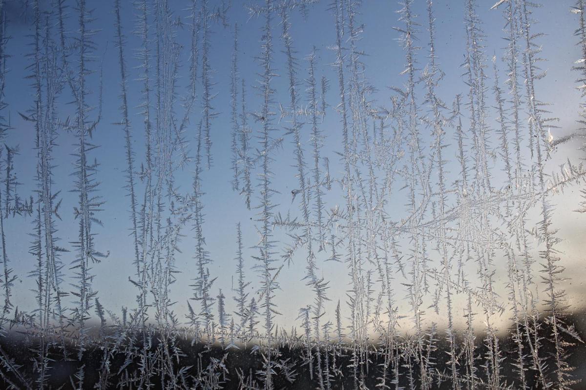
Gluggavef0ur - Icelandic for Window weather, looks nice from inside but isn't really. A noticeable east wind by Saturday as the southern cloud and rain fade. More sunshine and frost.
There will be a lot of fine even sunny weather coming up this weekend but with a chilly wind. So don’t worry that it is incredible out there and you might be stuck inside. Looks can be deceiving.
It’s spring today, for all those who aren’t into the meteorological definition of three months - March/April/May. Spring Equinox in the northern hemisphere although in the brisk wind it does feel chilly. Northern Britain and Northern Ireland enjoyed blue skies and sunshine yesterday (with a few showers), a real taste of spring and there will be more of that today. The March sunshine is bringing warmth to sheltered spots but by night the clear skies will result in frosts.
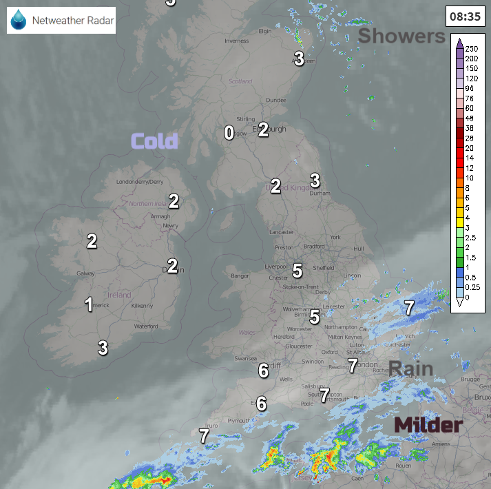
There are still a few showers this morning, this time for eastern Scotland coming down in a cold northerly flow with a few wintry flurries possible today. The long, lingering frontal band is still bringing cloud cover to southern England and heavy showers to the Channel Islands which clip the south coast of England today. There is also patchy rain for SE Britain from Lincolnshire, Norfolk down to Sussex.
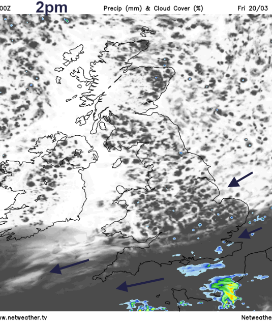
High pressure is going to topple over Scotland today. This means light winds in the north, more settled weather and a lot of fine, dry and sunny weather. The showery rain and the cloud cover will fade over southern Britain during today with outbreaks of rain becoming confined to the English Channel and some patchy bits for Kent and the Isle of Wight.
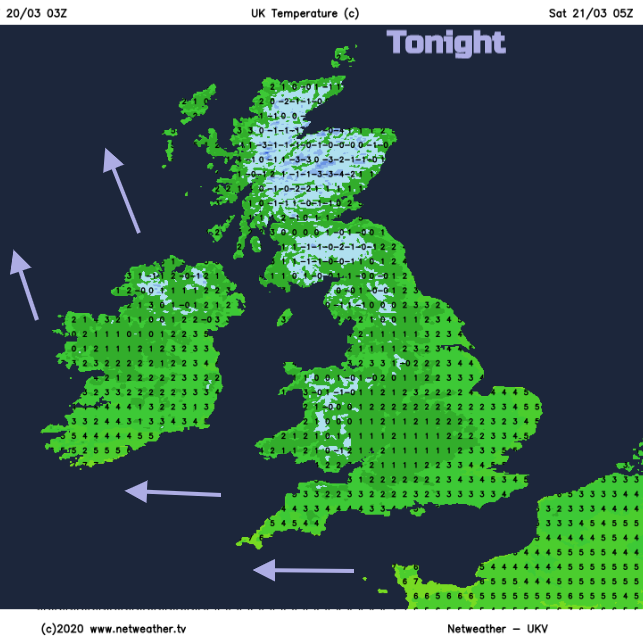
The high doesn’t linger over us for long and slips over southern Scandinavia, so the brisk easterly continues for the western Channel and a SE wind for Ireland. This flow will keep more cloud in these areas but for much of the UK there will still be clear skies, dipping temperatures by night with a touch of frost. The air will be cold over the UK to start the weekend. Saturday looks fine and sunny but a brisk east wind will pick up and make it feel much colder. For those inside, looking out of the window it will appear like a gorgeous spring day but don’t be fooled, that wind will be chilly.
The Icelandic have a phrase for it Window-Weather (Gluggaveður). Nice to look at but not so good to be out in.
Another cold night but with some low cloud creeping in off the North Sea and a strong southerly wind for western Scotland as the cloud and some precipitation reaches around the UK in the flow around the High. This could bring some snow to Highland early on Sunday.
Another fine, sunny day with chilly winds but not as cold as on Saturday. It will still feel cold for North Sea coasts with an easterly off the sea but at least it’s dry.
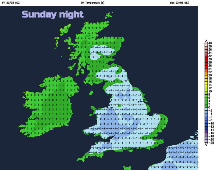
Sunday night will be even colder for England and Wales, gardeners take note if you have been busy at the weekend.
By Monday in a southerly wind with sunshine temperatures should lift into double figures with more fine weather. The dry, bright conditions last into next week with lighter winds, a milder flow from the south and just the far NW of Scotland seeing some rain on Monday, more and heavier in the NW by Tuesday.