


Cloudy but mild day in the south, heavy rain spreading across the north later before slowly spreading south over next few days, colder and drier conditions following from the north.
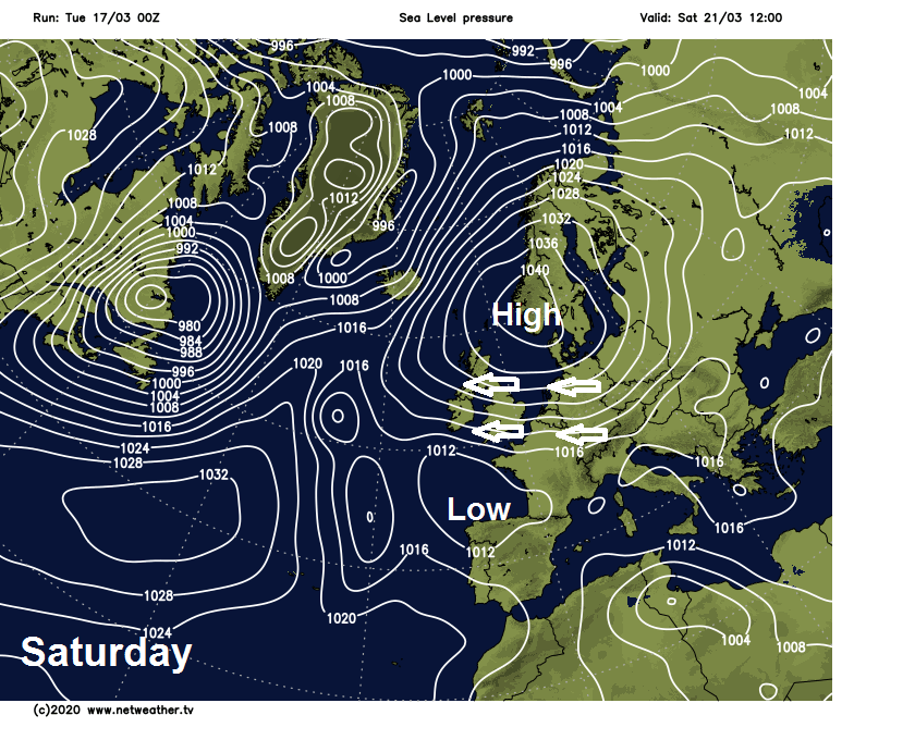
After several weeks of low pressure in charge of our weather, bringing the wettest February on record and a wet start to March, high pressure will build in from the west by the end of the week to settle the weather down. A large area of high pressure looks to park close to the northeast of Britain through the weekend and into early next week, bringing dry and settled conditions, though feeding in a cold easterly breeze making it chilly out the sun and bringing a risk of overnight frost.
Before the prospect of drier, settled but colder conditions for all from the weekend, a brisk southwesterly flow will draw in some rather mild air across the south over the next few days, with temperatures reaching the mid-teens today and the far south tomorrow. There will be cold front lying across central parts today, with cooler conditions to the north, a wave in the front will bring a spells of heavy rain across parts of the north and west from this evening into tomorrow, before the cold front and its rain sink south to reach the south on Thursday - where it will stall for a time.
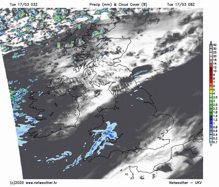
For now, outbreaks of rain have moved down across the north and west overnight with a cold front sliding south, bringing a cloudy and damp start to the day across Wales, northern, central and western areas of England, with some patchy light rain or drizzle in places. The cold front has cleared Scotland and Northern Ireland, so here it’s a bright but chilly start, but with a few showers across the north. Also the SE of England and East Anglia is off to mostly dry, bright but chilly start ahead of the cloudier skies further northwest, with a few rural spots close to freezing.
That cold front that moved down overnight will stall across Wales and northern England, so for much of England and Wales it will be a cloudier day than yesterday, with patchy light rain affecting mostly Wales and western parts of England, misty and murky over hills and coasts here too. Mostly dry for the rest of England, with some bright or sunny spells possible towards eastern England. After a bright or sunny morning across Scotland, with a few showers in the north and west, outbreaks of heavy rain moving across Northern Ireland by late morning will spread east across Scotland along with the far north of England during the afternoon and evening. This rain courtesy of a wave developing along the front lying across central areas which will move further north.
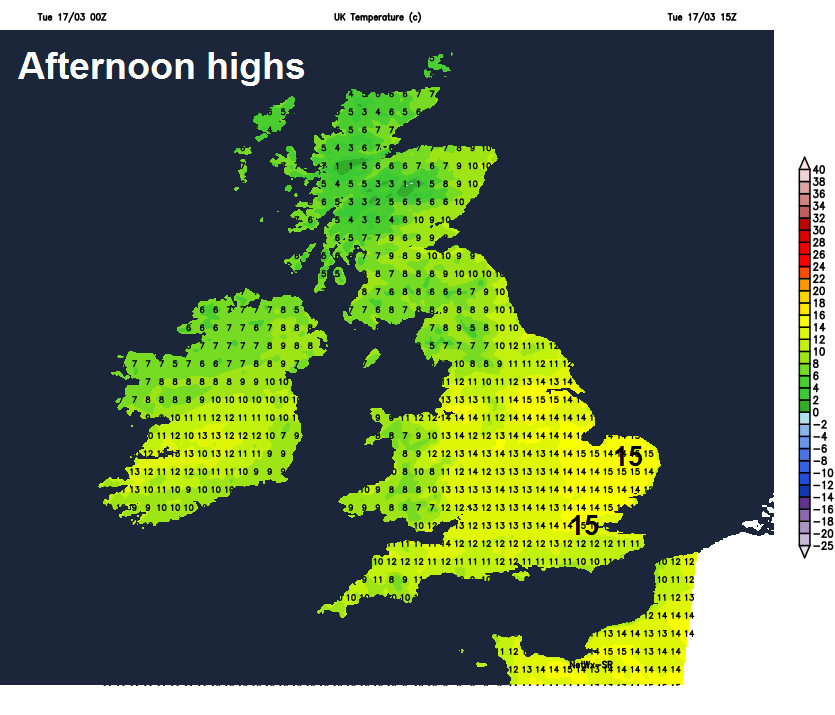
Quite mild across England and Wales in the southwesterly breeze, temperatures reaching 11-15C. Cooler across Scotland and Northern Ireland – with highs of 7-10C.
Like last night, a cold front bringing a band of heavy rain across Scotland, N. Ireland and the far north of England this evening will slide southeast across northern England and Wales tonight before stalling again. Dry but mild and cloudy across southern England, south Midlands and East Anglia. Colder, blustery and clearer conditions following the cold front across Scotland and N. Ireland overnight, with wintry showers across northern and western Scotland and a touch of frost in sheltered glens and eastern areas of Scotland.
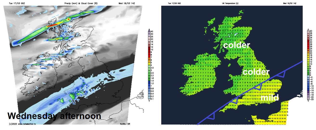
A cold front will slowly shift southeast across England and Wales on Wednesday, bringing a mostly cloudy day, with a band of patchy rain sliding southeast, though the far southeast of England should stay dry. A colder but brighter day for Scotland and Northern Ireland, with sunny spells, but also wintry showers affecting northern and western Scotland along with perhaps northern coastal areas of N. Ireland. Temperatures ranging from 8-10C from the Midlands northwards, but still rather mild across the far south of England south of the cold front moving south, where temperatures could reach the mid-teens.
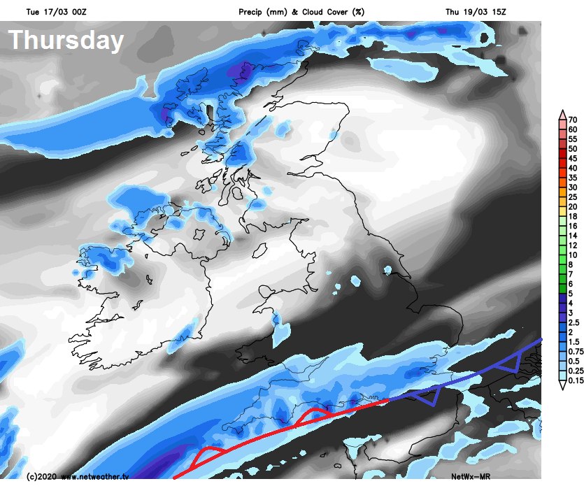
That cold front sinking south tomorrow will linger close to the far south on Thursday, bringing a cloudy day across southern England – with outbreaks of rain. Mainly dry and sunny further north across Britain, as high pressure builds in from the west, but on the chilly side, with temperatures in single figures.
Cloud and rain perhaps still lingering across the far south of England on Friday too, as that front become trapped between high pressure to the north and low pressure over Iberia. But for most it will be chilly and sunny in a brisk northeasterly breeze.
The weekend looking dry, sunny but chilly by day, in a brisk easterly or northeasterly breeze. Pleasant enough in the sun out the wind. Turning cold and locally frosty overnight under clear skies.


