There is more rain in the forecast this week. Bad news for the flood-hit areas particularly Wales into the West Midlands and northern England. Storm Dennis brought huge amounts of rain hot on the heels of Storm Ciara's soaking and it has taken until today for the peak in river levels to be seen in South Wales.
There is more rain in the forecast this week. Bad news for the flood-hit areas particularly Wales into the West Midlands and northern England. Storm Dennis brought huge amounts of rain hot on the heels of Storm Ciara’s soaking and it has taken until today for the peak in river levels to be seen in South Wales.
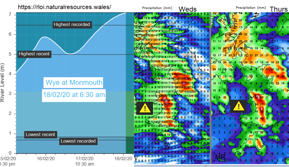
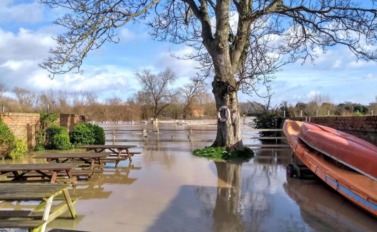
The River Wye at Monmouth just had its highest level this morning, as all of that rain flowed down off the Brecon Beacons. This lag is why flood warnings carry on even when the skies brighten, and the sunshine appears. There are two severe flood warnings still in place.
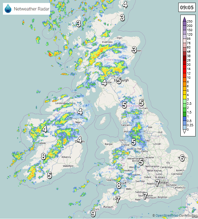
There will be some bright, fine but windy weather today across the UK. That wind will make it feel colder but eastern areas always stay more sheltered from any rain or showers. There have been wintry showers for Scotland overnight with snow on the tops and today there will be further clusters of heavy showers with rain, hail and sleet coming in from the west. They continue to push eastwards over Scotland so the day will be changeable. The showers come and go, more of them for the west and temperatures around 5 or 6C. Northern Ireland will also see plenty of showers rattling through although hopefully more brightness this afternoon, also 6C with a brisk westerly wind.
Northern England could see more wintriness in the showers and longer spells of wet weather over the Fells, Pennines and Peaks with hail adding to the iciness of some showers. It will feel cold as the wet weather moves through, but brighter skies should return after a wet spell at lunchtime. Eastern and SE Britain will have more fair weather, sunny but windy and the odd shower but late afternoon into the evening there will be a band of heavy showers working their way eastwards. Temperatures 6 to 10C.
The River Severn has also seen very high levels at Upton and Worcester, the defences are working this morning so far. There are seven Severe flood warnings out for England, also on River Trent and River Lugg.
Also, on the River Wye at Hereford, north of Monmouth. None of these areas needs any more rain but there will be more this week and the Welsh hills and mountains could see up to 100mm Wednesday into Thursday. This is more likely for NW Wales with South Wales still forecast to see around 50mm on saturated ground and very high rivers.
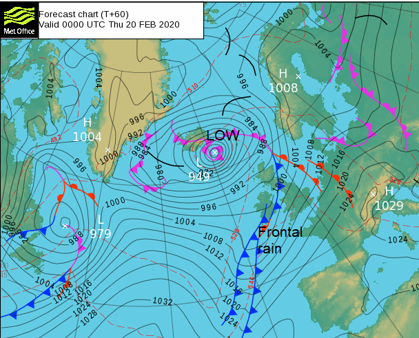
As a low pressure moves near to Iceland midweek its weather fronts will bring rain across the UK. There could be small waves, kinks along the front which slow down the movement of the rain WN to SE and so increase the totals. Wednesday starts fine with lighter winds, but the rain moves in during the day as the winds freshen again. Most of the rain will be for NW UK on Wednesday with more early Thursday before the front finally pushes right over Britain later in the day. Mild SW winds veer to colder westerlies with another bout of wet and windy weather later on Friday for the NW.