Such an intense high pressure was never going to shift quickly and so we keep our settled UK weather. Changes afoot for the weekend as the winds pick up by Sunday, even a little snow for northern hills.
High pressure is still with us keeping our UK weather steady but it will slowly lose its hold this week with a change on Sunday to wind and rain from the west. . There is a very weak weather front dangling north-south bringing more cloud today but unable to do much more. For some, it means a grey misty and murky start for Wednesday but still chilly this morning for clearer parts of southern Britain. The high is now centred to the west of Ireland, at only 1042hPa compared to the peak of 1050.5hPA last weekend.
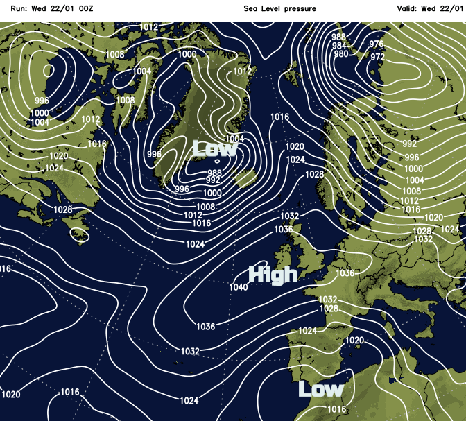
Around the large high, Atlantic low pressures have been forced northwards to Scandinavia and one intense low pressure #StormGloria dived southwards and has brought wintry conditions to Spain and wild weather to the western Mediterranean.
Today
The winds will be light everywhere today from the north or the west. Much of the UK remains dry but there will be a few coastal areas that are damp with light rain for the far NW of Scotland. Temperatures by day will vary from 10C in the north to 5C for Kent. Skies vary with cloud trapped within the high pressure but still some breaks and gaps allowing sunny spells,
Air Pollution: There is the possibility of localised Moderate or High air pollution near urban centres, mainly in the southern half of the country, with fog and light winds inhibiting the dispersal of locally generated pollutants. DEFRA
Tonight, won’t be cold but still with light winds. A frontal band will head into the far north of Scotland for Thursday, so the winds pick up here with a fresh SW wind. Later on Thursday, the rain band sinks southwards over Scotland and there will be low cloud and dampness for Northern Ireland and NW England and Anglesey.
Friday brings a cooler start with light winds. There will be more cloud in the north from the old front, but it should be dry, maybe some dampness where the front fades. The high holds on, around 1024hPa and there will be another settled day.
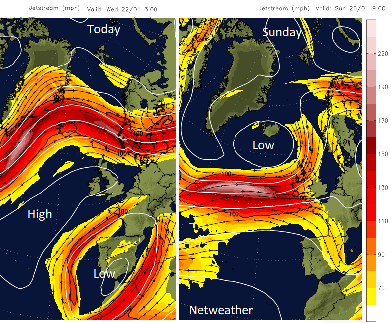
The high fades and the Jetstream shifts southwards once more, to begin throwing low pressures our way from the Atlantic.
The Weekend
For most there will still be plenty of dry weather this weekend but with the winds picking up, more noticeably by Sunday. Saturday morning starts off chilly with a frost for SE Britain. There will be more cloud and dampness for Ireland and much of Scotland as the southerly winds freshen. Much of England and inland Wales keeps lighter winds and fair weather.
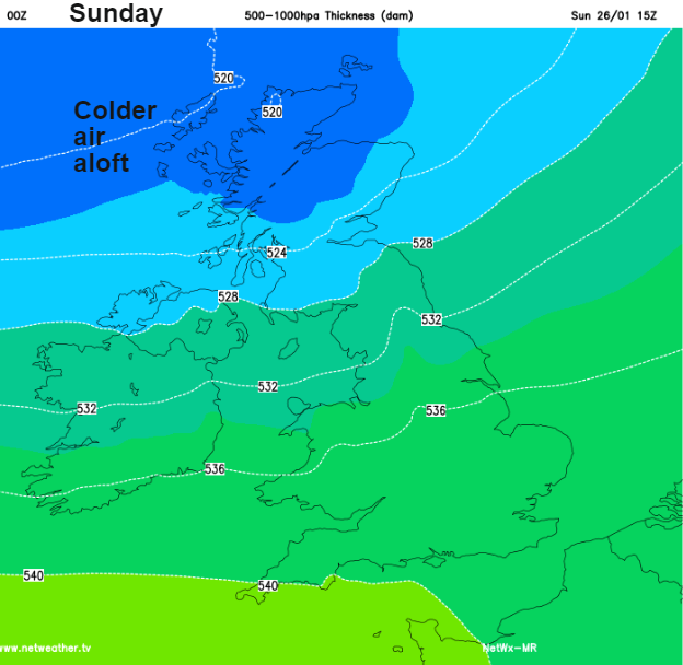
By Sunday there will be a fresh SW wind, strong for coasts and hills in the north. As a cold front sweeps across the country there will be a change from the mild start (out of the wind) to a chill in the air. There will be rain from the NW, but it falters across Britain so the wet weather on Sunday is mainly for Northern Ireland and western Britain. As the main cold front heads SE, lines of showers pile into western Scotland with snow. Wintry showers could reach the Cumbrian Fells and Pennines but the main accumulations will only be for Ben Nevis, the NW Highlands and Aviemore. For the southeast and London, it will be a more unsettled day but mild at 10C
Monday looks very unsettled with another low pressure bringing rain, winds and hill snow.