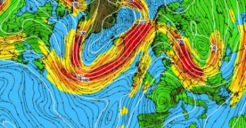
Yellow warnings for Wind and Rain are popping up across Britain in the next few days. Low pressures are barrelling across the Atlantic bringing quick-moving, unsettled conditions with strong winds and bursts of heavy rain. Water levels in places are still high so any extra rain could cause problems. There could also be travel disruption due to the strong winds.
A possibility of strong gusts as a deepening low approaches the UK from the SW Wednesday night and crosses Wales and England. For exposed coasts and hills.
There is also the risk of hill snow for higher level routes of southern Scotland and far north of England. Cumbrian Fells, northern Pennines, Cheviots and Southern Uplands
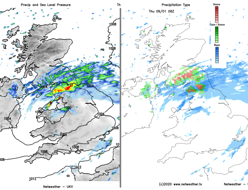
From a second low pressure, there will be a band of heavy, showery rain. This spreads from Cornwall, Devon, the Channel Islands at lunchtime over southern England on Thursday afternoon.
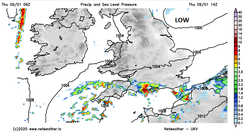
"Local groundwater flooding is expected in parts of Hampshire, West Sussex and Brighton and Hove for at least the next five days." Env Agency. Risk of river or surface water flooding as heavy rain moves through later on Thursday for southern England.
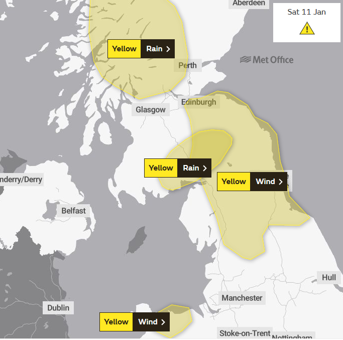
Warnings Saturday: "Strong winds may cause travel disruption through Saturday. Persistent and heavy rain will develop through Friday night continuing for much of Saturday. " MO
Strong to gale force southwesterly winds will bring outbreaks of heavy rain across Scotland, this heaviest and most persistent across western, central and southern Scotland... up to 100mm possible over high ground of Argyll. Strong southwesterly winds are expected, with gusts of 50 to 60 mph likely, perhaps 70 mph over the highest routes. NW Scotland is no longer included in the warning. 09/01
Local river and surface water flooding is possible across the north-west and north-east of England on Saturday and Sunday. Land, roads and some properties may flood and there may be travel disruption. Env. Agency.
Loading recent activity...