It's back to 'real-life' for many of us this week, and the weather is giving us a helping hand of sorts by returning to a common theme - rain and wind.
Harrumph. That was all over too quickly, and now it's back to real-life again, with the added 'bonus' of the weather also turning wetter and windier this week. Looking on the bright side though, there are only 354 days to go until Christmas day 2020.
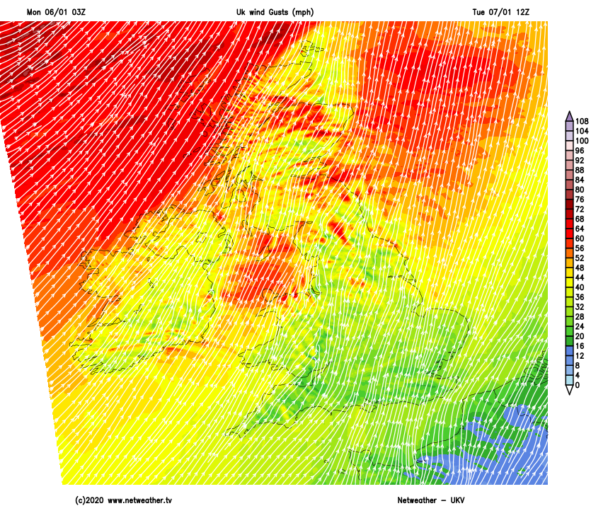
Today we have rain moving in from the west this morning, clearing Scotland, Ireland along with the western side of England and Wales this afternoon. It'll then move further east through the remainder of the day, clearing southeast England this evening. The wind is also blustery, especially across the west and north this morning, but the strongest gusts (of up to around 60mph) will ease this afternoon. It's a cold front bringing the rain today, and behind it, we'll see cooler, fresher and clearer air for a time, with just a few showers running into Scotland and Northern England. Thanks to those clearing skies, there'll also be a few pockets of frost overnight - they'll be short-lived in the north though as the next bout of wind and rain will soon arrive.
The bulk of the action on that one will be across the northern half of the UK, with the winds being a real feature, and stronger than they've been today. Gusts of 65-75mph are likely in exposed places, enough to bring some disruption along with problematic road and sea conditions.
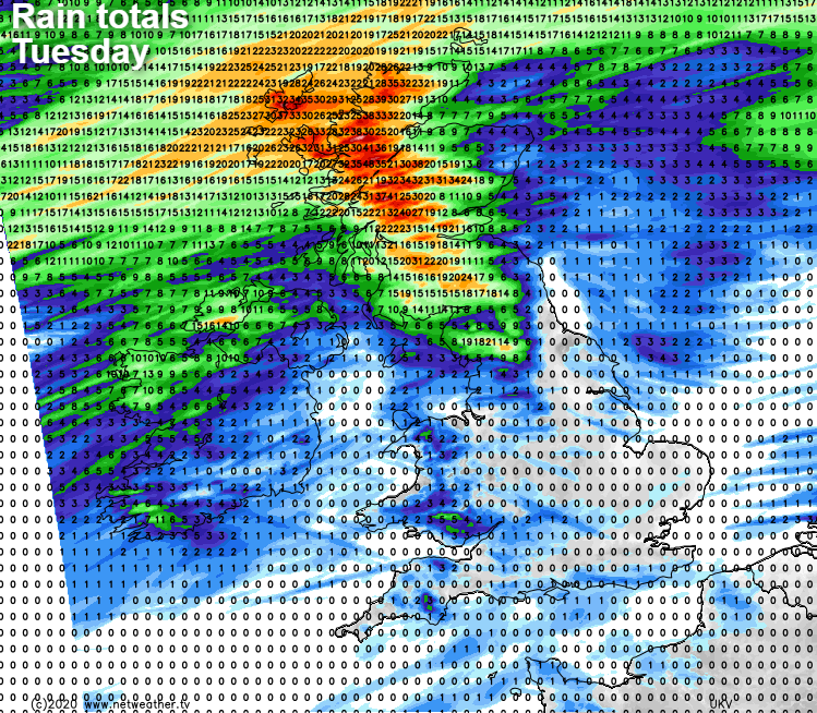
With the wind, there'll also be some heavy, showery bursts of rain coming through, especially but not solely in the west. Away from Scotland and the far northwest of England, there will be some showery rain about, but many parts will stay dry. It'll be a murky day with lots of cloud around, but after the chillier interlude, overnight temperatures will jump back up into the mild category again with highs of 11-13c widely.
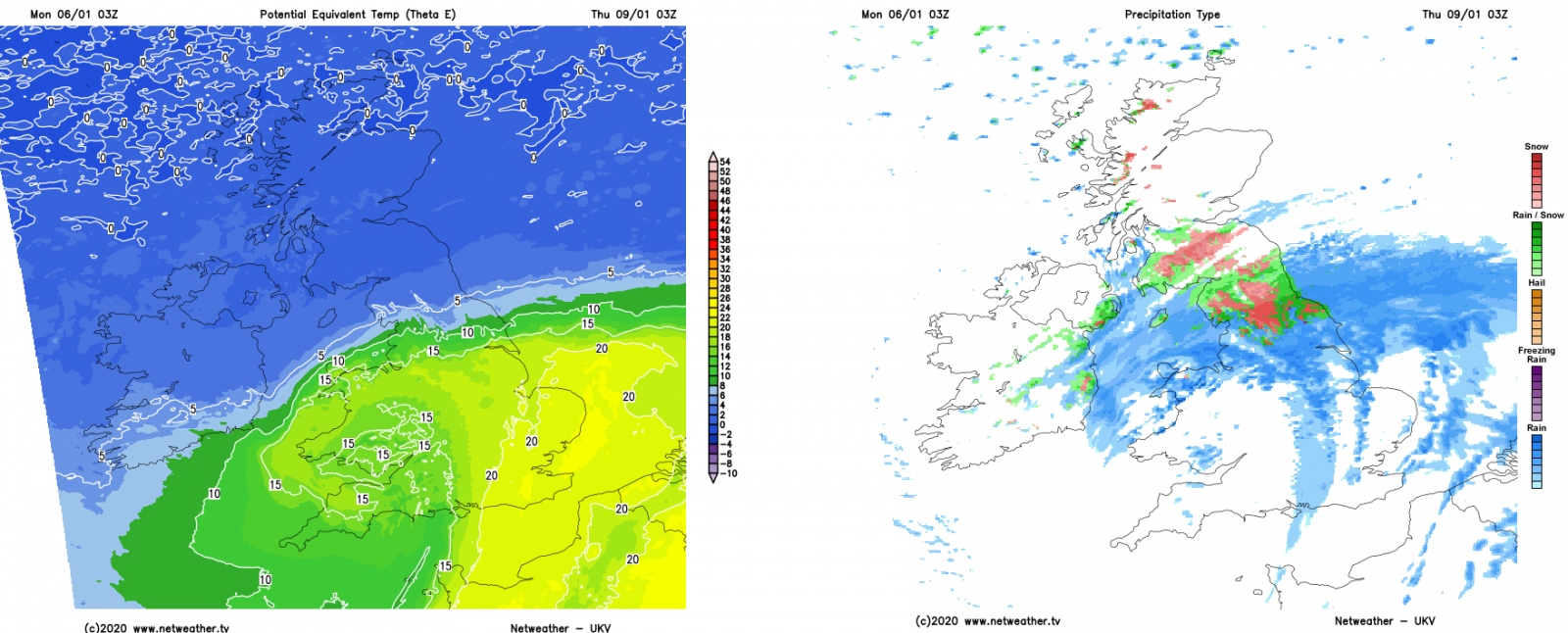
Colder air will arrive back into the north on Tuesday night, bringing some frost and a few wintry showers here. Further south, the mildness stays in situ, with lows not dropping below 10-12c in places. Wednesday then starts with a three-way split. Cloudy and mild in the south, clearer, chillier but dry across northern England and Southern Scotland, then cold with some wintry showers across Northern and Central Scotland.
The far north will see little change through the day, with bright spells and a scattering of showers which will be wintry over the hills. Rain and thickening cloud will be moving up from the southwest though, bringing a period of wet weather across southern and central England, along with Wales by the end of the day. Northern England should stay mostly dry before nightfall, but cloudier skies will arrive in advance before the rain comes overnight. That's only part of the story too, as with some colder air still in place, there is the potential for snow up over the high ground of Northern England and Southern Scotland for a time.
There's likely to be quite a difference in temperatures north to south as the low pressure bringing the rain and snow arrives, which will serve to pep up the precipitation. Winds may also be strong around the low - but there is some uncertainty, as the track and intensity of it are subject to change.
That should all clear out of the way during Thursday. There will be a few showers here and there - particularly in both the far north and far south of the country. The milder air may stick around in the far south, but most parts will be into the fresher airmass, meaning temperatures won't be far from average for the time of year with frost patches overnight.
The quieter weather should then continue into the start of Friday, but the next spell of wind and rain isn't going to be far away from the northwest of the UK at this point. The unsettled pattern will carry on into the weekend too, with the northwest always most likely to catch the wettest, windiest conditions, whereas those further south will see the best of the dry, bright and often mild weather.