Bang on cue, as life returns to normal next week and everyone heads back to work and school, the weather is moving back to what's been its default position since the Autumn, bringing us bouts of rain and wind as low pressure swings through.
Bang on cue, as life returns to normal next week and everyone heads back to work and school, the weather is moving back to what's been its default position since the Autumn, bringing us bouts of rain and wind as low pressure swings through.
Three spells of wet, windy weather will arrive in the coming days, on Monday, Tuesday and Thursday. In the meantime, Sunday will be a bit more benign, with most parts staying dry but often cloudy. There will be some drizzly rain in the west at times, and some heavier outbreaks of rain moving into the north of Scotland through the day. Winds will be blustery across the north of the country too, although winds will ease down through the day before picking up in the northwest later ahead of the system bringing wind and rain for Monday.
Temperatures today will be on the mild side for the time of the year (again), generally ranging from 8-10c. Overnight, the mostly cloudy skies continue so staying mild everywhere.
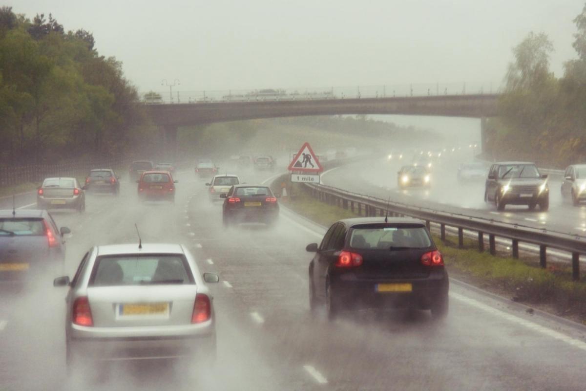
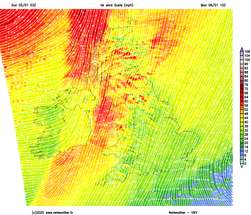
Rain will arrive across the west of Ireland and into the northwest of Scotland first thing on Monday, spreading across much of Scotland and into other western parts of Britain by lunchtime. Winds will be gusting to 60mph in exposed parts of the north and west during the morning too, before slowly falling back into the afternoon.
The rain will continue to move southeast through the day, becoming more patchy and arriving into the southeast in time for the evening drive home. Behind the wet weather will be clearer skies, fresher, colder air and a scattering of showers - these mostly across Scotland.
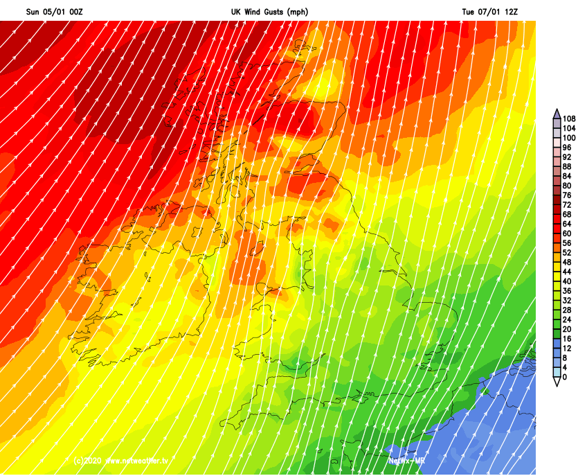
The next period of wind and rain will be arriving in the north of the British Isles in the early hours of Tuesday. That's going to mean a lively start to the day across Scotland, Northern Ireland and the north of England on Tuesday morning. Winds gusting 60-80mph are likely, along with a spell of heavy rain. Combined, this is likely to mean some tricky conditions on the roads and some disruption. The Met Office has already issued weather warnings.
Away from the northern half of the UK, it'll be a quieter day though, with just a few outbreaks of rain coming through from time to time. It'll be a mild day, with highs making into the teens quite widely.
By Wednesday the wind will still be blustery across the far north of Scotland, but elsewhere it'll be calmer. Colder air will have sunk south overnight to all but the south of the country. Here it'll be cloudy too, with some patchy rain getting into the southwest, eventually pushing north and east into other areas. The cloud will break as you head north, with some sunny spells breaking through from northern England northward, but there'll also be some sharp showers across Scotland - these falling as snow over the hills.
Low pressure then approaches from the southwest overnight and into Thursday. This'll initially push heavy rain up from the southwest across much of England, Wales and southern Scotland. Then, as the low itself moves through, there's the potential for some powerful winds, although there's some uncertainty over its track and intensity at this stage.