Rain and muggy air clearing southeast today. Fine for many tomorrow, but then we're gearing up for a very unsettled spell which will last through into the start of next week.
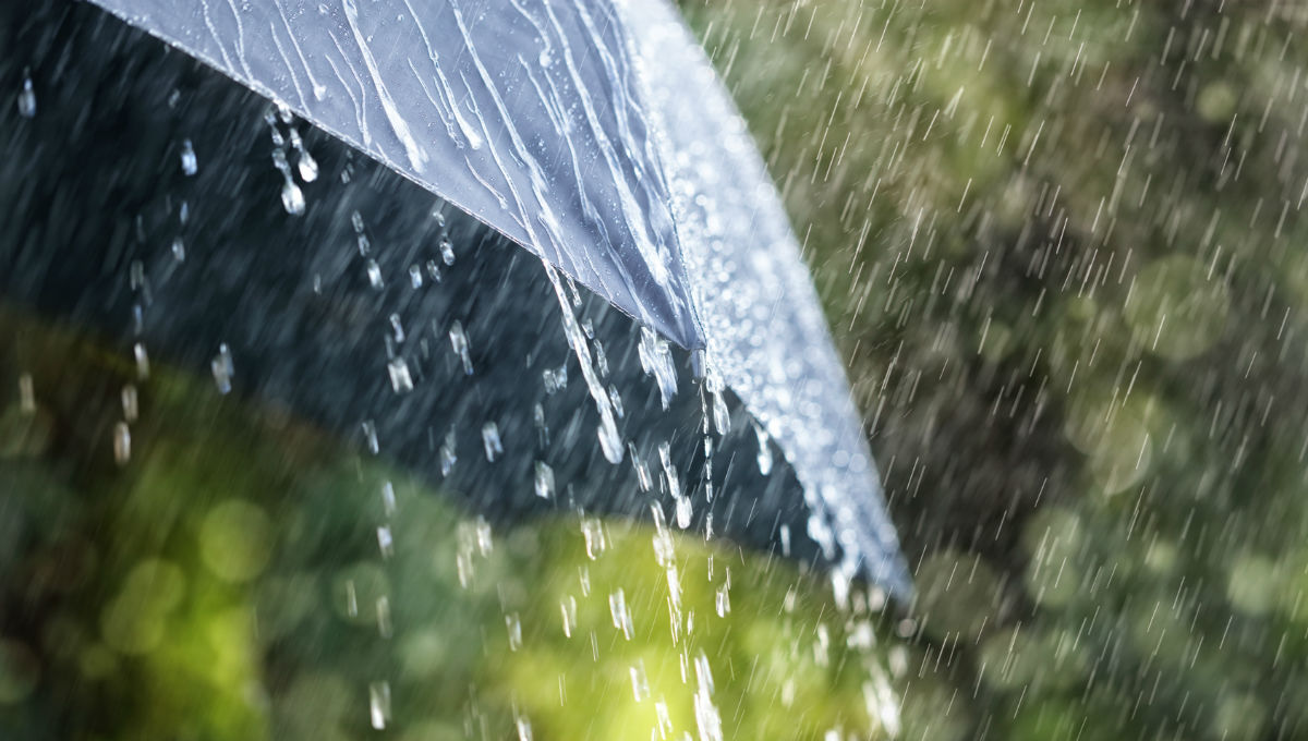
If you woke up to the rain this morning, it really felt like a dark Autumn morning. What didn't feel so autumnal were the temperatures overnight though, with many parts of England and Wales at 15-17c. To the northeast of the rain, it's a different story as cooler air has arrived, with Cairngorm dipping to 4.9c in the early hours.
The rain and muggy air will clear southeastward during the day today, leaving the clearer, fresher air with a few showers in the west in its wake.
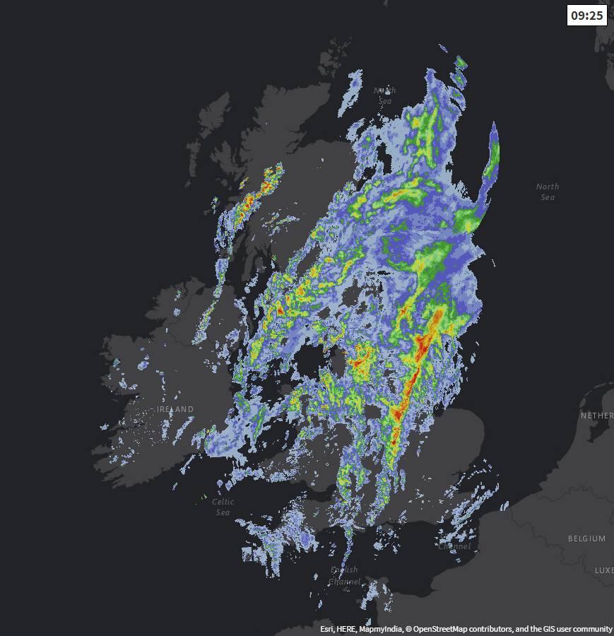
Radar image from earlier this morning - check the latest here.
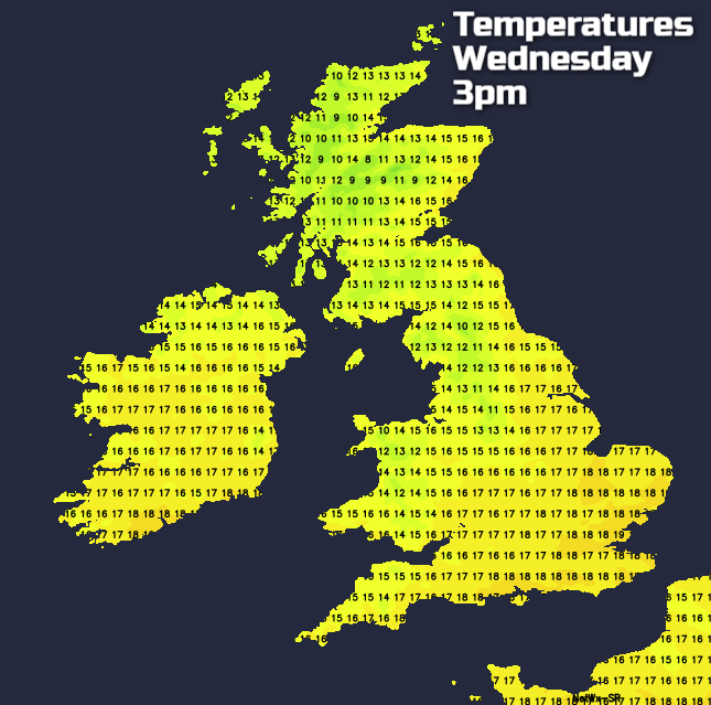
England and Wales will keep the muggy feel today, with highs reaching the high teens or low twenties. As the rain clears though, it will become fresher, with some sunny spells developing. Scotland and Northern Ireland will already be in that more refreshing air, but highs will still reach 18-20c in eastern Scotland, the mid-high teens elsewhere.
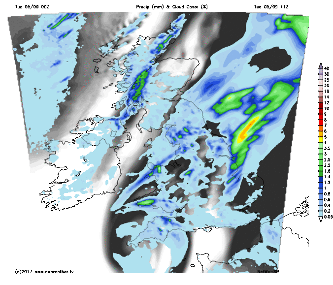
The last of the showery rain will clear the southeast this evening, to leave many places dry and just a scattering of showers in the north and west. Temperatures overnight will be quite different to last night for most and dip down into single figures quite widely.
Tomorrow then dawns dry and bright for most, with much of the country staying that way. There will still be a few showers affecting the north and west though. With the sunny spells, 16-18c will be a typical high, peaking at 18-20c in the southeast. Those values tempered a little by the westerly breeze though.
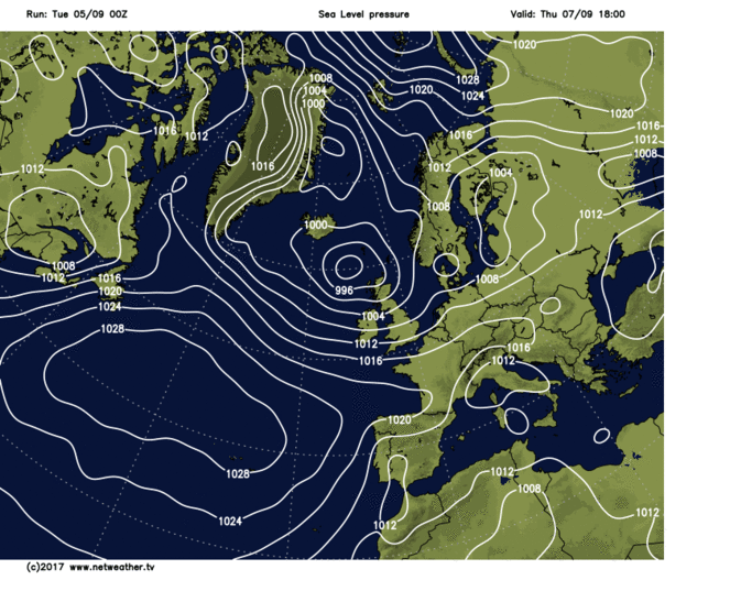
That picture of calm won't last too long though, as the end of the week, along with the weekend is set to turn very unsettled. It all starts on Thursday with rain and gusty winds moving down from the northwest. Scotland and Northern Ireland will see this all arriving during the morning, with southern England last to see it later in the evening. Some of the rain is likely to be heavy - especially in the west.
Once that clears through, Friday and Saturday are going to be similar days with sunny spells and blustery showers. Then just as the low pressure responsible for all of that clears into the north sea, another one is set to arrive later in the weekend and be with us for the start of next week. This one could be deeper than the first, so winds may well be stronger with severe gales possible, along with more rain.
At this range, there is low confidence in the precise track and strength of the lows - especially the one on Sunday, so please stay tuned for updates over the coming days.