
The rain over eastern England is clearing off into the North Sea, so the sunshine will spread and overall it will be a fine, but breezy day. More showers from the NW overnight into Friday and the brisk winds pickup.
Wind and rain will appear in the forecast over the next few days, interspersed with bright, warm bits. Currently, the overnight rain from frontal bands, is still over the eastern half of England, trailing over the Midlands into central Wales, with the low pressure centre away to the NW of Scotland.
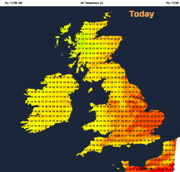
This afternoon will be quite different for eastern England with warm sunshine, blue skies and temperatures around 23C.
This band of rain will clear away eastwards into the North Sea. There is already some fine, bright and sunny weather about and this will appear in more parts of the UK as the front moves off. There will be more cloud from the west with a scattering of showers flowing in. The SW winds will freshen during the day, so again it will be breezy. If you are stuck under one of the lines of showers today (most likely for N.Ireland and W.Scotland), it will be rather frustrating as the downpours keep on coming. However, for most places, there will be sunshine today. It will warm up, with temperatures in the high teens and low to mid-twenties C. This afternoon will be quite different for eastern England with warm sunshine, blue skies, and temperatures around 23C.
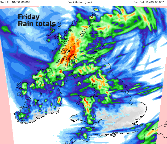
Tonight, more showers arrive from the west with a wet spell for Scotland. Anther low pressure forms in the north and the winds pickup. Friday becomes blustery for most, just the far north of Scotland having lighter winds near the centre of the low. Pulses of rain move over Scotland in the morning then Northern Ireland at lunchtime with more showers for Wales and NW England later in the day. Friday looks cooler for everyone and more unsettled away from SE Britain where it could stay dry and bright.
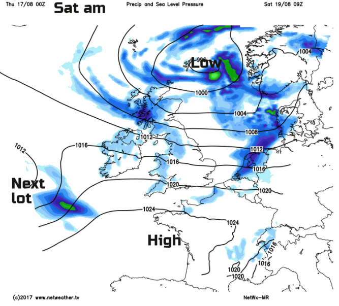
By Saturday morning, the low pressure is still spinning about over Shetland, bringing showers in on brisk westerly winds, but with plenty of bright weather away from the NW. The showers for NW Britain could be heavy and thundery with a scattering of lighter showers coming into NW England too. Pressure then begins to rise and this should bring more settled conditions but the winds only ease in the evening,
The next part of the forecast has lower confidence. Out in the western Atlantic, well off the coast of the US is Hurricane Gert. This is about to head over the colder waters of the north Atlantic and weaken but will start to move across the Ocean towards NW Europe. This tropical system will then become mixed up in our weather systems and its energy and tropical warmth entrained in low pressure systems heading our way for the second half of the weekend.
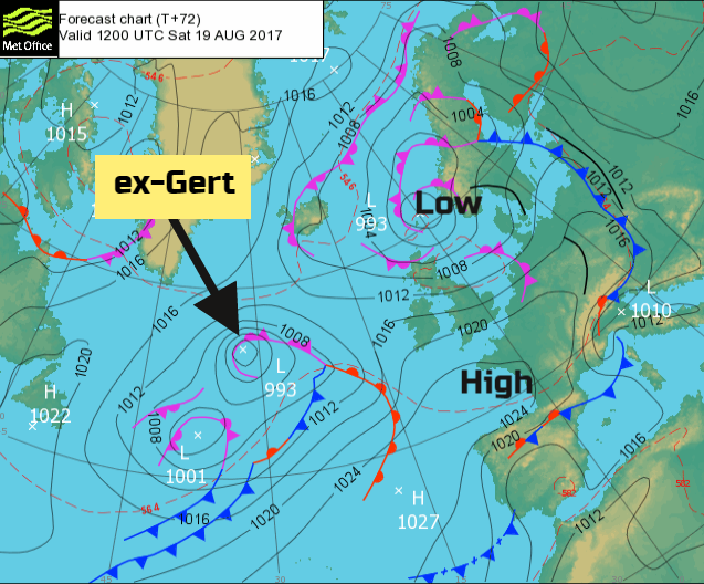
If you are looking at the symbols on a weather app and bemoaning rain on Sunday, hold your horses. The forecast models fluctuate a lot when they get this extra tropical input. So, we’ll have to see when the wind and rain from the two incoming Atlantic lows arrives; it may not be until Monday. Usually, from systems like this, we get heavy rain, blustery winds (maybe gales) and some very warm humid air. Keep an eye on how the forecast develops.

More on Gert and our windy week