Blog looking at risk of snow moving southeast Saturday night and the risk of snow early next week
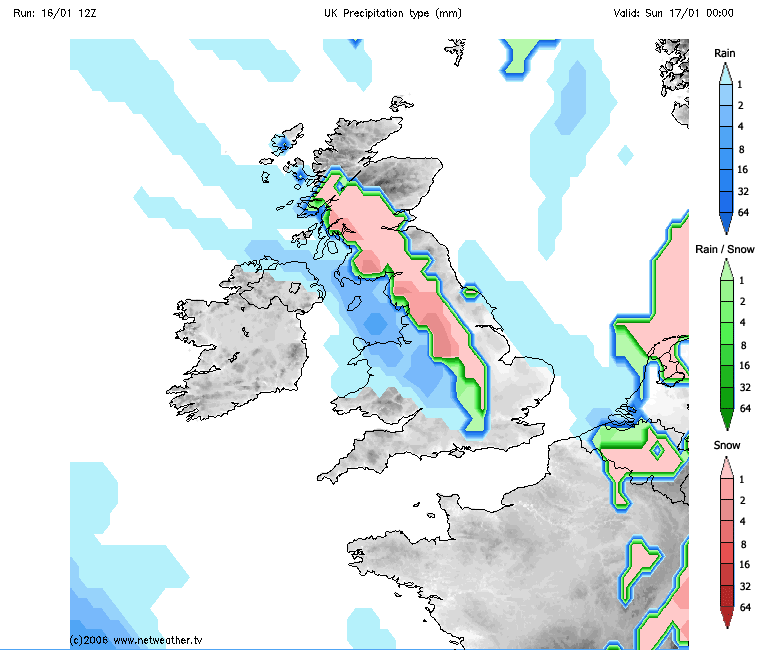
A frontal system that moved in across the NW this morning, bringing rain, sleet and snow across western Scotland and has edged further southeast through the day across the northern half of the UK, with quite a snowy afternoon inland across central and southern Scotland, northern England over and east of the Pennines and also over the hills of north Wales. Coastal areas of NW England, with less cold air, have seen rain or sleet falling.
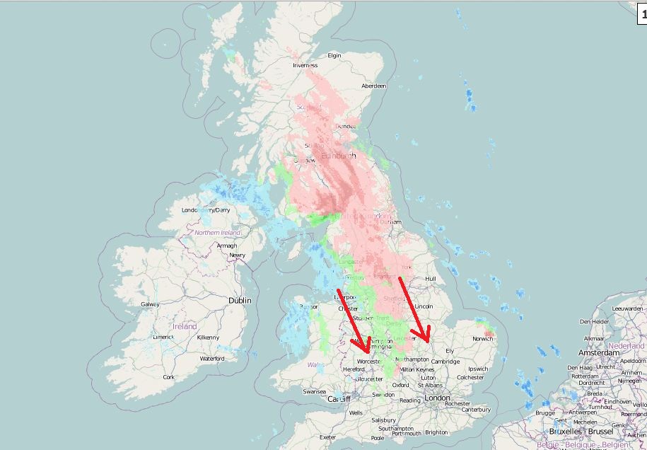
This frontal system moving in from the Atlantic today will slow its progress eastwards as it encounters colder air embedded across the UK, the sleet and snow along it will continue to slide SE from from northern England and north Wales across The Midlands this evening, reaching central southern and SE England / Home Counties late evening and overnight.
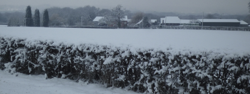
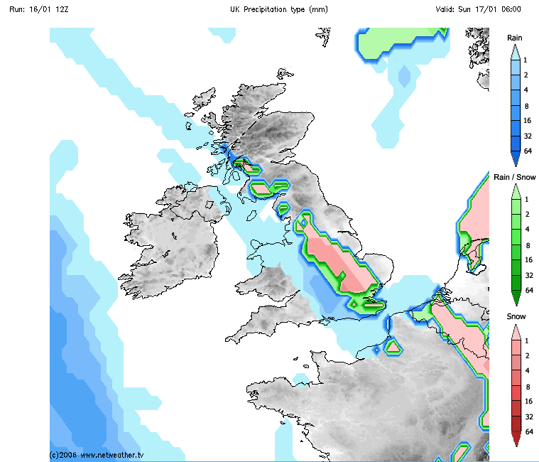
The snowfall will continue across southern Scotland and northern England into the evening before clearing south overnight, tending to form an increasingly narrow zone as it slides SE across central and southern England this evening and overnight. Where snow falls, we could see 1-3cm at lower levels, perhaps 5-10cm across higher ground of Scotland and northern England before it clears later. Ice will become a hazard where the snow freezes on untreated surfaces as temperatures fall close to freezing overnight. Sleet and snow should clear southeast from central southern and southeast England during Sunday morning. Freezing fog patches could be an additional hazard across eastern parts of England by dawn, perhaps lingering through the morning.
Sunday sees another weak frontal system slowly push in across the west, bringing a murky and cloudy day across SW England, Wales and NW England, with patchy drizzle or light rain and some light snow over higher ground, but not really amounting to much.
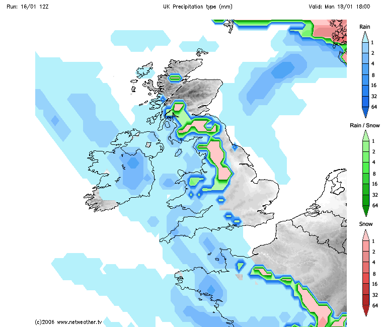
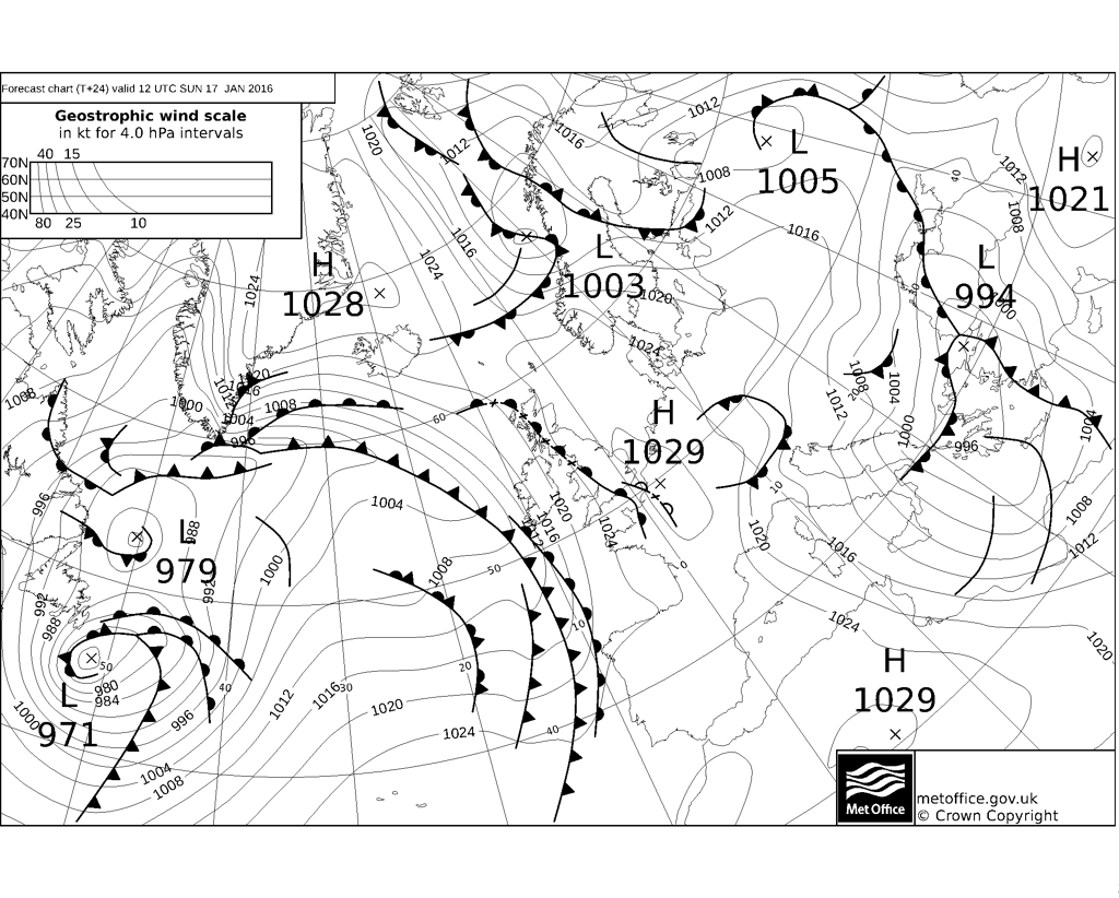
Another more active front moves in from the west on Monday, which could bring snow on the eastern edge of the band of precipitation it brings, particularly over higher ground, though there is, for now, uncertainty just how far east the front will get as it stalls against the cold high pressure over eastern areas. So eastern parts of England, could stay dry before the rain, sleet and snow fizzles out further west.