


Blog looking at much colder weather spreading across the UK from mid-week, bringing a risk of snow in places. Answers on how cold it will get, where it might snow and how long the cold spell will last.
Following the warmest December on record for the UK, when we saw temperatures in the south more reminiscent of April or early May, winter finally looks to arrive across all parts through next week.
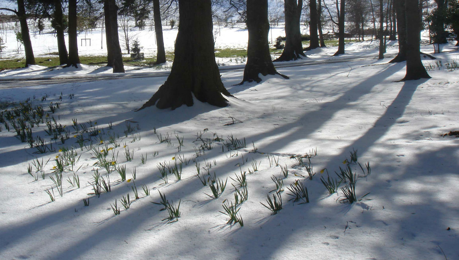
The unseasonable warmth in December confused nature, with insects flying around along with daffodils blooming and grass growing so long it needed the lawn mower.
Scotland and the north of England have seen some brief bouts of colder and wintry weather to make it feel more seasonal, particularly more recently. But for the south, it’s been mild or very mild pretty much since winter begun. So for the south, the coming nationwide cold spell developing next week will be a shock to the system.
Changes in the upper flow wave patterns in the northern hemisphere and jet stream configuration are leading to troughs and ridges positioning favourably to draw cold air south across northern Europe, including the UK, next week.
The drastic change from the conveyor of Atlantic systems bringing wind, rain and mild air to the UK to a pattern that is more ‘blocked’ from these Atlantic systems may be related to changes in the atmosphere driven by El Nino and the Madden Julian Oscillation (MJO).
The warm Sea Surface Temperature (SST) anomalies over the central and eastern tropical Pacific, typical of El Nino, have enhanced the low-level westerly flow here and increasing Atmospheric Angular Momentum (AAM) to an enhanced state. AAM is a measure of how fast the atmosphere is spinning relative to the earth’s rotation and high AAM can lead to an increase in poleward fluxing eddies- which has been linked to amplification (buckling) of the jet stream over temperate latitudes of the northern hemisphere – leading to a greater chance of blocking that allows cold arctic air to spread south across N America and/or Europe.
The Madden Julian Oscillation (MJO) – which is a tropical convective disturbance that propagates eastwards over the global tropics over a 30-60 day period – has wide ranging impacts on weather patterns in extra-tropical regions such as N America and Europe. There are 8 phases of the MJO, and typically it is phases 7, 8 and 1 that can impact the upper flow patterns in a northern hemisphere winter to produce high latitude blocking which favours very cold air, that is normally bottled up over the arctic, to escape to mid-latitudes of N America and Europe.
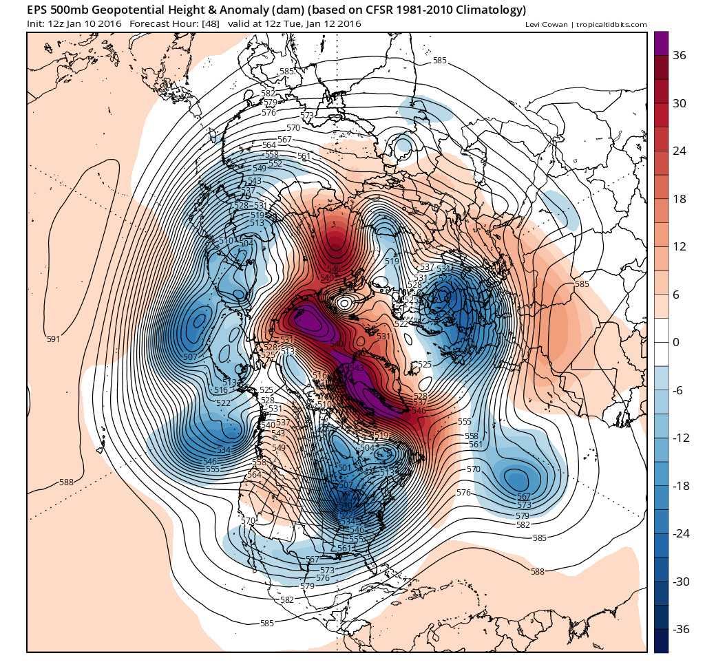
MJO forecasts since the beginning of the New Year, particularly from the European Centre of Medium Range Forecasting (ECMWF), have indicated the MJO wave to move through 7 and 8 (where it currently is) before slowly declining through 1 and 2. This has coincided with a rise in pressure/heights over arctic/pole since late December, as warm air has surged north aloft across Alaska and also Scandinavia and northern Russia recently, resulting in colder air being forced south from the arctic across N America and now Europe.
ECMWF MJO forecast (10th Jan)
.gif)
Over the next few days, we start to see the upper flow pattern change over the N Atlantic, as a deep pool or vortex of cold air drops south over eastern N America which in turn forces warm air aloft north across Greenland, creating a blocking area of high pressure to the west of the UK over the mid-Atlantic up through Greenland. The blocking ridge of high pressure building north across Greenland joins high pressure of the arctic, shunting cold air down from the arctic circle towards the UK, as low pressure drifts east of the UK.
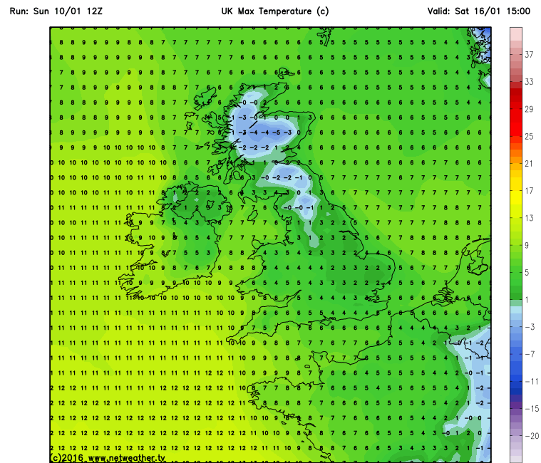
The showery low pressure system sat over the UK this weekend and early next week will only slowly shift east by the end of the week, so temperatures will only gradually turn colder from the north. Temperatures returning to average early next week across the south while falling slightly below average across the north. It’s really Thursday onwards that we see a marked change to colder conditions across all areas from the north, as true arctic air pushes south, with below average temperatures nationwide. On Thursday and Friday, GFS indicates daytime temperatures struggling to get any higher than 0-3C across Scotland and higher ground of northern England, 4-6C further south. Daytime temperatures are indicated to be coldest on Saturday as high pressure builds in creating an inversion preventing low overnight temperatures from rising much, perhaps struggling to get much above freezing over inland areas. Slightly less cold on Sunday, but still cold, though perhaps turning milder across the far west.
Saturday max temperatures from GFS
For the UK, it is often difficult to forecast where and when it will snow away from higher ground, as quite often temperatures and dew points are very marginal – which means a subtle change in either in a borderline set-up can make a difference between rain or snow falling. Temperatures aren’t so crucial for snow to fall, it can snow with a surface temperature above freezing, though for it to settle the ground temp needs to be around 0c or below. The dew point is more crucial for snow to fall, above 0C and it will likely be sleet or rain.
Quite a complicated synoptic picture as we go through the week, which makes forecasting even trickier. Monday and Tuesday are looking generally showery, then as low pressure moves east into the North Sea, winds turning more northerly for a time on Tuesday, with colder air feeding down, cold enough in the north and west for snow to fall over higher ground. Then a brief ridge of high pressure builds in Tuesday night, killing the showers and clear the skies to lead to a cold and frosty night.
On Wednesday, winds look to turn more westerly again, with an area of low pressure moving in from the west over Ireland. After a frosty start for most, a mostly dry but chilly day in the east, but showery rain moving in across western areas by evening, turning to snow over higher ground in the north.
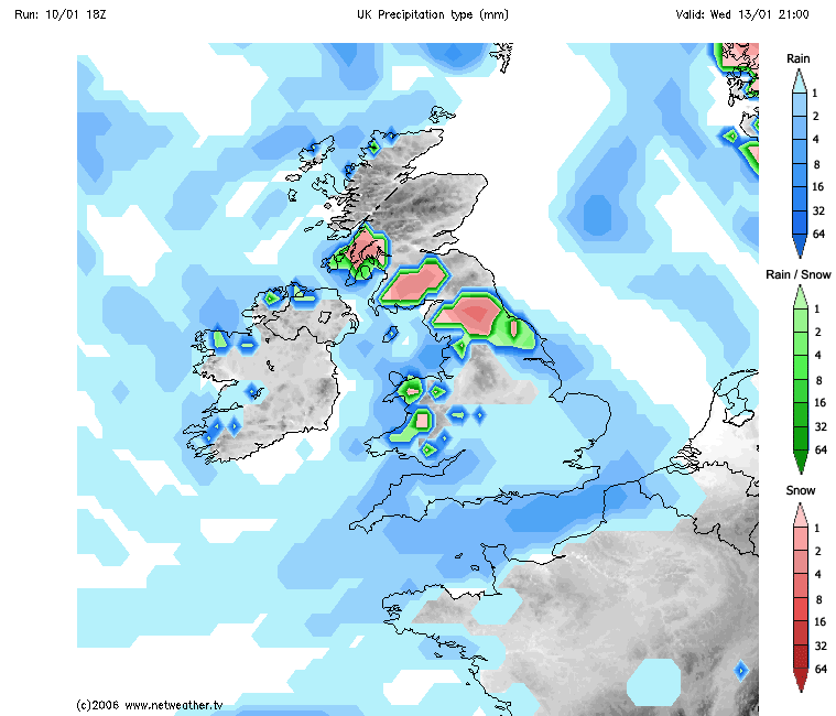
Low pressure indicated to drift east across the UK Wednesday night, passing out into the North Sea and Low Countries on Thursday, with a brisk and bitter northwesterly flow pushing south across the UK, chance of some sleet and snow, even in the south on the back of this low clearing east early on Thursday.
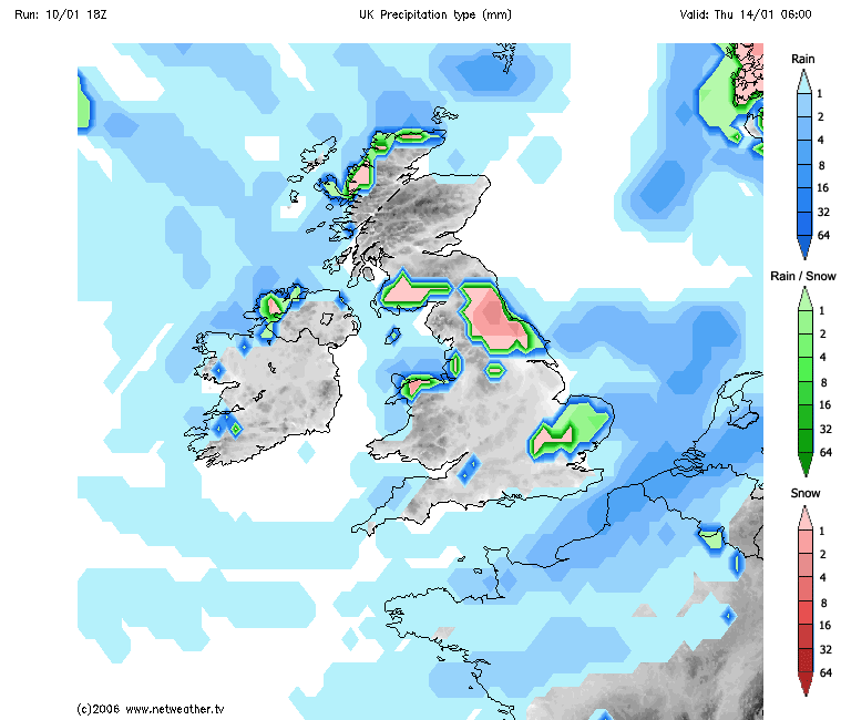
Then Friday, increasing uncertainty in detail from models, sleet and snow showers likely towards eastern coastal counties, exposed to northerly wind, 18z GFS throws in a wave low crossing east over southern UK (as previous runs showed too), which could bring a spell of snow here, but ECM yet to show this low.
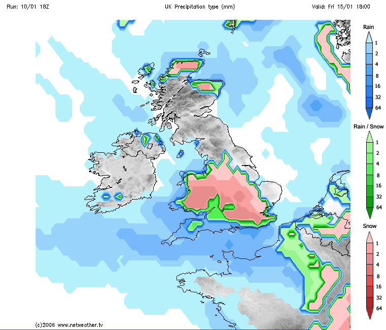
Into the weekend and beyond, the models loosely agree on low pressure close to the east at the end of the week slipping SE over mainland Europe. A ridge of high pressure builds northeast across the UK, bringing drier weather from the west. So Saturday perhaps starting with a raw northerly wind with sleet and snow showers in the far east, drier and brighter for many. Sunday, for now, looking dry and bright but cold after an overnight frost.
Beyond the weekend, the two main medium range models ECMWF and GFS from the 12z run today finally agree on cold anticyclonic conditions to start the week, before high pressure slips south into the near continent by Tuesday, with a return to more milder southwesterly flow across all parts by the middle of the following week. But there is still enough spread in the ensembles to suggest that high pressure may hang on across the UK longer than most recent high resolution runs susggest.


