


Thunderstorms spreading east across the Mediterranean this week have brought flash-flooding to Spain and southern Italy and now across Greece and the Balkans.
Severe thunderstorms brought torrential rains and caused deadly floods across parts of southern and eastern Spain earlier this week, with the same storm system moving further east across the Mediterranean, bringing flooding to parts of southern Italy yesterday and now a risk for Greece and parts of the Balkans over the coming days too.
Deadly flash floods caused huge amounts of damage in southern Spain at the start of this week, turning town streets into fast flowing rivers, washing away cars, trucks and anything else with it. In the small town of Adra in the Almeria Province of southern Spain, at least 30 people had to be rescued when they became trapped in cars as the streets turned into fast flowing torrents. Torrential rain also caused flooding in Valencia, Granada, Alicante and Malaga.
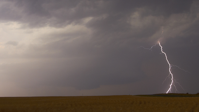
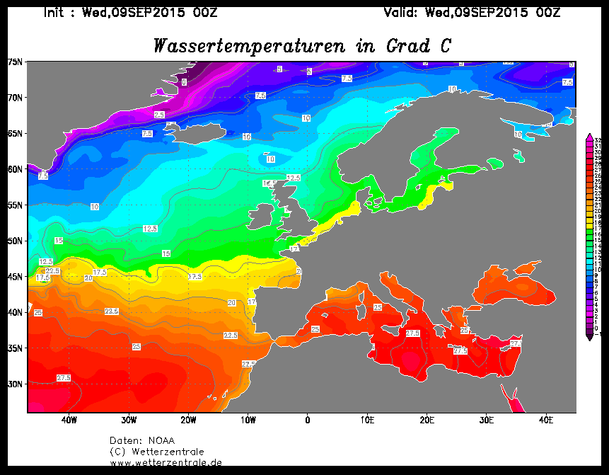
Flash flooding along the Mediterranean is fairly common in early Autumn, particularly September, when the sea is at its warmest point of the year after heating up all summer. Sea surface temperatures at the moment are typically 23-27C, which produces a lot warmth and moisture in the layer of air above it and thus a lot of energy to fuel big storms capable of producing extreme rainfall and large hail given the right conditions.
Current Sea Surface Temperatures (SSTs):
An upper trough, that was over Spain and the western Mediterranean earlier this week, has now arrived over the central Med. A surface low, dubbed the ‘Mediterranean Cyclone’ induced on the forward side of this upper trough moved out of Algeria and Tunisia early yesterday and is now SE of the boot heel of Italy over the Ionian Sea and heading towards northern Greece. Parts of the far south of Italy, such as Sicily, Puglia and Calabria have seen flash-flooding during Tuesday and Wednesday, as thunderstorms hit the area. The ancient town of Gela, on the southern side of Sicily, saw 95mm (just shy of 4 inches) fall in 24hrs ending 1900hrs Wednesday, 92mm of this total falling in 12 hours. With towns and cities, such as Messina, seeing roads and streets closed off as flood waters rushed through, submerging cars. Cascades of water were witnessed coming down the mountains on the eastern side of the island during the heights of the storms.
Low over Ionian Sea with cold front moving in across Greece...
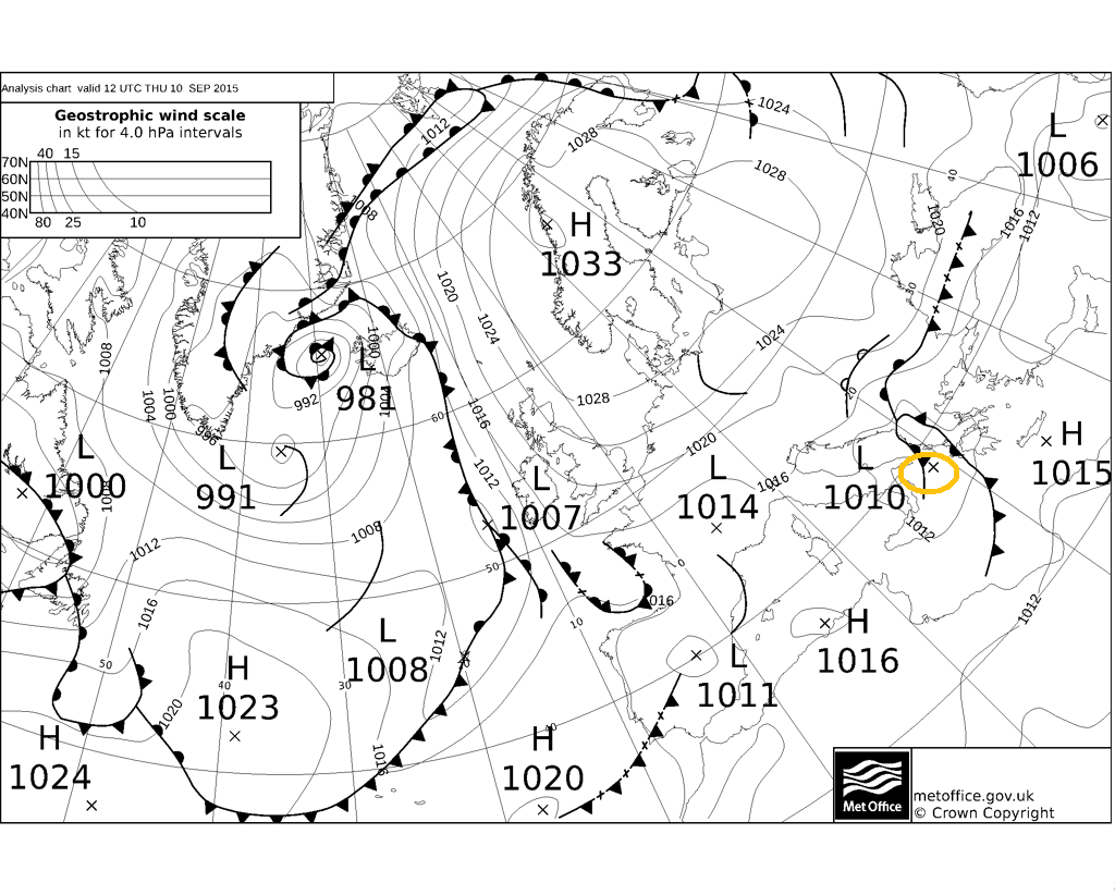
The low approaching NW Greece has an attendant cold front which trails south towards the northern coast of Libya. Strong thunderstorms have developed over the Ionian Sea and across western Greece along with Albania this morning ahead and along the cold front, as the very warm and moist airmass to the east of the front becomes very unstable. The storms spreading east over Greece and Albania this afternoon and evening, including some popular holiday islands such as Corfu, with a risk of excessive rainfall leading to flash-flooding in some areas. Though, Crete and other islands to the south of mainland Greece look to escape. Further storms are likely in the region over the next few days too, with a continued risk of flash-flooding across Greece, Albania, Kosovo, Macedonia, Serbia, Bulgaria, Romania and perhaps western Turkey. Storms may bring 50-100mm (2 to 4 inches) in places, perhaps upto 150mm (6 inches) locally.
Further west, more storms have broken out across the east coast of Spain this morning, as an onshore and upslope warm moist flow off the Mediterranean beneath steep lapse rates created by drier air aloft coming off the more arid Spanish Plateau create strong thunderstorms. The storms have spread east offshore over the western Med this afternoon and also close the Balearics this afternoon, as a strong jet streak moving east across Spain pushes them east. And holiday makers here should be aware there is the possibility of more storms affecting NE Spain and perhaps the Balearics on Friday over the weekend, as the warm/moist onshore and upslope flow and another trough arriving from the west create those storm clouds.


