On Monday (31/08/15) the Cape Verde islands (Cabo Verde) were hit by a rare hurricane in the eastern Atlantic.
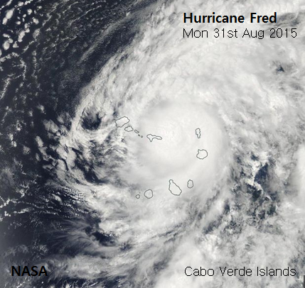
If you were heading for an early September holiday to the Cape Verde Islands in the eastern Atlantic you would expect 30C by day 25C by night, a fair amount of sunshine and the odd thundery shower. Not, however, a hurricane passing by. Yet earlier this week, Hurricane Fred brushed past the green Atlantic islands bringing torrential rain and damaging winds. It seems that the islands are now officially called Cabo Verde.
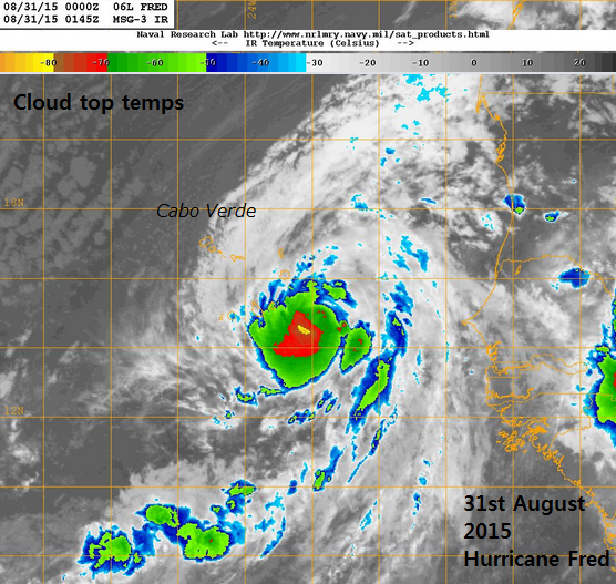
There are the occasional tropical storms that pop up in the eastern Atlantic but the last hurricane to pass over the then Cape Verde Islands was in 1892, this does not happen very often at all. Over 100 year ago Hurricane ‘Five’ moved through the waters in the centre of the islands, just south of Sao Nicolau, avoiding a driect hit. Usually the eastern Atlantic is the starting area for storms that end up across the ocean heading to the Caribbean and US. Fred is now the eastern-most hurricane (known) to have formed in the Atlantic tropics. Strange happenings in a strong El-Nino year.
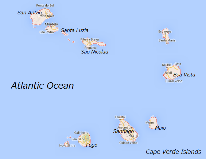
During Monday the centre of Fred passed very close to the eastern islands, grazing Boa Vista before heading to the NW islands of San Antao across to Sao Nicolau overnight. With over 5” of rain forecast, possibly 10” in places, these totals were equal to the annual rainfall for the islands. Actual observation amounts are still not avaliable. All this rain falling in such a small time meant flooding and landslides were inevitable. Coastal flooding was forecast too due to a storm surge.
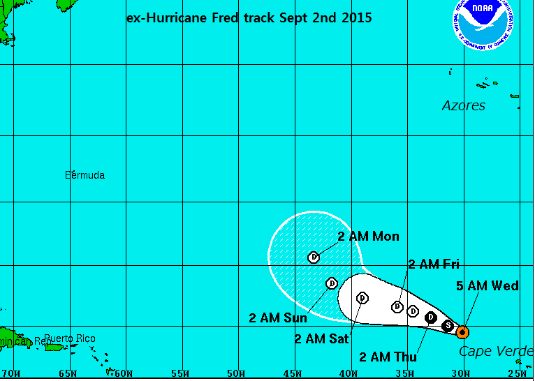
This episode brought trees down, roofs ripped off, interrupted power and phone lines with flight cancelled but with warnings no serious incidents occurred. However, the damage to roads and coast line and the loss of fishing boats will have significant effects to the people of the islands. Fred has now passed over cooler sea waters and began to weaken as vertical shear also picked up on Tuesday and the storm moved away. The track image below from NHC shows Fred fading and disappearing mid Atlantic
It seems the path of Fred did save the islands from the worst of the storm, as it missed the more populated islands in the south, but still a rare event indeed.