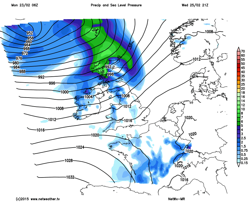
The blustery, wintry showers will continue over the next couple of days before a mid week mild blip sees temperatures hit double figures for some. Then it's a return of colder air from the north west as a band of wind and rain makes it's way south east.
The blustery, wintry showers will continue over the next couple of days before a mid week mild blip sees temperatures hit double figures for some. Then it's a return of colder air from the north west as a band of wind and rain makes it's way south east.
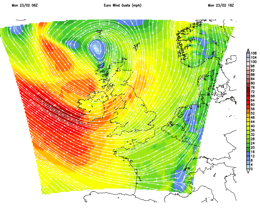
Winds today will continue to strengthen through the afternoon with gales and severe gales for exposed western coasts and high ground, spreading to the south west later and only easing a little as they affect the central belt of Scotland tomorrow morning.
The blustery showers continue tomorrow, not as frequently as today though, and then that milder air is arriving from the south west.
Later on Wednesday a spell of very wet and blustery approaches from the north west heading south east with colder air and more blustery, strong winds following into Scotland, and the colder air spreads south east behind the rain to end the week.