The showers will fade with more warm sunny spells and rising temperatures. Rain for the far northwest. Increasing air pollution levels in the fine, steady weather.
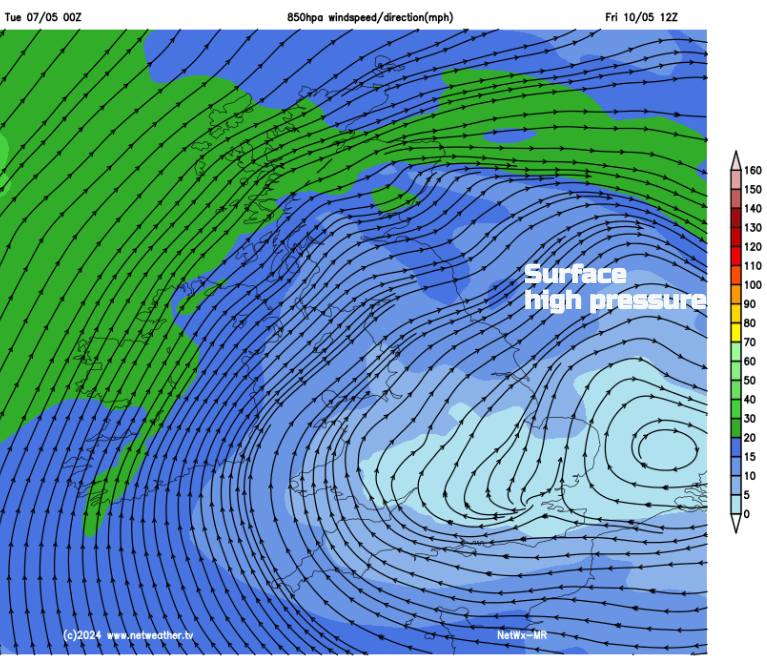
As high pressure builds over the UK this week, the weather will settle down, although frontal bands will brush past Scotland. Temperatures in southern Britain will rise into the low twenties Celsius with the high teens reaching other parts of the UK. Perhaps even warmer by Saturday, but with air quality issues.
The Bank Holiday weekend was mixed. Some places enjoyed warm sunshine with temperatures peaking around 21c for Hull and Derbyshire. Other areas sat under stubborn cloud and it was grey, damp and felt rather cold. Grampian saw torrential rain on Sunday 5th with flooding in Aberdeenshire. On Bank Holiday Monday Bradford and Leeds also experienced flooding after thundery downpours.
There will be a slow improvement. For Tuesday there is still a lot of cloud about this morning. The winds stay light. Bright spells appear as will a scattering of showers developing by the afternoon for Wales and England and the Southern Uplands. Eastern England will see fewer showers and more sunny spells today.
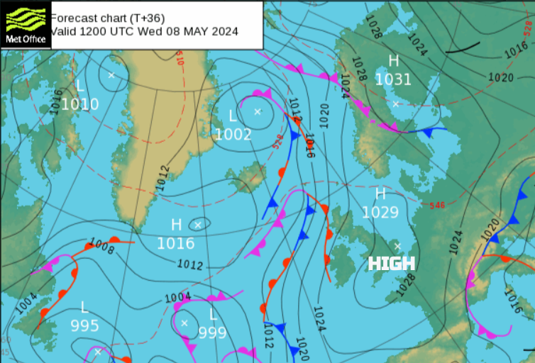
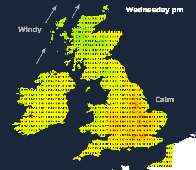
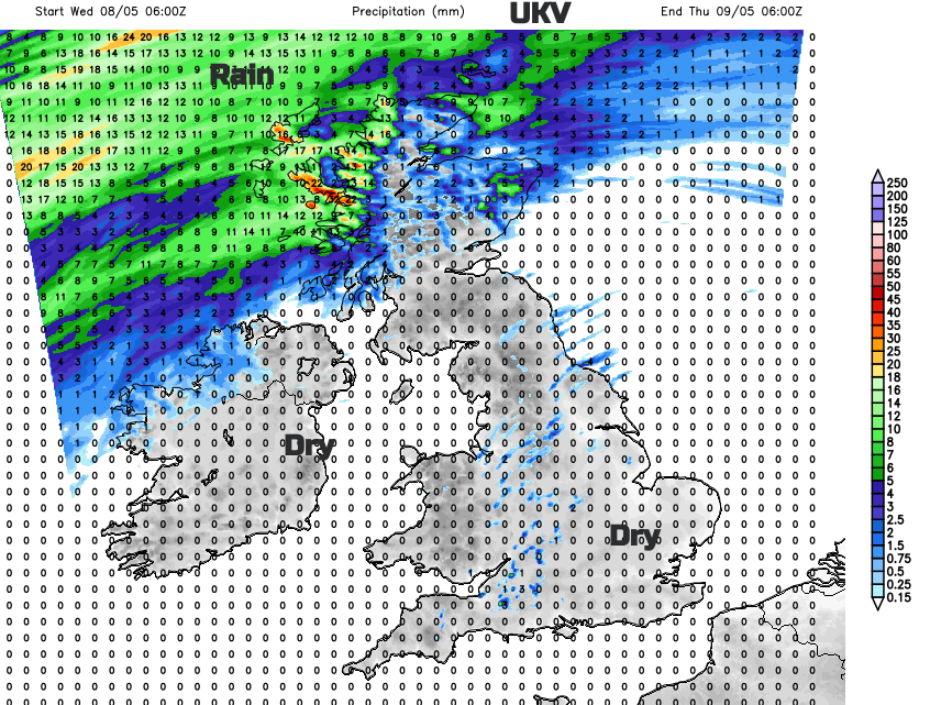
Overnight there will be a lot of low cloud over the North Sea which will drift over East Anglia by Wednesday morning but will disappear soon enough. There will be hardly any breeze but an incoming Atlantic weather system will throw high cloud in from the west. Wet and blustery weather will reach the Western Isles by lunchtime with more cloud and dampness for northwest and northern Scotland. Elsewhere, again it will be a fair day with varying amounts of cloud, and bright spells but a good amount of sunshine over Wales and England. Eastern Scotland could see 15 to 17C, Northern Ireland similar perhaps a touch higher if the sunshine breaks through for longer. Eastern Wales could reach 20C and much of England will be high teens to low 20sC. It will feel cooler for coastal Kent, Suffolk and Essex into the Thames estuary and western counties of Britain where there is more cloud.
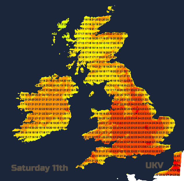
The passing rainbands will affect northern and western Scotland through the night with patchy outbreaks for the far north on Thursday. Overall there will be more cloud for northern Britain and Northern Ireland with clearer skies and more sunshine further south. Temperatures could reach 22 to 24C in a few sunny spots again with very light winds.
Friday looks similar with a settled day on Saturday. Sunday has low confidence. A larger Atlantic system could swing in from the west and bring cloud and rain to Northern Ireland and western Scotland but setting off showery rain ahead for Wales, SW England and more of Scotland. The ECM model is showing this. Alternatively, that system might not make inroads which would leave the UK with a warm, bright, mostly dry setup.
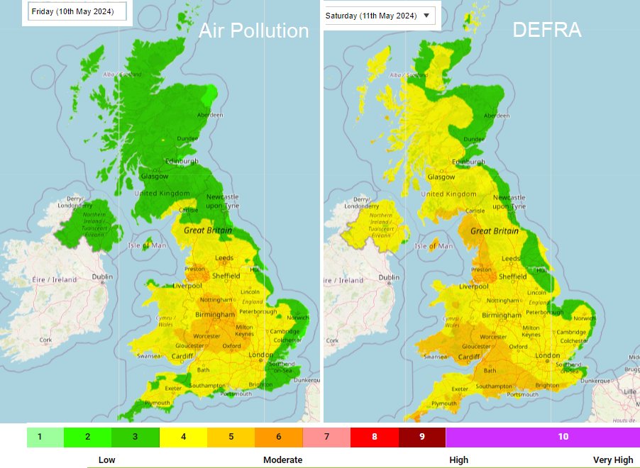
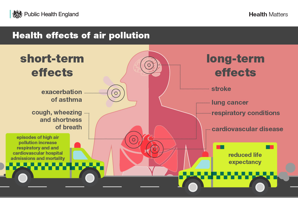
As the high pressure slips eastwards the stagnating airflow over the UK just begins to draw air from the near continent. Many will have had a dry week, with slowly descending air, hardly any breeze and there will be rising levels of Ozone and Particulates. Just worth considering the air quality in these steady conditions, as air pollution does have health impacts.
"Outlook : Increasingly widespread Moderate air pollution levels will develop through the outlook period with widespread Moderate air pollution across the entire United Kingdom, away from the east coast, forecast by Saturday. " DEFRA