Fresher air is now reaching across the UK with the risk of a few thunderstorms. Europe continues to swelter and there are signs that another pulse of heat could affect the UK in the middle of July.
Finally, fresher air has reached southeast England after days of heat for parts of the UK, but there are signs of more heat for the middle of July.
The first day of July was the hottest day of the year so far with a maximum temperature of 34.7 °C at St James’s Park in London. Close to this were East Malling, Writtle and Teddington, also passing 34C on a hot and humid day for SE England. In Scotland and Northern Ireland, the top temperatures were 17 to 20C as fresher air arrived from the northwest but London experienced another sultry, close night.
This hot and humid start to July followed England’s ”warmest June on record, the UK seeing its second warmest since the series began in 1884, according to provisional Met Office statistics.” Met Office
Across Europe, there has been dangerous heat as heatwave conditions intensified. There were red heat warnings for France, Belgium, Germany and Croatia as schools closed and in Italy, working outside was stopped as power blackouts occurred. This has been an incredible surge of heat, assisted by day on day heating under clear blue skies. Tropical nights (above 20C) are a particular concern for people’s health as there is no time to recover.
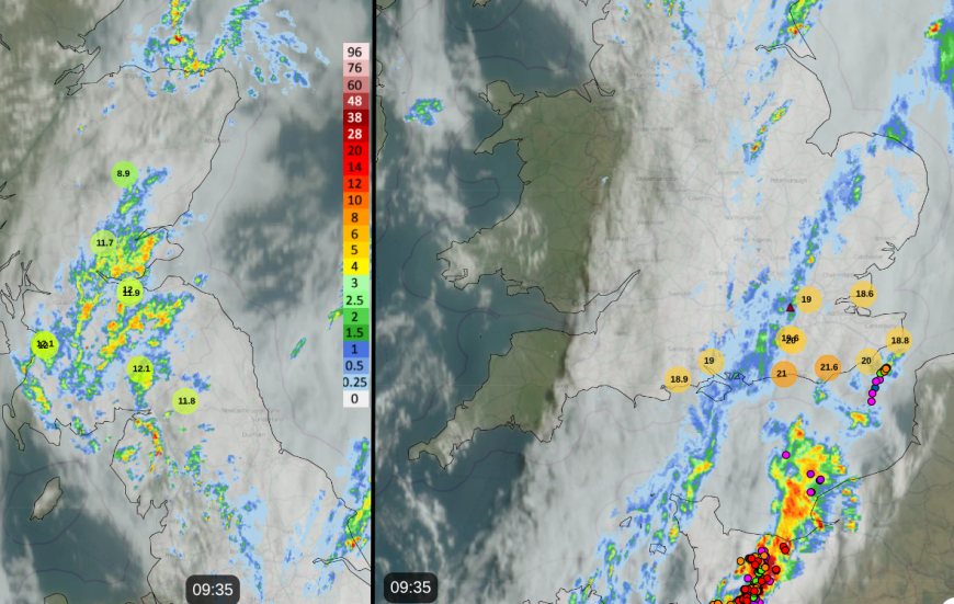
Netweather Radar showing observed cloud and rain data with lightning strikes and hourly temperatures (Max and Min)
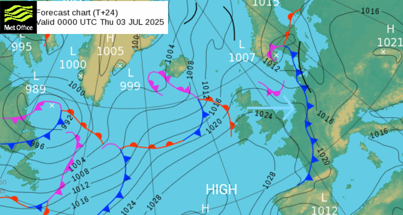
For the UK, change and relief come as a cold front makes its way south and east, moving into northern mainland Europe. The Met Office has a yellow thunderstorm warning for NE England, SE Scotland but the wet weather should be away from the east coast of Britain for the evening rush hour.
“A fairly sharp upper trough will move east across the UK…combined with surface breeze convergence and some surface heating - will support the development of heavy showers and some thunderstorms towards E Scotland and NE England.“ Convective forecast
There will be heavy rainfall with the risk of flooding, hail and sudden strong wind gusts.
There has been early morning rain and elevated thunderstorms over Kent and Surrey, with the wet weather along a trough line ahead of the front, extending from the Isle of Wight up to Norfolk. This gets mixed up with the cold front, so there will be further outbreaks of rain for SE England as the risk of thunderstorms grows for northern France and the Low Countries.
Although it will still be warm tonight for Greater London, it won’t be as oppressive and muggy. For northern Britain and Northern Ireland, overnight temperatures will fall into single figures.
For the next few days, parts of England will see temperatures in the low to mid 20sC, perhaps reaching 27C but it won’t be as humid, so it will feel different. Still very warm by day, but not as sticky and less uncomfortable by night.
When will it heat up again?
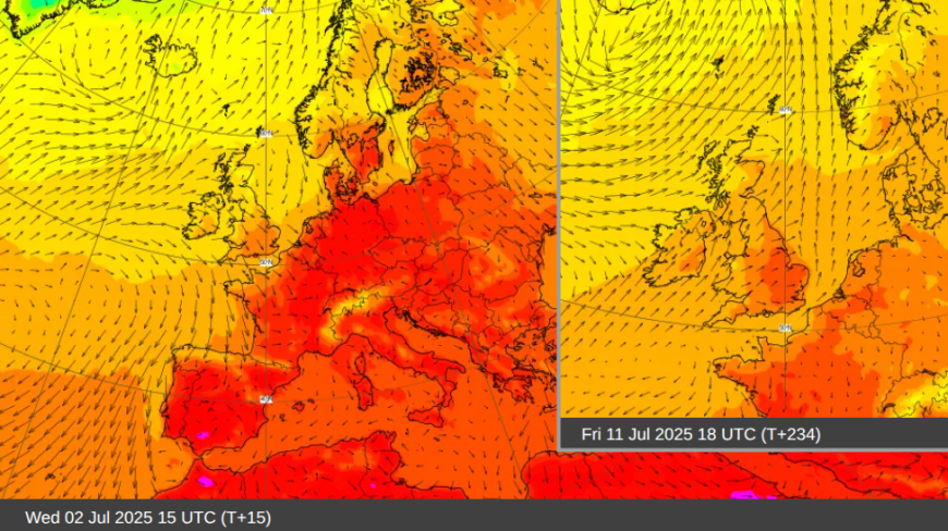
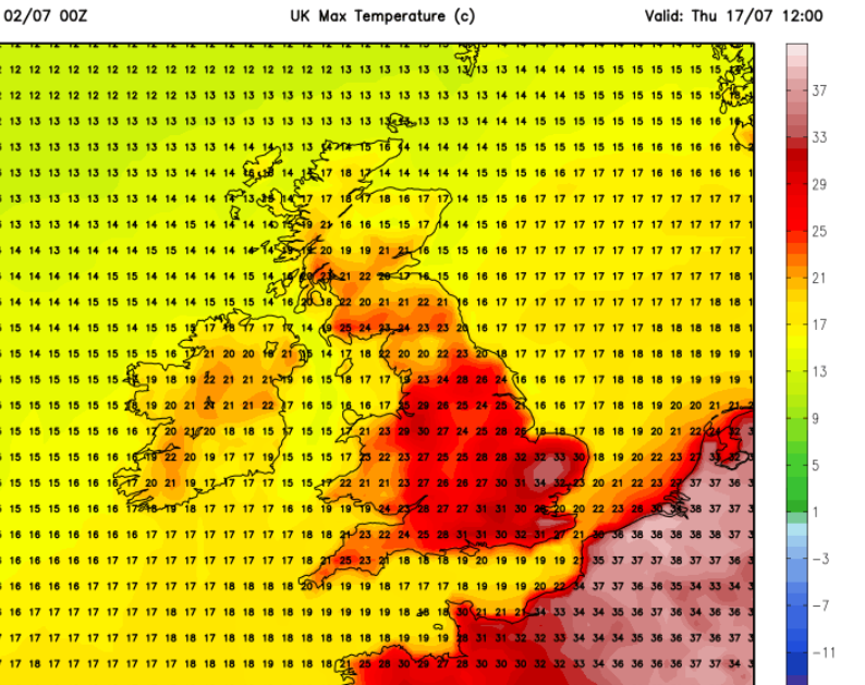
Mid-July is looking likely for another hot spell. For this week into the beginning of next week, temperatures will be around average, but creeping up for southern Britain. By Friday 11th, there could be heat again through France and temperatures nudging 30C in England. The GFS Model shows that heat intensifying for France by Tuesday 15th, Wednesday 16th, and by Thursday 17th, showing a 34C for inland Anglia. This will be at the northwestern edge of more intense heat for mainland Europe. This is a fair way off but the ECM model also seems to support this trend.
The heat can remain and build up over the Iberian Peninsula in summer, and it also leaks into southern France, enhanced by strong sunshine. The jetstream dips southwards past the UK this weekend with fresher air. Next week, the Azores high tries to hold on, reaching over southern Britain but the more zonal jet will bring more low pressures over the northern half of the UK from the Atlantic. The GFS then shows disruption of the jet and this surge northwards of the heat through western Europe for the middle of July.
Loading recent activity...