Heatwave conditions continuing today & tomorrow, temperatures could reach 34C on Saturday. However, thunderstorms look to break out tomorrow afternoon onwards across central, northern and western areas, before cooler conditions arrive on Sunday.
Heatwave conditions, as defined by the Met Office, are underway across England, and will last through to Sunday - when temperatures are expected to come down. Yesterday's top temperature of 32.2C at Heathrow and Kew in London made it the warmest day of the year so far, and temperatures today will again reach similar values in the south, perhaps reaching 33-34C somewhere in across eastern England on Saturday. Nights are warmer now too, not falling below the high teens last night across large parts of England and Wales and tonight will be another warm one, perhaps a tropical night (not falling below 20C) in a few spots.
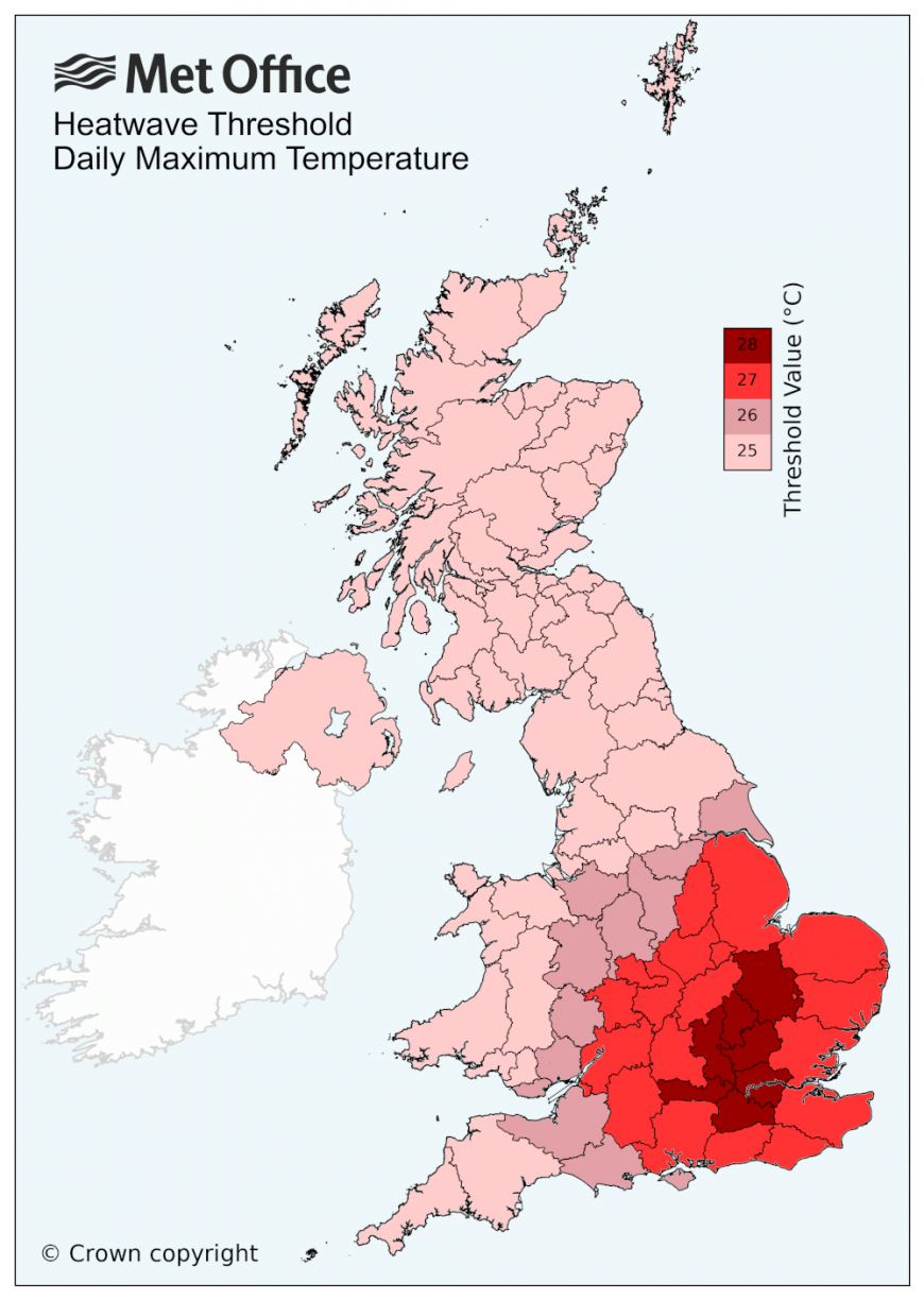
A UK heatwave threshold is met when a location records a period of at least three consecutive days with daily maximum temperatures meeting or exceeding the heatwave temperature threshold. The threshold varies by UK county, see the UK temperature threshold map below.
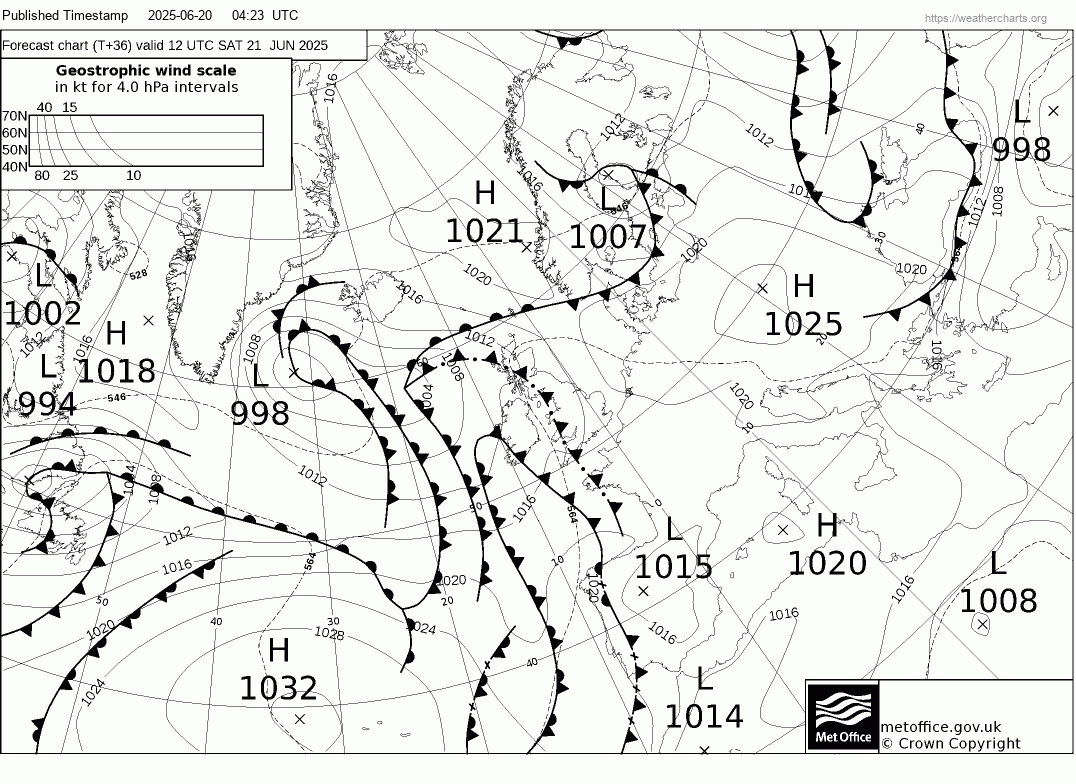
Saturday looks to be the hottest day, as the plume bringing the hot air from Iberia reaches its peak in warmth. However, at the same time, cooler and fresher conditions will be making inroads from the west, pushed towards the UK by an upper trough moving east and low pressure deepening to the northwest.
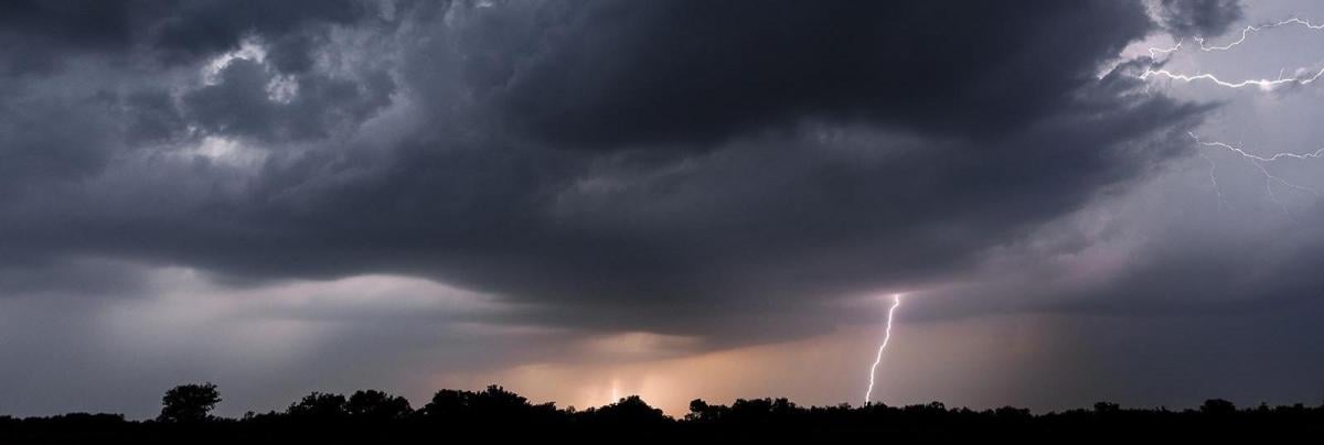
The cooler air to the west and hot air to the east will be marked by a cold front - which will push eastwards later on Saturday, with heavy downpours and thunderstorms breaking out ahead and along the frontal boundary, across northern, central and western areas Saturday afternoon, evening and overnight, before the cold front clears the east early Sunday.
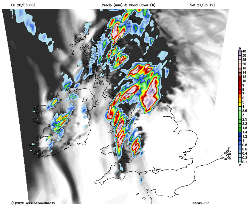
Models are showing quite large amounts of CAPE (Convective Available Potential Energy) across northern and western areas on Saturday afternoon and evening, as cold air in the mid-levels associated with upper trough moving in from the west moves in above the hot and humid plume lower down spreading north. Surface heating, cooling aloft and rapidly falling pressure from the west across northern and western UK will release this instability to support heavy downpours and thunderstorms to break out and track northeast across SW England, Wales, Midlands, northern England and eastern Scotland ahead of surface cold front moving east, these eventually clearing the northeast overnight.
Large amounts of CAPE forecast by UKV across central, northern and western areas Saturday afternoon
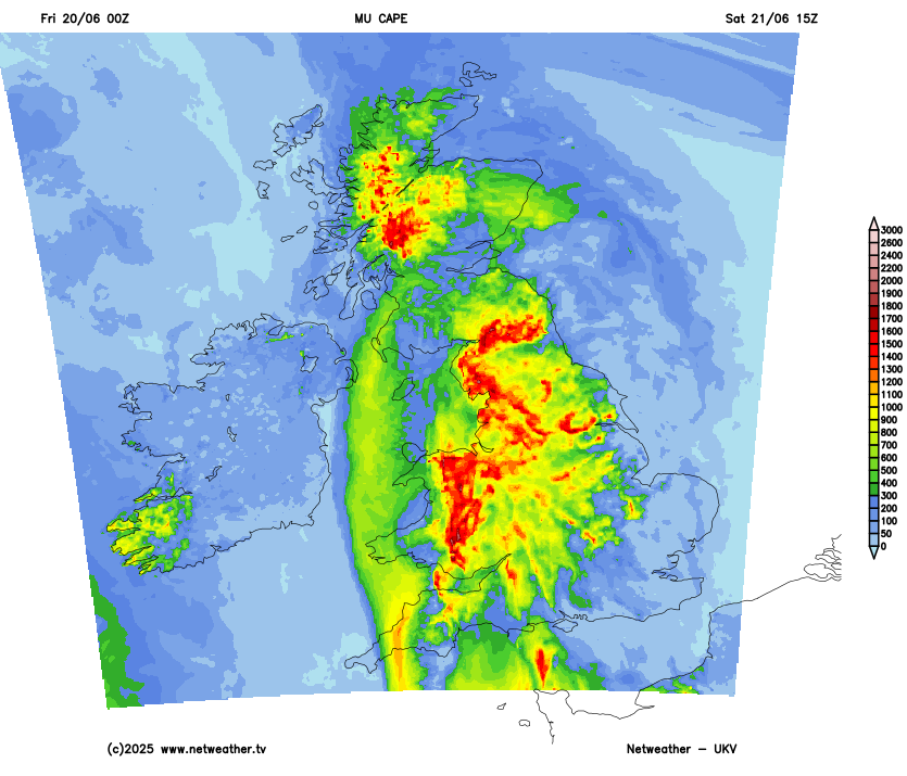
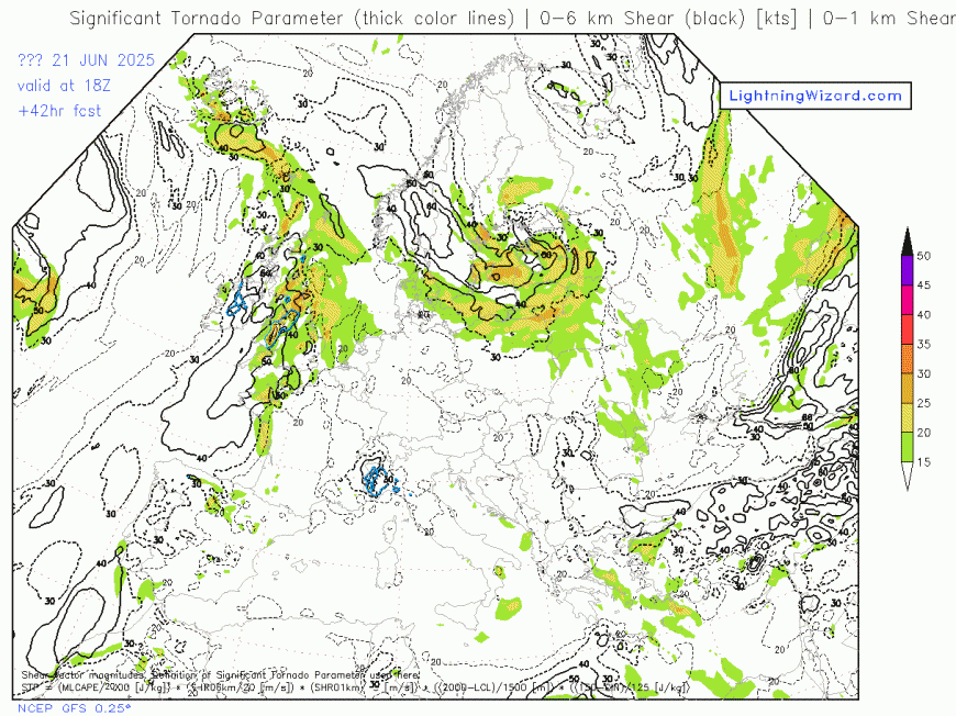
There looks to be a risk of large hail given the high CAPE (1,000-2000 j/kg) and fairly strong deep-layer shear (40-50 knots) - especially across parts of the N Midlands, NE Wales and N England. Frequent lightning, strong wind gusts and intense rainfall leading to flash-flooding could also pose a hazard from stronger storms that develop - given the favourable environment for strong convection.
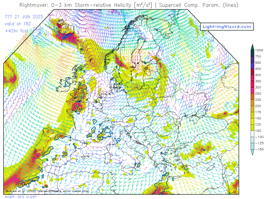
Strong deep layer shear forecast on 1st chart, also strong storm-relative helicity may bring an enhanced risk of supercell thunderstorms developing, with a risk of large hail and perhaps a tornado (if storms become surface based)
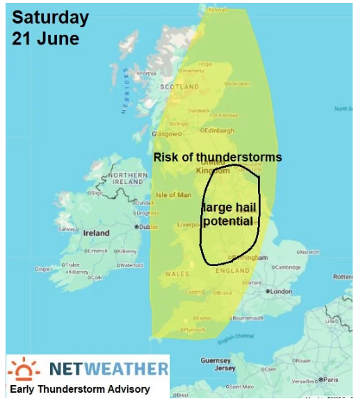
An early Thunderstorm Advisory has been issued, while a Thunderstorm Watch for Saturday will likely be issued Friday evening or Saturday morning, when more detail can be given on where the greatest risk of thunderstorms and associated hazards will be.
Residual warmth from Saturday may hang on across East Anglia and far southeast of England on Sunday, with temperatures reaching 25-27C, but generally turning cooler and fresher behind a cold clearing east first thing. An upper low and collocated surface low moving in close to the northwest on Sunday, which will drive a cyclonic southwesterly flow towards the north and west - which will support band of heavy and thundery showers to spread east here. A risk of hail and squally winds with any heavy showers. A few weaker showers spreading further east, but SE England may stay dry.
A more changeable outlook next week, with an increasingly active jet stream, driven by a steep contrast over the North Atlantic and North America, pushing east across the UK. This will mean areas of low pressure moving close or over northern UK, with frontal systems passing through - bringing spells of rain or showers but also some drier brighter weather to many areas. Though the chance of rain in the south may become towards the end of the week, as the jet stream shifts north - allowing high pressure to build back in from the Azores, bringing increasingly drier, warmer and more settled conditions in the south. But some uncertainty how quickly it will become more settled in the south. So, maybe good news for those going to the Glastonbury Festival - which starts on Wednesday and goes through to Sunday, it could start changeable with chances of rain, but turning drier and warmer, perhaps hot over the weekend.
Loading recent activity...