With temperatures in the high 20sC, Friday looks to be the hottest day of this week, around 30C but what about the weekend? There will be more thundery showers and warmth.
In the next few days, we have heat and humidity from Spain, high pollen and sunshine but also the threat of heavy downpours and thunderstorms for some parts of the UK. Friday looks to be the hottest day with 30 or even 31C possible.
What about the weekend? The heat will last until Saturday in some parts of Britain, but fresher air from the Atlantic will arrive from the west by Sunday. Eastern England will hold onto the heat longest.
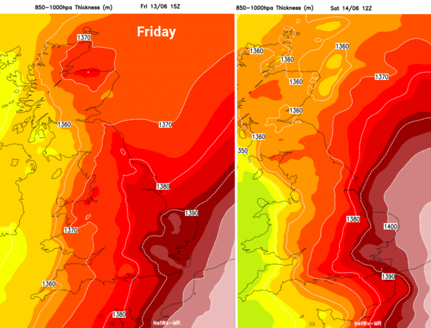
Eastern England holding onto the heat for longest later this week
Whilst some areas will see sunny, dry and very warm weather the overall picture is complicated by the risk of heavy showers and thunderstorms. These will bring more cloud and restrict the temperatures. It will be hard to glean a helpful forecast from hourly weather symbols on an app. Showers will come and go, and there will be the risk of thunderstorms in some areas. However, not everyone inside those warned areas will see an actual thunderstorm. It might be 2 or 10 miles down the road or soak you, accompanied by lightning, hail even flash flooding thanks to sudden torrential rain.
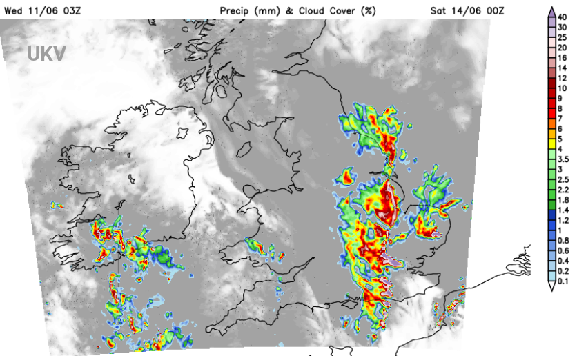
Friday evening has already been highlighted by the Met Office with a yellow thunderstorm warning from Friday pm until 6am on Saturday across SE Britain. “Thunderstorms may bring some disruption during Friday evening, and overnight into Saturday. Although many places within the warning area may not see any impacts, torrential downpours could bring 30-50mm of rain.”
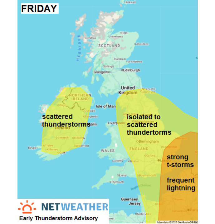
The Netweather convective forecast highlights various areas on Friday but it is the orange region closer to the English Channel later in the day that could prove most lively.
“the development of strong thunderstorms moving NE across SE England, East Anglia, East English Channel and near continent in the evening/early night. The storms may form a Mesoscale Convective System clipping far SE England and over near continent, with risk of frequent lightning, hail, 30-40mm rain in an hour and gusty winds.”
There is still plenty of uncertainty between the models about the development of these storms and their path north or northeastwards. The timing is later on Friday and overnight, but it still includes the Friday evening commute.

Saturday
East Anglia, London and the Home Counties will all have a very warm and humid start on Saturday with the temperatures leaping up in the sunshine. Across Britain, it will be another warm day but just beginning to lose the heat. It will still feel very warm in any sunshine but it will feel cooler by Saturday evening and when any showers pass by. Pinpointing those showers is difficult this far ahead as an area of low pressure moves north over Britain. If you have an event on Saturday you will have to wait til closer to the time thanks to this unsettled picture. Some places will see another lovely day, others will see a downpour or two. These could be heavy and thundery in the day. Temperatures will be widely 18 to 23C. Southern Britain should have a fine, sunny end to Saturday
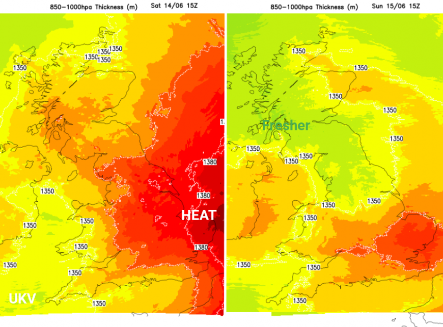
Any nighttime showers will soon clear away from eastern Scotland and NE England on Sunday. It will feel different, fresher as the westerly flow picks up but still warm in any sunshine. Temperatures will still reach 17 to 22C, higher perhaps for Suffolk and Essex as the very warm air clears away eastwards. This depends on the sunshine amounts, as the could be the odd heavy, even thundery shower for eastern England.
A weak weather front will bring this fresher air and more cloud in from the west. With a band of patchy rain for Northern Ireland and northern Britain, it won’t amount to much but will complete the change away from the current very warm and humid air. Wales and SW England will see a few early showers as this moves in.
Loading recent activity...