
As new or postponed Half-term skiing plans come into view and there has been significant snowfall for some Alpine resorts this weekend. The Northern Alps look okay but high pressure remains.
As the Winter Olympics continues on its artificial slopes, some European ski resorts have seen decent snow in recent days. For the Alps, southern resorts are struggling this year but there has been snow this weekend for eastern Switzerland, western Austria and the Dolomites. WeathertoSki have an update for us.
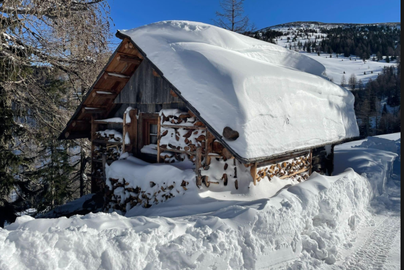
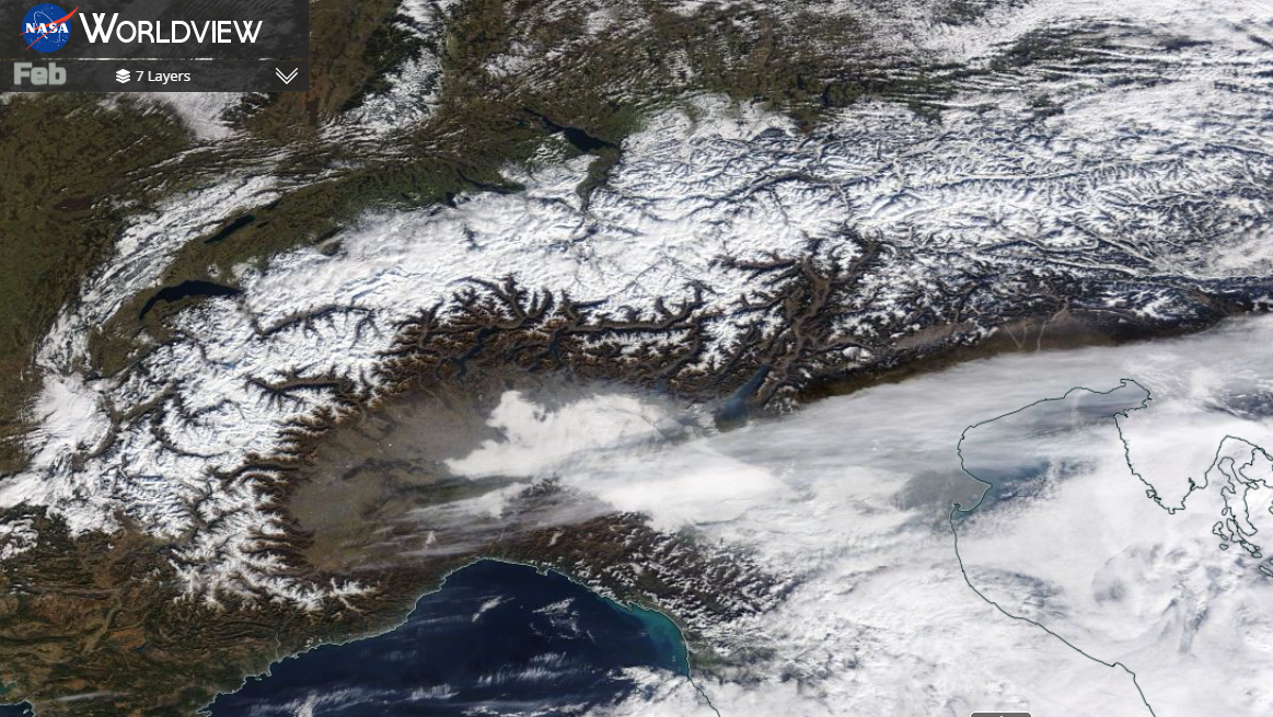
Image - Eastern Alps, Austria Feb 2022 forum member Carinthian
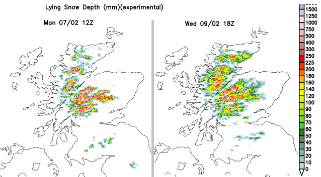
Half term is coming up. For some, starting this coming weekend whilst others will be later in February. With Christmas trips being cancelled or postponed when COVID travel rules changed this could be the opportunity for some people to finally get back on the slopes, maybe inspired (in a less extreme way) by what they have been watching at Beijing 2022. Scotland has seen snow showers this week, but not enough of the white stuff this season.
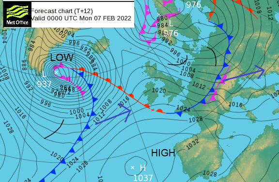
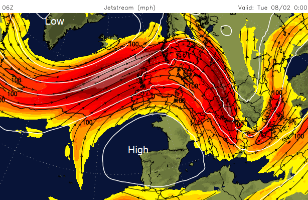
The Jetstream has shifted further south and with distinct temperature contrasts at this time of year, we see a strong jet core over the north Atlantic to start the week, developing deep low pressures. Although overall there is a mobile westerly flow off the Atlantic, these cold fronts are managing to dig right down and stir up the weather for the Alps. The week started with heavy snowfall, strong winds and plenty of cloud. Conditions are now brightening up. Tuesday and Wednesday should see plenty of sunshine, very light winds with daytime temperatures shifting above freezing.
However, after the significant snowfall at the weekend, there are avalanche warnings on Monday. Klosters and Davos “Due to the current snowfall, there may be restrictions on the mountain railways. Avalanche level 4 There is currently a high avalanche danger in Davos Klosters. Therefore, please stay on the marked and secured slopes.”
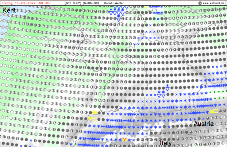
Snowfall forecast for Friday 11th February over the northern Alps.
Fraser from WeathertoSki gave an update on the current conditions.
"As we approach the busy half term week, there is a big discrepancy between snow conditions in the northern and the southern Alps.
The southern Alps - by which we mean the southern French Alps (departments of Haute-Alpes, Alpes de Haute Provence, Alpes Maritimes), most of the Italian Alps, the far south of Switzerland (Ticino) and the southern Austrian regions of Osttirol and Carinthia - have, for the most part, been quite dry this winter. Indeed, the far south-western Alps (e.g. Sauze d’Oulx, Bardonecchia, Isola 2000) haven’t seen any proper snow for nearly two months now. These regions can still offer some perfectly reasonable piste skiing, but snow depths are uniformly below average, and dramatically so in the south-west.
In the north-western Alps - by which we mean the northern French Alps (e.g. Courchevel, Flaine, Avoriaz) and the western Swiss Alps (e.g. Verbier, Villars) - snow conditions are much more favourable thanks to recent snowfalls, even if snow depths are still slightly below average for the middle of winter.
The very best snow conditions right now are in the regions where multiple snowfalls in recent weeks have led to snow depths that are closer to or above average for the time of year, i.e. the central and eastern Swiss Alps (e.g. Engelberg, Laax, Klosters) and much of Austria (e.g. Lech, St Anton, Ischgl, Saalbach, Kaprun, Obertauern)."
This year the weather has stagnated over western Europe. We've seen it here in the UK, it's been dry. For a time there was little wind, it was frosty for southern Britain, closer to the high. And this same high pressure has kept the weather dry for the French Alps. Further east, weather systems have managed to topple around the side of the high pressure and approach from the north, but lee areas have missed out.
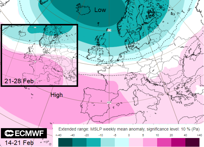
Looking at a very broad picture of the next two weeks pressure pattern, there is a strong signal for more of the same. High pressure lurking over Iberia and the Azores this week but building in further over Europe, to the UK ready for the main half term week. Fine, settled weather but not a lot of snow. There could still be fronts toppling around the high but little chance of low pressures scooting across at the Alps, developing and adding more snow.
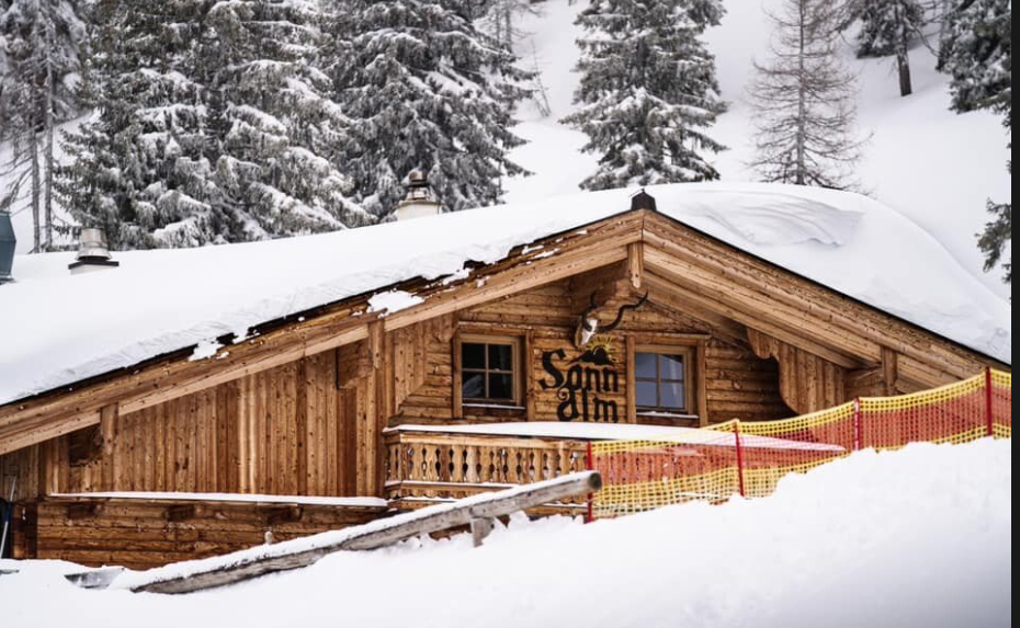
Image - Austria,thanks to Carinthian
By the end of this week, there will be a frontal boundary right across Europe, bringing some snow to the northern Alps once more but curling over the French Alps by Saturday. The origins of this are from a low pressure affecting Iceland on Monday, a storm down to 930hPa with red warnings for severe gales and blizzards. This will force its cold front down through the UK with more snow showers for northern Scotland and then gradually waves closer to the Alps for Friday and the start of weekend. The southern (lee) side of the Alps will again only see some amounts of snowfall. The western Europe high pressure has kept steady weather for France and the western Alps but there have been cold plunges over eastern Europe around that anticyclone. In January, the Greek islands were caught by a plunge of cold air and wintry weather. Northern Greece does see winter snow but Mykonos is not used to snow on the beaches.
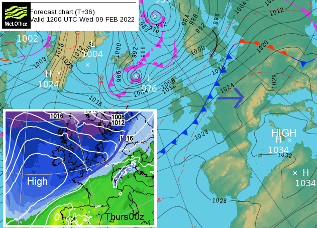
Another toppling cold front later this week, moving around the eastern side of high pressure
High pressure will be building over western Europe helping to draw down the cold air but keeping things steady. The high pressure over western Europe has been responsible for lengthy dry spells and protects against perturbations, such as these digging south fronts. It does move on for the start of the new week, 14th Feb, with a chance of snow briefly for the French Alps as it clears. It then turns milder with a westerly Atlantic flow by midweek. Signs of another frontal sweep from the NW potentially to end next week, which could bring more snow to the Alps but the high pressure out west remains.
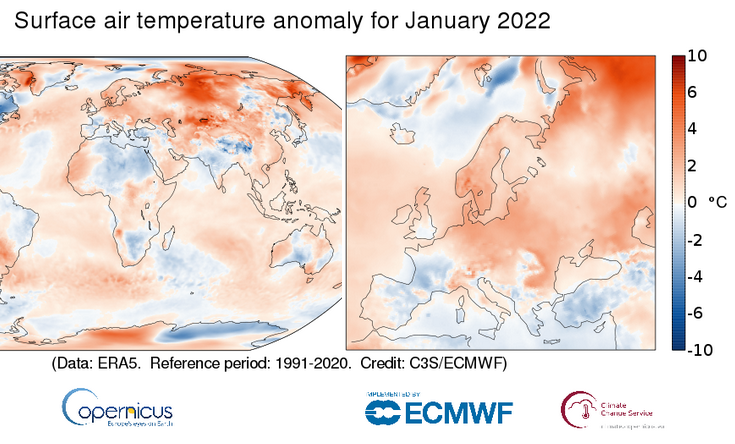
The warming climate isn’t helping overall, even if low pressures, even storms, do still dump good amounts of snow. Globally, January was: 0.28°C warmer than the 1991-2020 average for January. 6th warmest January on record. Temperature anomalies across Europe vary more.
Scotland had seen some snowfall this week but is accompanied by strong winds, even gales. There will be further heavy snow showers in the cold Polar air, especially later Wednesday into Thursday as a small low pressure centre moves past Northern Scotland. All the ski centres will be wishing for more snow.
Nevis Range - 'We are not open for snowsports or sledging due to early season conditions on the hill. Beginner lessons are available on our dry slope - limited availability and weather permitting. Gondola closed on Mon 7th due to high winds. '
Cairngorm Mountain - 'Small Snow patches to 600 metres. A light dusting of overnight snow has added to the very good condition of the Lower Learners Area which is available using snow produced by snow factory and fan guns. 2 lifts and 2 runs open, road open too.'
More Ski world and Alpine resorts
Snow in the Alps chat in the Community forum


.jpg?w=350)

