Isn't the weather strange this week, one minute it's warm and sunny, the next cold and raining or even hailing
Welcome to the world of April showers. Showers at any time of year get similar comments but the contrasts with springtime showers seem to heighten our surprise.
I suppose it is partly the promise of summer, when the sunshine warms us and we think of lighter nights, holidays and just non-winter conditions. Just as we have taken off/put to the side our winter coats and hats and retrieved the bag of summer clothes from where ever they are stashed, then along comes a downpour.
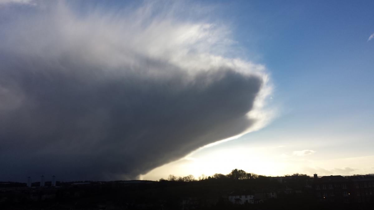
Not just a light shower. We get darkening ominous skies, blustery winds, it feels cold and then a mix of rain, hail, thunder, lightning and as we saw earlier in the week, sleet and hail.
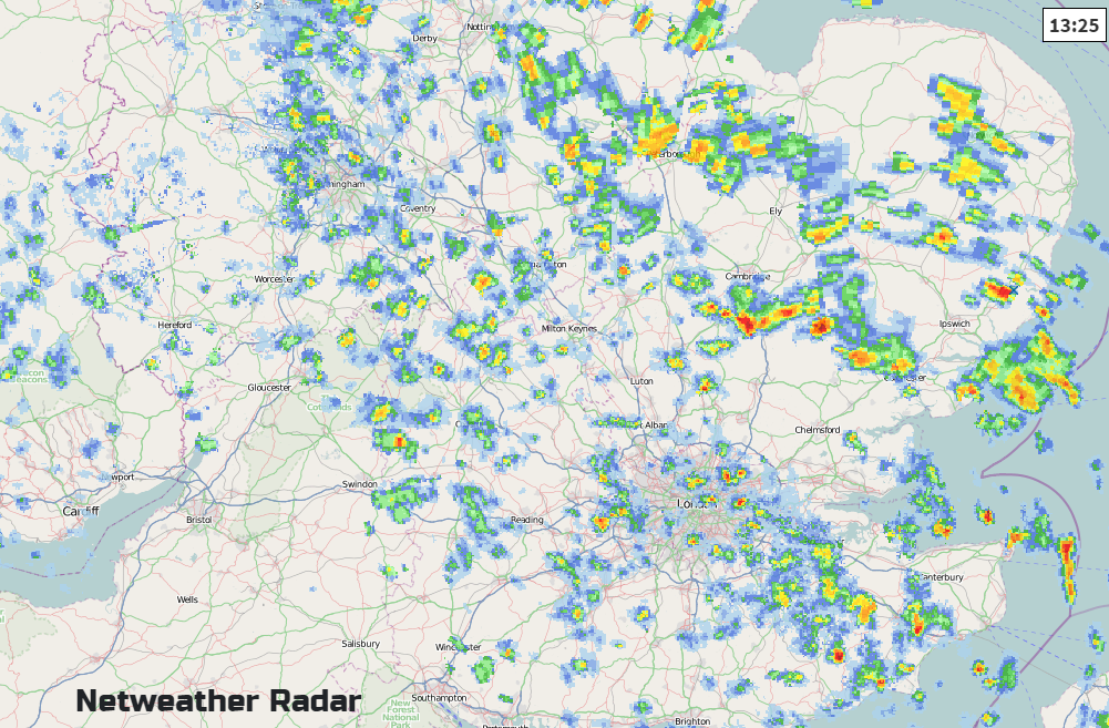
The radar picture below shows individual showers, the colourful areas showing rain amounts. Reds and yellows of heavier rain, the whole lot moving southwards in the winds. Gaps inbetween are dry and sunny. So one person can be getting drenched whilst 1 mile down the road another person is catching the lunchtime sun.
Showers are little convective cells, blown along by the wind. This week we've had a cold north wind bringing cold air from the Arctic, which rises as it reaches the UK with milder sea temps and a bit of warmth over the land. Up go the clouds, Cumulus- Humilis (little fluffy ones, no rain) Mediocris and then shower producing Cu Congestus with its cauliflower tops. More development results in Cumulonimbus Cb clouds. Large, dense clouds often with a distinctive anvil top, producing hail and thunder.
Forecasting the exact path of a shower relies on Nowcasting and looking at the radar. These showers are creeping southwards, developing in the early afternoon sunshine and warmth. There is the potential for thunderstorms within these showers but exactly where and when is still beyond our current forecasting. Nick Finnis's Convective forecast for 26th April shows the areas most prone and likely to see a thunderstorm.
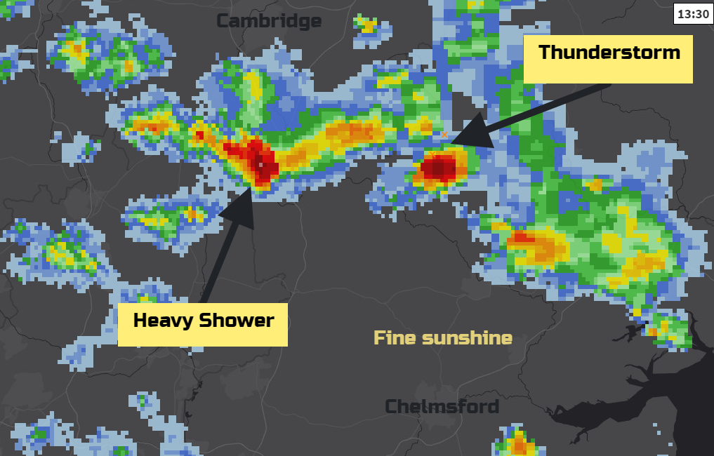
Looking in closer detail at the radar you can see how the shower distribution varies over a small distance. This is quite a headache for weather presenters to get across as a message. It could be you see a lovely day with sunshine and even get sunburnt. However, there is a risk of getting completely drenched, feeling chilly and maybe see hail or snow. All in one day or even one hour. Other people just comment on how weird the weather is,
So next time that showers are forecast, remember these little colourful blobs on the radar and think about the downpours and the sunny gaps inbetween.