A fairly quiet, grey, cloudy weekend. A bit of patchy rain, and fog about. Not the frost that we have seen recently, but looking much colder by the end of next week.
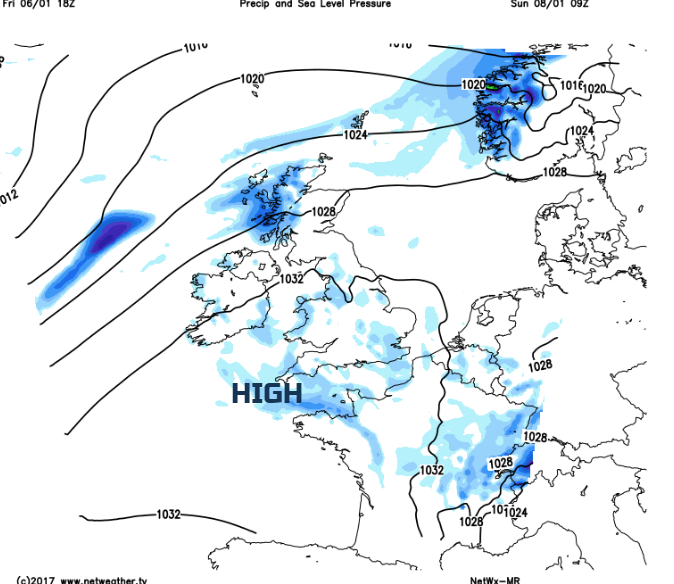
We have quite a settled pattern this weekend with a lot of cloud weather, damp and murky at times, all thanks to high pressure in the south keeping things quite steady. Temperatures will be up after the recent frosty days.
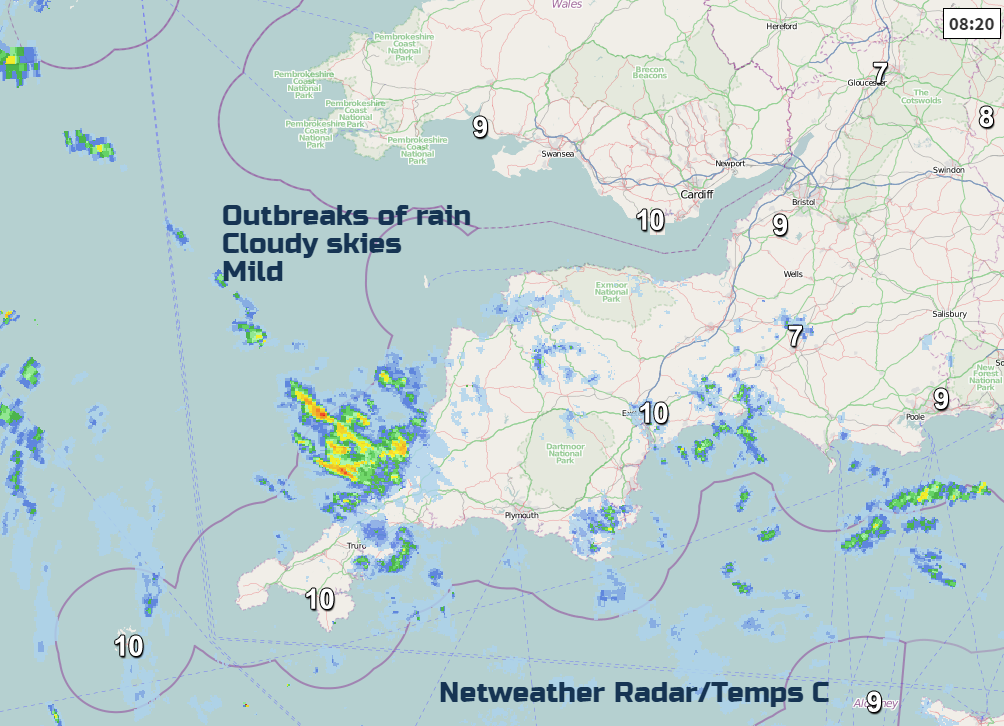
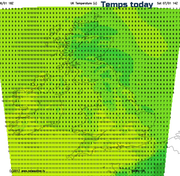
Overall, it’s a mild and cloudy picture this morning around 7 or 8C. Inland and northern Scotland is still colder with patches of frost in places but for this weekend the UK is looking less cold at around 6 to 9C by day. However, it won’t feel that great with the grey skies and dampness. Weak weather fronts will drift and lurk over the UK, bringing thicker cloud and patchy rain at times. There is also fog this morning, particularly for NW England, but with poor visibility in other areas to start Saturday.
SW Britain will be mild today with temperatures into double figures but it remains grey and murky. At the other end of the UK, Grampian could see brighter skies and sunny spells but at only 6C. Other areas could see brighter skies such as Herts, Gloucs, W.Yorks although the winds are light.
For Saturday night most parts will be cloudy and mild. Northern Scotland will see clearing skies and so temperatures here will dip near to freezing in a few spots.
Sunday looks to be another grey cloudy day with damp weather for NW Britain. Again a few breaks will allow come brightness, glimpses of sunshine, mostly for eastern parts with more of a breeze from the SW for N. Ireland and Scotland.
Next Week
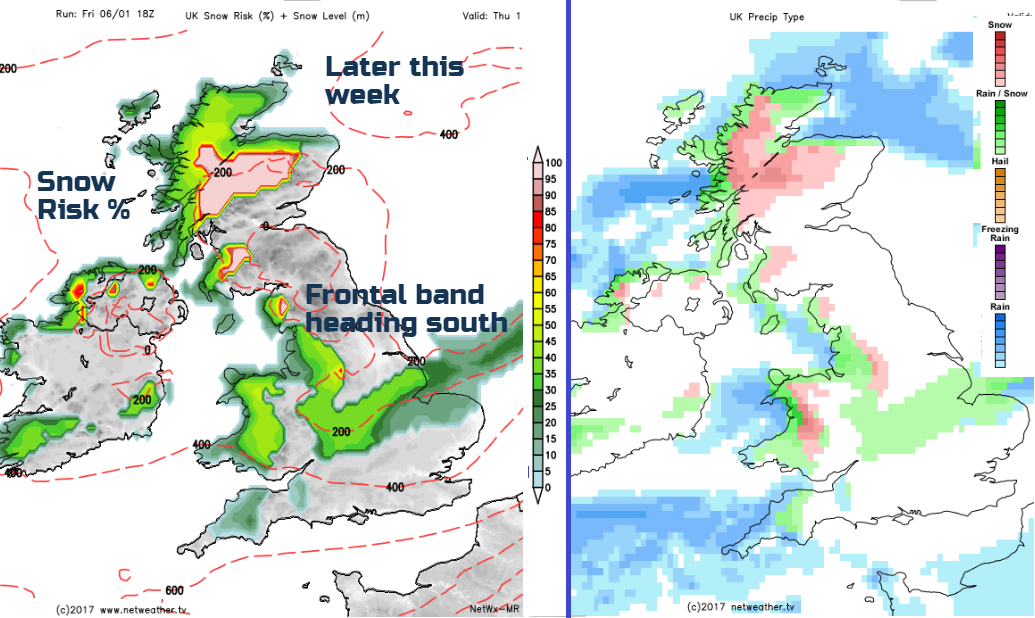
Monday looks more blustery, windy in the north, with cooler air flowing down across the UK behind a weather front. The frontal band will bring rain over Scotland and N.Ireland in the morning, spreading to England and Wales through the day, reaching southern parts later. Clearer, colder weather after the rain will be accompanied by wintry showers for NW Britain.
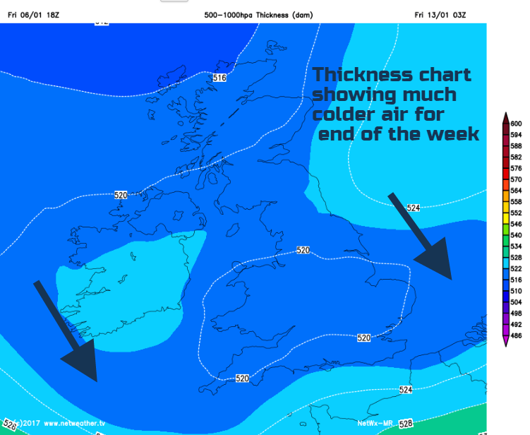
The blustery flow from the Atlantic continues next week, brisk winds in the north, less so in the south til Thursday. The end of next week see forecast models signalling colder air over the UK as the winds turn to the NW. It’s still a far way ahead but will be causing a bit of excitement for “coldies”. Just something to watch as this week progresses. There is snow on the charts and not just in Scotland. However, for southern Britain all this wintry weather has got to move all the way down through the UK first, it will be quite hit and miss in the south, if this scenario comes off.
Will It Snow? Find out here for your location