This coming weekend will bring warm sunny spells but also a scattering of showers and cooler nights. It's still a fine end to the week just not quite as stunning.
Last weekend brought warmth and sunshine to the UK with the top temperatures of 25.9C then 27.5C on Saturday and Sunday. This coming weekend there will be more warm sunshine but in a light north to northeasterly flow, the top temperatures could struggle to get quite as high.
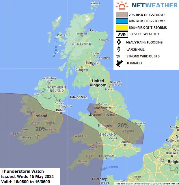
Sunday 12th ended with heavy, thundery showers creeping northwards through the UK. Today, Wednesday 15th brings a risk of thunderstorms and there could be some lively showers about on Saturday 17th. This coming weekend there will be a scattering of showers and a bit more cloud about compared to the blue skies of last weekend. The main risk areas on Saturday look to be inland southern Britain and the Highlands of Scotland.

The nights will feel a bit cooler, not the mildness many experienced whilst gazing at the G5 geomagnetic storm Aurora show last Friday. Temperatures will again be in the high teens, just into the low 20sC although feeling cooler for windward coasts and in any showers. London and Bristol should reach 22C, Manchester and Glasgow up to 21C on Saturday, Belfast perhaps 19C at the weekend.
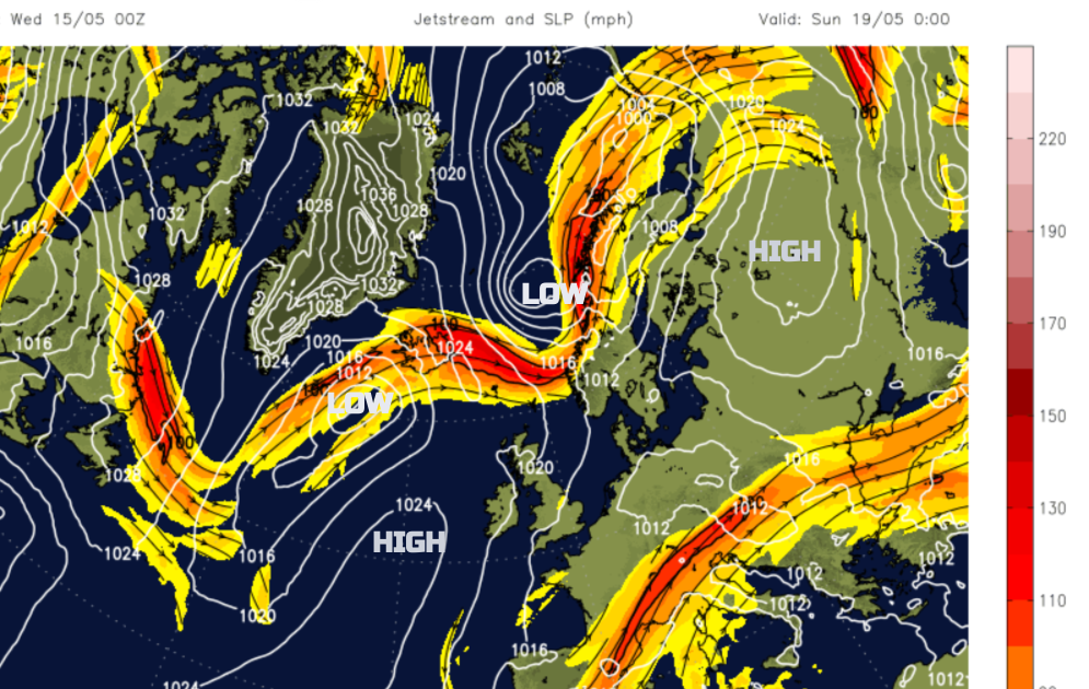
High pressure will try to topple over the UK on Saturday from the Atlantic. The air will be unstable with a slightly cooler flow from the northern North Sea over the ground warming up in the afternoon as the sun does its work. So there will be some showers inland. A low pressure heads for Iceland on Sunday with the jetstream away to the north of the UK.
For southern Wales and southern England there could be some heavy and thundery showers. The focus of these will be along convergence zones, where inflowing air from the north encounters a more westerly flow along the Bristol Channel or the English Channel. It creates lift as the air has to go somewhere. And that is up. Further north in Britain, there could be isolated heavy showers over high ground but there will be a lot of fine, bright or sunny weather around too.
A pocket of colder air will swing over the far north of Scotland on Saturday as a fading cold front passes by

Saturday night sees low cloud edging in off the North Sea like a grey blanket across much of England from the east right down past the M25 and M4.
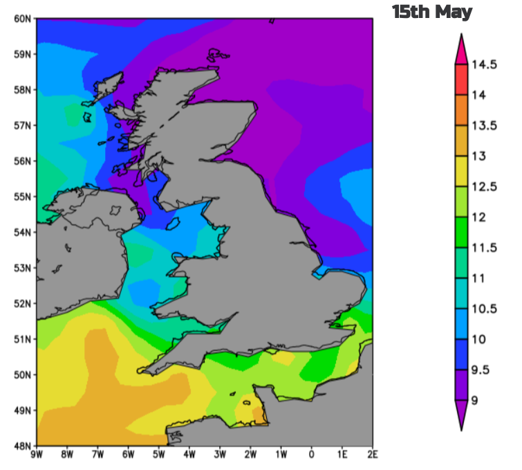
Don’t be fooled by any lengthy sunny spells that a May dip in the sea is in order. The sea surface temperatures are low at this time of year, it will be bracing.
On Sunday after a fine start, there will be more cloud filling in over northern Britain and Northern Ireland with the risk of a few showers inland by the afternoon. With thicker cloud in the far north, dampness will pester the far northwest of Scotland. Wales could also see a few inland showers by the afternoon but for many areas, it will be bright or sunny with very light winds and a fine day. There will be a bit more of a breeze off the North Sea for East Anglia and Kent. Also, a northerly breeze will make north Devon, west coast Wales and County Down feel a bit fresher.

Another fair weekend for much of the UK. Just watch out for the showers, particularly on Saturday afternoon over SW Britain, a few for northern inland high ground and the cooler nights. There will be warm sunshine to enjoy and another May weekend to partake in National Walking Month.


.jpg?w=350)


.jpg?w=175)