High pressure remains in charge of the weather across the UK this weekend bringing more sunshine and warmer temperatures than of late. There'll still be widespread overnight frosts though.
I don't mind admitting it - this weather keeps on throwing me at the moment. Looking out of the window and feeling the sunshine's warmth when indoors makes me do a double-take whenever I go outside and feel what is still a bit of a chill in the air. Temperatures are starting to creep up a little, though, with Scotland leading the way: Yesterday, Glasgow was the country's warmest part, reaching a very respectable 15.9c.
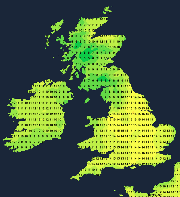
Today, it'll be a similar story, with the foehn effect helping those to the north of high ground in Scotland and the west of high ground in England and Wales to see temperatures into the teens. It'll likely be the northeast of Scotland, fairing best today, with maxes of 15c or so. As we move through the weekend, more regions will see highs of 13-16c or so, with just the east coast continuing to struggle a bit thanks to the wind blowing in off of the North Sea.
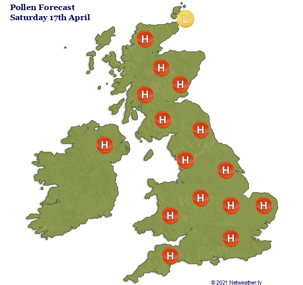
With the sunshine and warmer temperatures though, the pollen count will be on the rise, with much of the country seeing high levels of tree pollen by tomorrow (Saturday).
High pressure will stay well in control of the weather through the coming days, but its influence will be waning a touch in the far northwest, allowing weather fronts to move in close-by at times. One of those is in play today, bringing more cloud into the northwest of Scotland and also across the western half of the island of Ireland. Some rain is also likely to make it into the Western Isles for a time later on. Elsewhere, it's a settled, mostly dry picture, although there are still one or two showers affecting England's east and southeast. Cloud will bubble up this afternoon, though, so the sunny, fine start that many have seen won't necessarily last throughout.
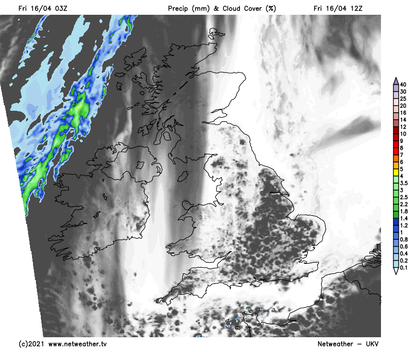
Skies will clear again overnight in all but the far north and west, which will mean another widespread frost and chilly start to the weekend, with some fog patches here and there. For most, Saturday will be a sunny day and a touch warmer than of late for many, with highs typically reaching 11-15c. The cloud will increase during the afternoon again, though, and will also be thickening from the west across Ireland and northern Scotland, ahead of another weather front.
That front is likely to bring some outbreaks of rain into the west of Ireland during the afternoon or early evening before spreading east to other parts of Ireland and western Scotland during the evening and overnight. All the while, it'll become more showery. Elsewhere, another dry, frosty night will follow. Then for Sunday, it's the same again for England and Wales with broken cloud bringing some good sunny spells. Temperatures may well be another notch warmer too, reaching 13-16c generally. For Scotland and much of Ireland (north and south), it'll be slightly different, with more in the way of cloud, a quite blustery wind, especially near coasts, and some outbreaks of rain in the west and north.
That'll all be thanks to a low pressure area, just out in the Atlantic, which'll nudge further north and east early next week. Initially, it'll probably still only be the west and north noticing any difference, with more outbreaks of rain coming and going, but some of that rain is likely to try and start to push south and east by Tuesday.