


Northwestern Europe and the UK will turn colder this week as a chilly Arctic flow moves around an area of high pressure. to the southwest, Spain and Portugal, the Azores, Madeira and the Canary Islands are experiencing wild conditions with torrential rain and strong winds as two low pressures move by.
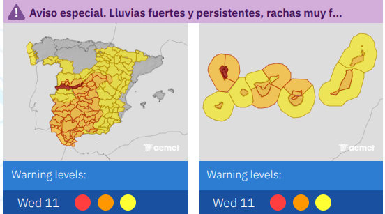
AEMET warnings for Spain and the Canary Islands on Weds 11th
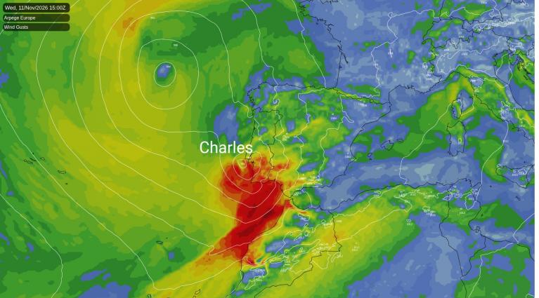
Madeira has been stormy as ‘Depressao Charles’ moved by on Tuesday night. Lashing rain and strong, gusty winds hit the Atlantic island before heading towards the Canary Islands and mainland Iberia for the middle of the week.
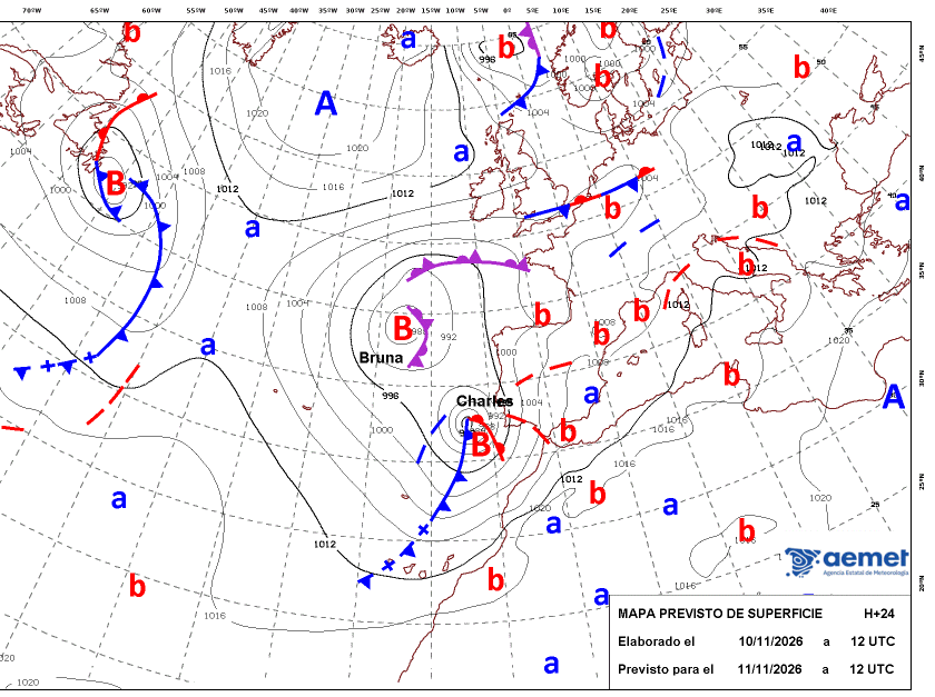
Away to the north is Bruna, another significant low pressure named by IPMA, the Portuguese Met Service. This brought stormy weather to the Azores and Madeira at the weekend with disruption and flooding. It's not finished with Iberia yet.
Remember, Spain and Portugal are in a different storm naming group. In our list we've had Austen and Boelo, our next storm would be Chloe.
The two lows become almost combined into a week of terrible weather with wild and very wet conditions. Over 300mm of rain is possible for Sistema Central, Spain and gusts over 80mph for La Palma, Canary Islands. The coast of Portugal continues to experience stormy conditions with large waves. Lisbon received heavy rain from incoming Storm Charles on Tuesday 10th November and many regions of Portugal have red or amber rain warnings, amber or yellow wind warnings. with schools closed across the nation for the middle of the week.
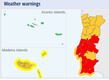
IPMA warnings for Portugal and Madeira on Wednesday 11th
Earlier this year Portugal was battered by Storm Kristin (followed by Leonardo then Marta) with widespread flooding, coastal damage and disruption. Iberia had a very wet winter which helped water supplies get through a dry, hot summer. For us in the UK, although there is some rain on Wednesday 11th linked to the outer bands of Bruna, England and Wales continue in drought and another settled, mostly dry spell.
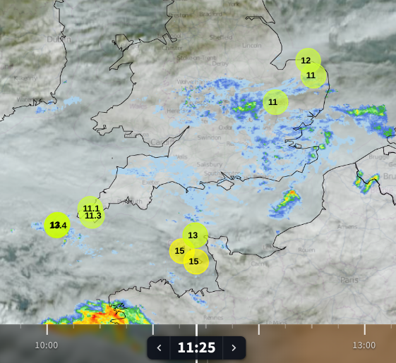
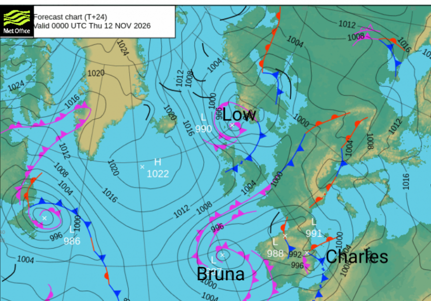
As Storm Charles moves across Spain on Wednesday there are various rain warnings from AEMET. With a national strike on Wednesday there is already disruption to transport and schools which should mean that more people are at home anyway. There are wider wind warnings and wild conditions expected along the south coast for Cadiz province. Large waves and the risk of tornadoes or water spouts are mentioned. As the cold front moves over southern Iberia, there will be heavy downpours and thunderstorms with further rain from occluded bands linked to Bruna.
For us in the UK, it will turn colder with frost and a risk of freezing fog in a few northern spots. High pressure is to the northwest and a cold northerly flow will bring showers to northern Scotland today, and the east coast of Britain by Thursday. It was chilly for northern Britain and Northern Ireland on Wednesday morning with fog in the Central Belt where skies had been clear.
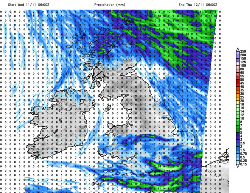
For the UK we are still under the influence of high pressure. Many areas return to light winds once the influence of Low Bruna edges away. However it will be wild for the Northern Isles and feel very cold overnight with gales and very rough seas forecast.
For England, the northeasterly breeze will ease as the rain fades on Wednesday morning, with clear and calm conditions for southern Britain by this evening. Further north, the light westerly breeze will veer to a cold northerly. Bands of showers will arrive for the far north of Scotland. Some of the showers will be of hail, even sleet or mountain snow for northeast Scotland but they should remain as rain for eastern England on Thursday
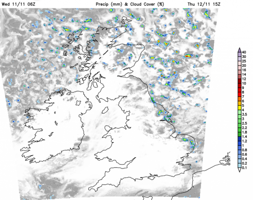
The day starts windy in the northeast but the chilly wind will pick up for most of the UK by lunchtime. There will be plenty of sunshine. The strong north wind, even gales, will continue for northeast Scotland on Thursday morning as a low centre feeding the showers rolls down the North Sea and off towards Denmark. Aberdeen, Newcastle and Whitby will really feel that cold wind too.
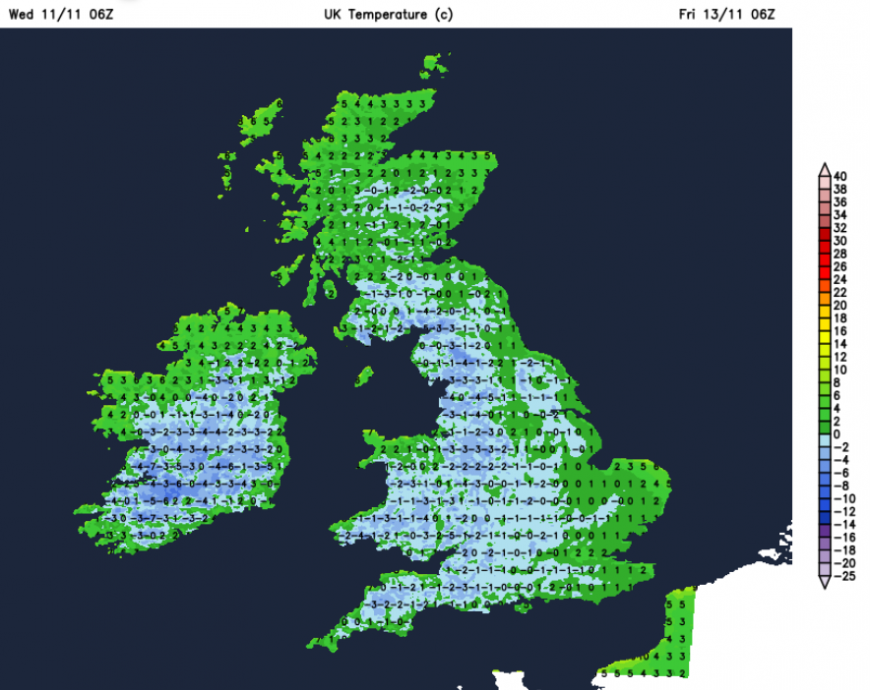
Then the high pressure slides over Ireland on Friday. The feed of showers will shift to northwestern Scotland and the north coast of Northern Ireland into Anglesey but mostly move offshore for eastern Britain. Again it will be dry and sunny with a frosty start. This is cold Arctic air across the UK, with a moderate westerly wind for the far north of Scotland, further away from the high. There will be more cloud in the far north on Friday with showers, and again some mountain snow.
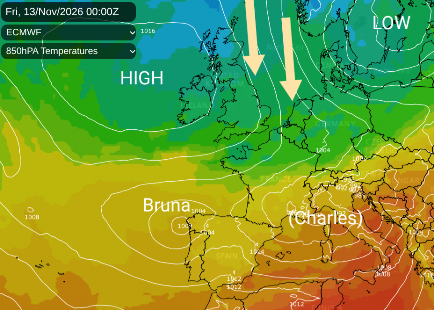
The cold air will continue across Scandinavia and the Baltic States into eastern Europe by the weekend. The remnants of Charles will bring heavy rain, the risk of flooding and coastal wildness to the south of France on Thursday. Warnings are already appearing from Meteo France.
Loading recent activity...