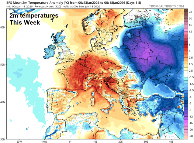
It’s a different feel to the weather to start this week, we’ve lost the cold northerly arctic flow of last week and gained a milder southwesterly flow off the Atlantic driven by areas of low pressure moving northeast. It will be generally unsettled for the rest of the week and into the weekend, with some wet and windy weather at times, also showers, but also some dry and brighter weather too. Temperatures will stay milder than average in the south. Temperatures will be more average in the north - with colder air moving in from the northwest at times, which means there could be a risk of frost overnight here - where skies clear.
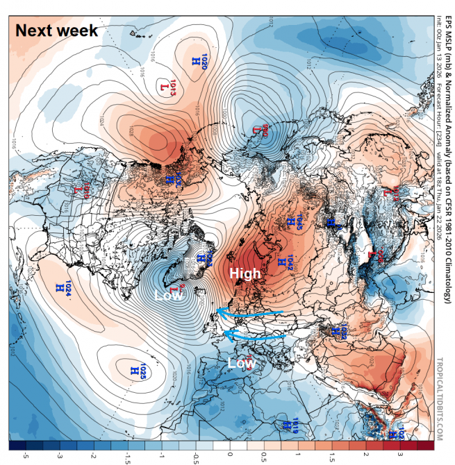
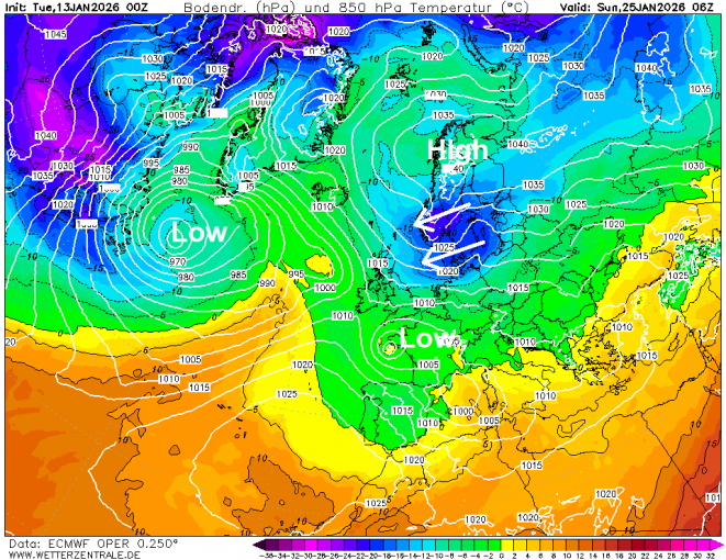
But it could be all change again next week, with the models as from early yesterday showing high pressure over Russia extending its influence further west across Europe, which will put the buffers on progress of Atlantic low pressure systems moving in not getting any further east than the the UK before disrupting against blocking high pressure extending west across Europe. Colder air at the surface looks to spread across the Uk from the east next week. Deeper cold air may also try to spread west towards across northern Europe under this block to the northeast, but for now there’s uncertainty if it reaches the UK, and if it does, when.
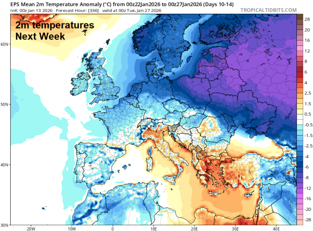
The UK could end up being in the battle ground between Atlantic lows and blocking high pressure to the northeast during the last third of the month, if the high wins out, it could send deep cold air in across the UK, if the Atlantic lows win out for dominance over the UK, it will be wetter and milder. But if both tussle for dominance over the UK, there could be some snow around for some, rain for others.
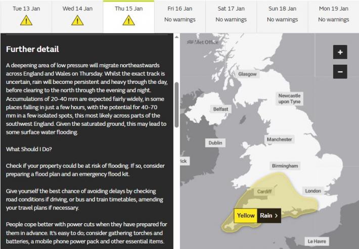
Before then, some wet weather to get through this week. The Met Office have issued a yellow warning for rain across parts of southern England for Thursday.
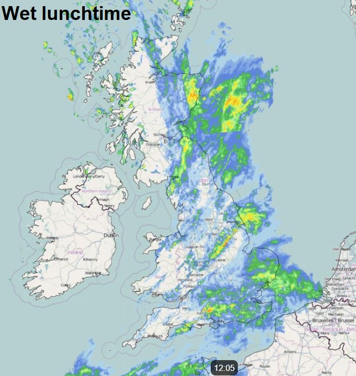
Today will be wet, with two areas of rain spreading northeast across many parts of the UK. Rain across central and northern areas will tend to clear east to drier and brighter conditions this afternoon. However, another area of rain spreading across the south of England this morning will tend to linger through the afternoon along a trailing frontal system.
After a widespread frost tonight, away from the far southeast, Wednesday looks drier and brighter during daylight, as a brief transitory ridge of high pressure moves through, but rain spreads across the west in the evening and showers move in across the south.
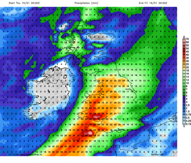
Overnight showery rain clearing followed by a brief respite of drier and perhaps brighter weather, before very wet and windy weather spreads north across England and Wales during the afternoon and evening, as a deepening low tracks northeast across England. Gales developing towards the southeast overnight. Quite a lot of rain may fall across parts of southern England by Friday breakfast time, particularly towards SW England - where saturated ground may lead to flooding.
Rain clearing northeast from northern and eastern areas Friday morning, could be some snow on the back edge over high ground as it does so. Drier and brighter conditions following, though showers towards the southwest near another area of low pressure drifting southeast.
The weekend starts to see a change to drier and more settled conditions from the near continent, as blocking high moves out Russia westwards across eastern and central mainland Europe. This will tend to divert further lows trying to move in off the Atlantic to the south of the UK and into SW Europe. Turning colder too at the surface going into next week, with colder and drier air feeding in off the continent, though air higher up may not particularly cold looking at 850 hPa level temperature charts. Temperatures from Tuesday perhaps only 4-6C across the UK. Some model runs in the extended range have brought deep colder moving into eastern Europe further west to the UK later this month. This would bring even lower temperatures across the UK with a risk of snow showers off the North Sea and/or snow along Atlantic frontal boundaries. But low confidence on deeper cold arriving from the east for now, as there’s isn’t overwhelming support from the ensembles for this occur for now, but is a possibility.
Possiblity of deep cold spreading from the east later in the month? Low confidence on this, but if it did, it would turn very cold with risk of snow
In a nutshell, unsettled and wet at times this week, chilly at night where skies clear, then turning drier and more settled from the weekend, colder next week, but staying mostly dry for the first half of the week at least.
Loading recent activity...