North-south split across the UK today and tomorrow, with cloud and rain in the north while the south remains dry, warm and sunny. Unsettled across all parts over the weekend, temperatures a little below average too.
It’s a cooler and fresher feel for all this morning, following hot days and uncomfortably warm nights across southern Britain until Wednesday. The flow will be from the west off the Atlantic over the next few days, hence the cooler and fresher feel. Pressure will be lower towards the north and also weather fronts will bring cool and often cloudy conditions with showers or longer spells of rain to the northern half of Britain today and tomorrow, while southern Britain will be mostly dry, sunny and warm.
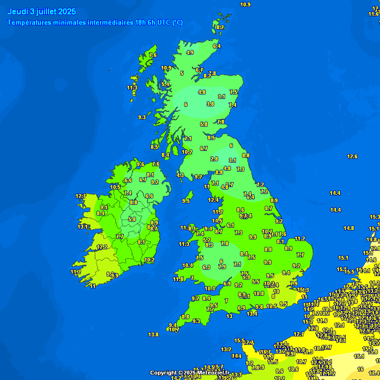
Lows overnight, much cooler in the south. Minima fell no lower than 20C in a few places at the start of the week
Over the weekend, the more unsettled conditions in the north will tend to spread south across all parts of the UK. So expect cloudier conditions across the south as well as north, with patchy outbreaks of rain or drizzle at times on Saturday, rain occasionally persistent over western hills, heavy at times in the northwest. Sunday is looking a brighter day with sunshine and showers. Turning drier and sunnier early next week, but on the cool side, with the flow from the northwest.
Temperatures falling a little below average over the weekend and into early next week, but signs of turning much warmer again in the south later next week
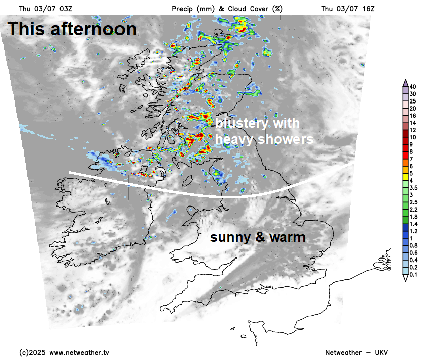
For now, a north-south split today, on the cool side and breezy across northern Britain with blustery showers developing across Scotland, N. Ireland and the far north of England, locally heavy with the odd rumble of thunder, after a dry start in the east, more persistent rain across western Scotland. Temperatures in these areas reaching the mid-to-high teens at best. Further south, a mostly dry and sunny day, with lighter winds than further north, comfortably warm too, temperatures reaching 20-23C, perhaps 25C in London.
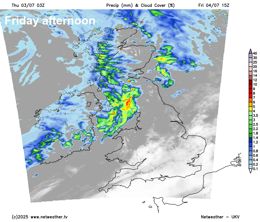
Showers easing before thickening cloud and spells of rain move east across Scotland overnight, drier with clear spells elsewhere. A relatively cool night, temperatures falling into the low teens widely, perhaps single digits in rural areas,
Cloudy and breezy with outbreaks of rain spreading east across Scotland and N. Ireland through the day, locally heavy and persistent, especially over western hills. Rain eventually spreading in across northern England and north Wales by the evening too, but, otherwise, a mostly dry day across England and Wales, best of the sunshine towards southern England and East England, turning cloudier further north and west. Temperatures stuck in the teens under the cloud and rain, low twenties in the drier and brighter areas, perhaps 26-27C across SE England and East Anglia - where it’ll be sunniest.
A generally cloudy day on Saturday, with patchy outbreaks of rain or drizzle over western areas through the day and the far south for a time, drier with perhaps some brightness or sunny spells developing across central and eastern areas of England and Scotland, especially east of any higher ground, but this could trigger some heavy showers. On the cool side, temperatures reaching 18C in Edinburgh to 22C in London.
Brighter for more areas on Sunday, but with some scattered showers too, perhaps turning heavy for a time across SE England and East Anglia. Similar temperatures to Saturday, with high teens in the north to low twenties in SE England, but a cool northwesterly breeze may make it feel cooler than the thermometer suggests.
Turning drier early next week. Monday may still have a few scattered showers and sunny spells, but many staying dry. Tuesday, for now, is looking mostly dry, as high pressure builds in from the southwest, though maybe a risk of some rain in northern Scotland. Southern Britain looks to remain dry for the rest of the week, with warm sunshine, perhaps becoming locally hot later in the week, northern areas more prone to Atlantic fronts, so cooler and cloudier at times, with a risk of occasional rain.
High pressure forecast to build back in from mid-week next week, so likely turning very warm or hot again in the south.
Loading recent activity...