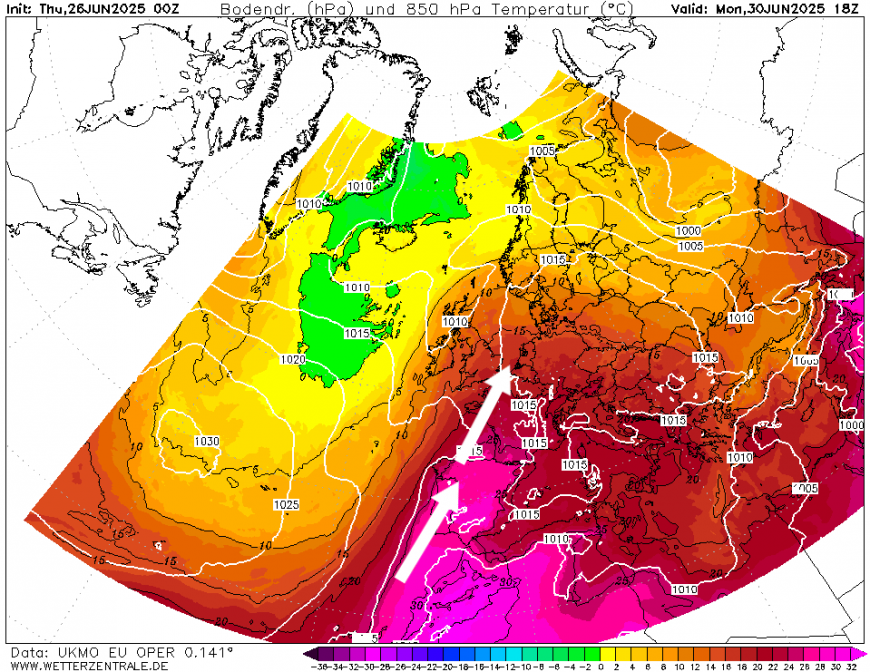
Another heatwave will build from Spain northwest across western Europe, including England over the weekend and into early next week. UK's highest June temperature record may be challenged. But Scotland and N. Ireland will be cooler with some rain, especially in the far northwest.
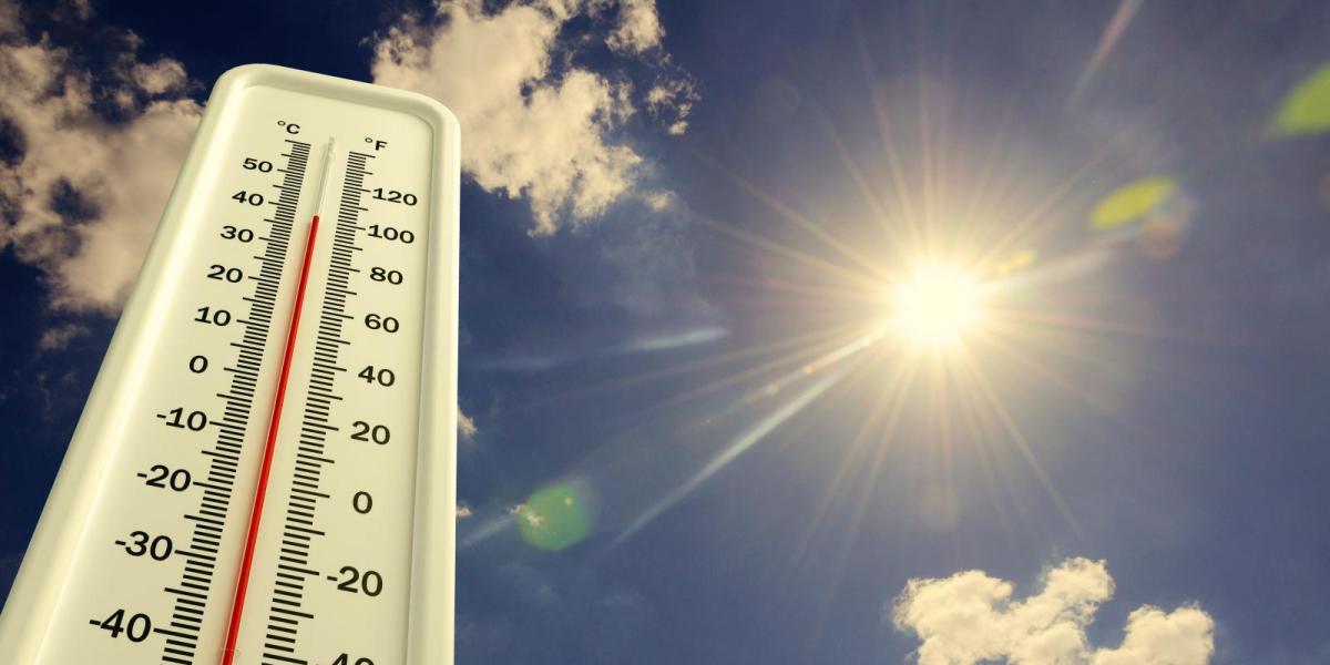
Large parts of Europe have seen well-above average temperatures so far this month, with temperatures in the afternoons reaching 10C above average and, in places, as much as 15C above the average maximum for June, with temperatures in southern France and southern Spain reaching 40C or more. Excerbating the warmth are record high temperatures for June in the Mediterranean and to the west of Europe.
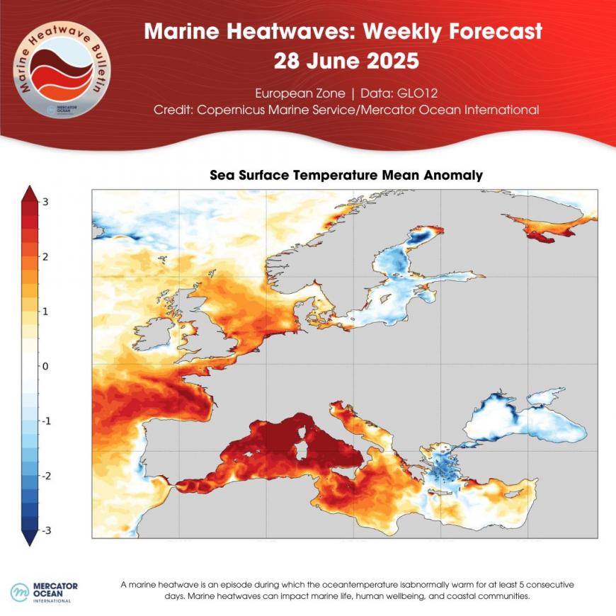
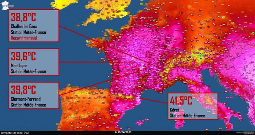
The recent heatwaves over mainland Europe has seen some very high temperatures in western Europe over the past 7 days. France has seen temperatures reaching the high 30s in some areas everyday since the middle of last week, reaching 41.5C in Ceret in southern France, near the Pyrenees, yesterday. Dozens of monthly high temperature records have been broken in the country. Parts of southern France have exceeded the June average by 5°C for the entire month. June is expected to end up being the second warmest month nationally, behind June of 2003, though regionally it is expected to be the warmest on record, most likely in the southeast.
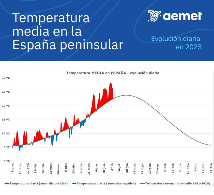
Spain has been exceptionally hot too this month. The Spanish Met service AEMET mention that there's no precedent for a June as warm as the current one, and is likely to be the warmest on record, as the anomaly graph below shows,
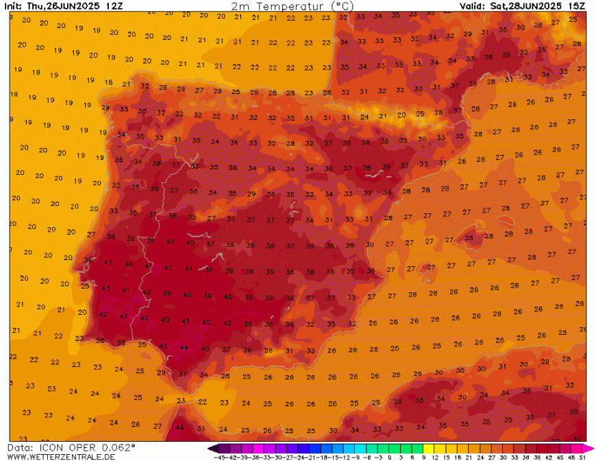
Temperatures in southern Spain and southern Portugal are expected to reach 41-42C this weekend, perhaps locally higher, as another heatwave develops.
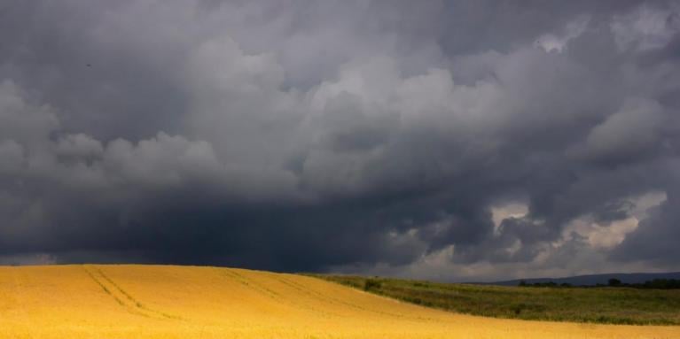
There has been some relief today from the recent heat over France, following some violent thunderstorms sweeping in from the southwest across many parts yesterday evening. The storms brought hail up to 10cm in diameter in western France, while wind gusts of over 70mph where widely measured in the path of storms that moved northeast. Paris was hit by intense rainfall that flooded parts of the Metro and also ripped off limbs of trees lining the city streets, causing some damage to parked cars.
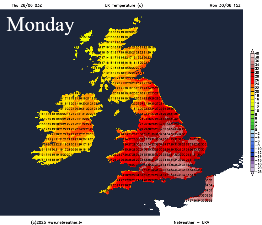
However, the cooler weather that arrived across northwest Europe this morning will be short-lived, as another heatwave, second one for England, will build in from SW Europe over the next few days. And this heatwave could be hotter than the last, perhaps threatening the UK June maximum temperature record..
The weather will remain fairly benign across England and Wale over the coming days while turning increasingly hot, as the heatwave develops in response to a strong ridge of high pressure vertically stacked through the atmosphere building in from the south along with increasingly warm air being pumped in from the southwest. Temperatures look to reach the low 30s degrees Celsius on Sunday across England, peaking on Monday, when some models show temperatures reaching the mid-30s Celsius.
However, with all this talk of heat in the south, it won’t be a heatwave further north though, with Scotland and N. Ireland seeing temperatures close to average over the weekend and into the start of next week. It will be cloudy and wet for Scotland and N. Ireland on Friday too, highest rainfall totals across western Scotland - where over 100mm of rain could fall by Tuesday next week. After a wet day tomorrow, the weekend should dry up away from western Scotland, where thicker cloud and patchy rain or drizzle may persist, but spells of heavy rain, perhaps thundery, look to return from late Sunday and look to continue through Monday and into Tuesday before clearing in the afternoon

Likely staying dry elsewhere from now until Tuesday, away from Cumbria, north and west Wales - which may see some rain. Potential for some thundery showers towards mid-week in the south as cooler conditions push in from the west to end the heatwave, but too much uncertainty on this for now.
Loading recent activity...