After the recent intense but localised storms, high pressure brings a more settled week for most. But isolated model runs showing extreme heat for late June have been widely shared and require careful analysis.
Last evening and overnight has been a stark case of there being a very high number of lightning strikes over and around the British Isles, but which were confined to a limited area of mainland Britain. The most heavily affected region was East Anglia and the south-east, where an exceptionally high density of lightning strikes per unit area was observed. Less intense, but still spectacular by many standards, thunderstorms were observed in west Wales and along the west coast of Lancashire and into Cumbria through the night.
However, the majority of the country missed them completely, reflecting the often hit-and-miss nature of thundery outbreaks in this part of the world. Potential for substantial thunder activity during this spell is largely over, although there is potential for the rain bands moving northwards through Scotland to trigger some further thundery activity at times.
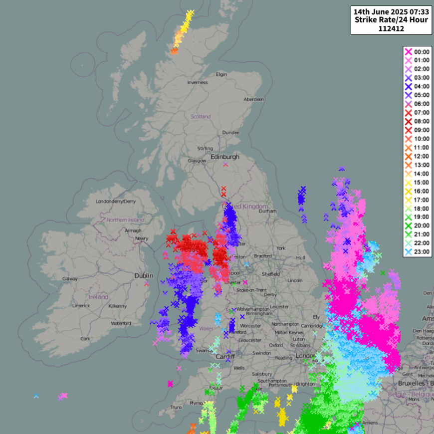
Generally, as demonstrated by Met Office research into lightning climatologies, there has been a marked decline in thunder frequency in southern England, especially near the English Channel coast, but increases in some parts of northern Britain, which was discussed in an earlier blog by Nick Finnis back in July 2024. This has resulted in the area of peak thunder frequency shifting northwards up the eastern side of England in recent decades, but last night’s event was more traditional with the largest storms reserved for East Anglia and the south-east.
During the coming days, we can expect high pressure to ridge into southern Britain, which will keep the weather mainly dry and settled. The weather will be predominantly dry and sunny in southern and eastern Britain, but with more variable cloud the further north and west you are within the British Isles, with some rain at times for north-west Scotland, this occasionally spreading south and east through other parts of Scotland but fading as it does so.
But there is potential for another thundery breakdown around the 20th June, as low pressure may start to push in from the west and introduce another plume of hot southerly winds. This will probably also bring some more hot weather, but probably not exceptionally so, as it doesn’t look likely that we will tap into especially hot air masses from Spain and Portugal or north Africa.
Beyond that, things are uncertain: we could move into a more unsettled spell of weather with low pressure systems tracking to the north of Scotland, but there is also a substantial possibility that after a temporary breakdown, high pressure could ridge back into southern areas, maintaining the northwest-southeast split pattern that is forecast for most of the coming week.
Some forecast model runs from the American GFS model have been pointing towards exceptional heat towards the end of June - a couple of runs have shown temperatures of around 40C in parts of England, which have been widely shared on social media.
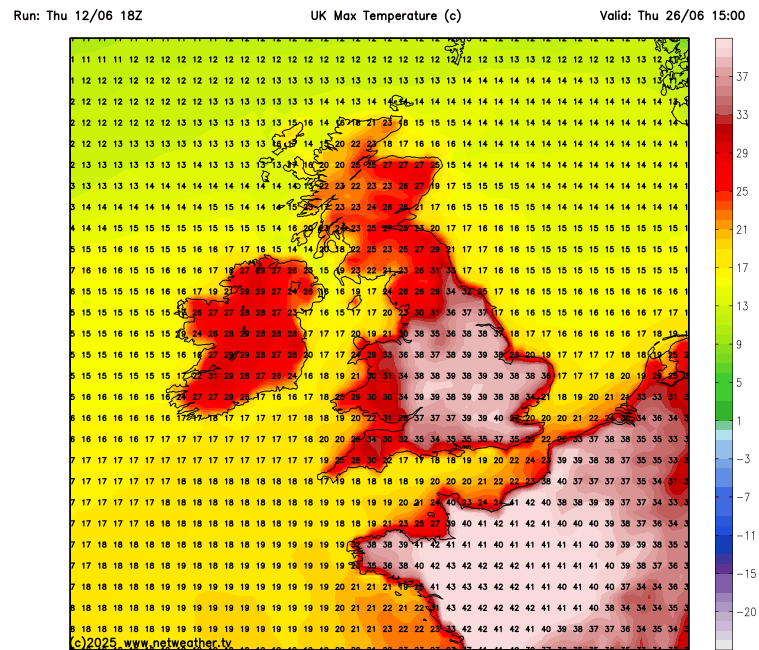
These runs do show that exceptional heat of that kind is possible as early in the season as late June in the current climate, with our hot air sources in north Africa having warmed at a faster rate than the global average in summer.
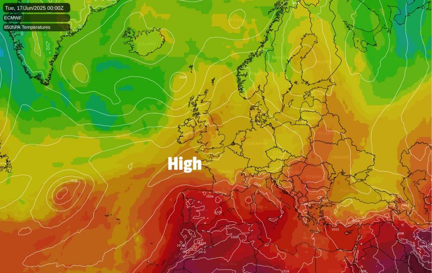
But it must be stressed that it is just isolated model runs that have shown this, and that as things currently stand, there is just an outside/remote chance of getting that kind of heat towards the end of June. The ECMWF subseasonal prediction system is going for high pressure being more frequent than average during the last week of June, but probably with highest pressure often centred over south-western Britain, which, although maintaining generally warm weather, may prevent much in the way of exceptionally hot air masses from north Africa and south-western Europe from reaching the British Isles.
On the whole, though, June 2025 is looking set to be another warmer than average month for Britain, despite some rather cool weather at times during the first third of the month. It also looks likely to be predominantly hot in the southern half of Europe, which has been a recurring theme in recent summers. As well as producing problems for locals and holidaymakers in these regions, this means that through the rest of this summer, there is enhanced potential for exceptionally hot weather to develop over Britain at some point, especially in inland parts of southern and eastern England, which would potentially be exacerbated by dry soils following a very dry sunny spring. If it doesn’t happen in late June, it could still happen at some point during July or August.
Loading recent activity...