Issued 2025-12-07 20:51:26
Valid: 07/12/2025 1900 to 08/12/2025 0800
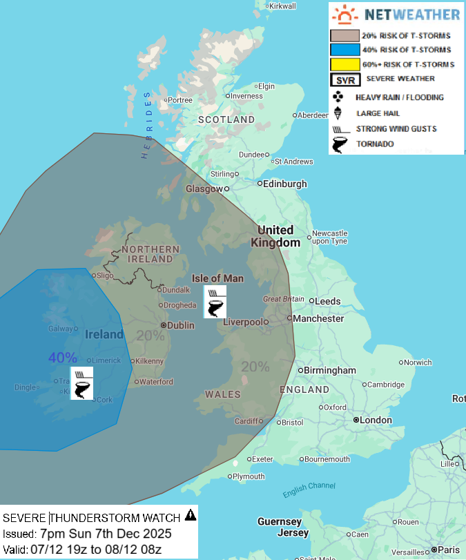
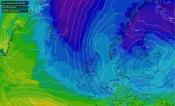
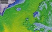
A marked shortwave trough arriving to the west of Ireland is producing a band of intense convective rainfall with embedded thunderstorms ahead of it, this is forecast to cross the island of Ireland late this evening and into the early hours before pushing NE and E across SW Scotland, NW England & Wales after 03z, then weakening as it encounters ridging further east. There is potential for damaging wind gusts created by downdrafts in this convective squall line, while strong low-level shear forecast will create an environment favorable for a tornado or two where stronger updrafts rotate. In addition, hail and intense rainfall leading to localised flooding will be an additional hazard.
Issued by: Nick Finnis
Issued by the Netweather forecast team whenever there is a risk of storms or severe convective weather, these discussion based and in depth forecasts will highlight the areas at risk and give an in depth description of the risk and the factors surrounding it.
Loading recent activity...