


492
-
Posts
185 -
Joined
-
Last visited
Content Type
Forums
Blogs
Gallery
Events
Learn About Weather and Meteorology
Community guides
Posts posted by 492
-
-
Meteociel - Cartes du modèle numérique GFS pour l'Hémisphère Nord
GFS continues to model very low 1000-500 thickness values over Central and southern Greenland (below 474) where the surface temperature was -54 C on Saturday. The extremely low thickness values are set to position themselves over southern Greenland over the next few days and closer to the UK than I have seen for many years. Of course it will not have much effect in the UK but demonstrates geographically just how close the UK is to the Greenland Icecap and how desperately cold it is not that far away.
-
 2
2
-
-
GFS is modeling extreme cold to out NW over next few days The temperature over Central Greenland recording -51 C at midnight and -39 C on the Greenland east coast. The cold modelled to be locked into the Arctic and intensifying during our current highly mobile spell. It is somewhat unusual to see such perilous cold so close to the UK although a couple of thousand miles away I suppose is not that close. Svalbald too has been between -15 C and - 20 C over the last couple of weeks which must be increasing the ice build up around its shores.
-
2
-
-
The high to our east is modelled to remain over Europe for the next few days with attendant warm days and some foggy nights. Dewpoints further to our east and southeast are impressively low and some of this very dry cold air must inevitably filter into the southeast of the UK. Fog may become less extensive but nights could turn very cold with some hard frosts where skies remain clear.
-
2
-
-
Whilst hunting for cold just now I notice Svalbald -21C, East Greenland -36 C and a 1000-500 mb thickness cold pool of 474 DM just north of Lapland. The intense high forecast to be to our east in a few days time is expected to suck up unusual warmth. If skies remain clear under the high an inversion is likely to develop with cold possibly foggy nights and potentially warm days. Where any fog forms it could be slow to clear with temperatures close to freezing in these parts. Along the south and east coasts where more of a breeze is likely temperatures are likely to be suppressed by the cool sea but mixing with the warm air aloft due to the breeze may alleviate the effect of the cold sea. It will be very interesting to see how the high behaves with such cold air surrounding it and a island of unusual warmth covering the UK.
-
3
-
-
A good 2.5 cm of snow in the west of the Isle of Wight at the moment with continuous moderate snow.
-
Satellite imagery shows an extensive snow cover over northeast France and the Low countries from the heavy snow there over the last couple of days. This acts as an ice sheet suppressing surface temperatures and with the wind direction modelled to flow from the SE it must increase the chances of wintry precipitation to southern coastal counties. Also 06Z GFS precipitation chart has the snow area slightly further south than the previous run now very close to the south coast. It is fairly rare to get snow actually laying on the south coast however parts of the south rise up to around 800 feet so from an imby prospective all to play for.
-
2
-
-
8 minutes ago, Tim Bland said:
GFSp furtherst south yet. Going to be a south coast event at this rate !

Sounds good to me !
-
6
-
-
1 hour ago, winterof79 said:
UKMO 144Z has a large Northern Siberian high developing as does ICON which goes on to develop it more so at 180Z
1060mB (is that a record Norris?)
GFS flails around miserably as per the norm with any HLB
whoosh it was gone
The record for a Siberian high is 1083.8 MB which occurred at the end of December 1968. I remember trying to convince a colleague it was a high we were plotting on the circumpolar chart and not a low as only the last three digits of the value were coded and plotted.
-
2
-
-
8 minutes ago, Mucka said:
The mean for GFS ensembles for first week of Feb is on the way back down as more runs sniff out a continuation of the cold theme and blocking later.
I think tonight's ECM ensembles will be more positive about long term cold prospects than this mornings as well, we will see.
Low resolution 12Z GFS shows a powerful Russian high 1060 mb moving westwards to our north and ridging towards Greenland.
-
2
-
-
1 hour ago, Weathizard said:
Went to Finland about 5 years ago and there was below -30 uppers, didn’t feel that much colder to be honest I think once you get to a certain cold level you feel numb to it, was -22 at midday so rather chilly
Was is Kusamo in N Finland a few years ago and it was -36 C. Looking out it could have been -1 C as there was little hoar frost as the air was so dry. A local lady was out walking her dog !
-
4
-
-
2 minutes ago, Empire Of Snow said:
It's a disaster. Simple as that. 0z at least kept the possibility of an Easterly after the first failure. Now we're back to late December 2018 model watching. Again looking at 300+ hours for a good blocking, a good ridge of the Azores high into the Atlantic etc.
I'm clearly disappointed so sorry for being a bit pessimistic. I hope UKMO will not flip but I fear the worse.
Low Res GFS 06Z NH profile is about the best that we ever see.
-
3
-
-
20 minutes ago, Mike Poole said:
Northern Annular Mode - same as Arctic Oscillation (AO)
Pacific-North American (teleconnection)
Sub-tropical Jet
Circle of Death - that middle bit of the MJO plot where it isn't influencing the weather much.
(I think! Difficult to keep track of them all!)
Many thanks Mike.
-
38 minutes ago, Nick F said:
GFS finally picking up on the PNA ridge over western NAM linking with polar height rises working in tandem to force the trop polar vortex and thus jet south across the NAO region, aided by a strong STJ emerging from the USA too. Plenty of cold zonality and cold northerly shots in the run there to bring some transitory northern snow towards end of next week, even the south in FI/Sat 19th.
The continued presence of the Euro trough all important - as it acts as a sink for all the deep cold arctic air to be pulled into and prevent the dreaded Azores ridge build east into Europe.
Also GFS and EC now showing consistency in retograding the MJO back through colder phases after leaving 8 and a spell of COD before re-emerging in 6 or 7 - this will encourage blocking over the Atlantic and Greenland eventually in tandem with the continued propagating down of easterly winds in the strat towards top layer of the troposphere, increasing threat for UK cold and snow.
Does Net Weather have a list of acronyms ? I am struggling with NAM, PNA, STJ, COD for example.
-
 1
1
-
-
6 minutes ago, ICE COLD said:
I know it’s at T384 hrs but a stonking northerly would be following a few frames later
Yes it is 384 but unusually deep cold air is poised in just the right place to the north of Iceland and looks ready to sweep down across the UK. All change next run.
-
4
-
-
4 minutes ago, inghams85 said:
Hahaha!
I feel we may see more and more low pressure disrupt as we hit +96 hours as the models upgrade the high pressure nearer time until we see one of these dive South East and the Scandinavian high pressure build over the top giving North Easterlies
This is certainly what GFS is suggesting. The high to the east builds as very cold air is brought ever further west into Europe while at the same time the low struggles to make progress against the developing block.
-
2
-
-
Some improvement on 06 Z GFS mid range with Russian high positioned much further northwest than 00z with trough disruption beneath the ridge forcing very cold air back as far west as Denmark.
-
2
-
-
On 27/12/2015 at 7:23 PM, THE CHOSEN ONE said:
Damienslaw - GP kept reffering to a persistent northwesterly flow - nothing about a continental flow ....
Anyway my comments on tonight -
overall things remain very positive - the 3 steps to cold from the east in the UK are
* eastern europe
* Central europe
* Western europe ( obviously lol ) with step 3 the hardest to forecast & the most volatile
I would score the ECM 8/10 tonight -
why?
well its not the classic big draw Easterly we hoped for - a la 91 however all that means is the convective snow threat may be off the menu -
However , to get widespread snow in the UK it requires an element of the atlantic being present with the polar front straddling the UK
The most important element today was for the models NOT to shunt the upper air cold pool NW out of europe into scandi as once its up there its hard to recover any cold -
What the ECM has done is build the ridge over the top towards iceland holding that deep cold over central / western europe- its then on tap to filter into slider systems that are alligned NW SE across the UK
The ECM 192/216/240 has very high snow potential for the UK from frontal snow events & crucially at 240 its looking like theres plenty of sustainability post that timeframe
so often do we see cold hitting the UK at 168 only to already be seeing the end at 240
very exciting charts at the moment however FI still at 120-144 leaves stage 3 open to a lot of volatilty
we could still hit the jackpot chart at 192 but also still miss the deep cold altogether....
exciting times in a period of blocking not forecast by anyone as theblock has developed well before NYD....
S
Although I am unable to reproduce the fax charts here I have just toggled between the latest T+96 and the T+120 and was surprised to see such a dramatic westward extension of the cold air towards the UK by Saturday.
-
1
-
-
Changes are occurring as early as T +72 with repeated westward corrections near the UK with fronts held to our west as warm air surges north aiding the building of a significant ridge to our east. Watch near time to see if the trend continues tomorrow.
-
1
-
-
Latest UKMO T+84 fax resembles a chart from an earlier decade with a big high to the NE, trough disruption over the UK and with an occlusion trying to move westwards across the southern half of the UK. A bit of a westward correction when compared to the previous run e.g yesterday evenings T+96.
http://www.wetterzentrale.de/pics/brack2a.gif
http://www.wetterzentrale.de/pics/brack3.gif -
What's the GFS up to now? In the semi-reliable too...
0h run
6h run
All eyes on the East...
Agreed. UKMO, ECM and GFS have all been entertaining the idea of some sort trough disruption close to the UK over the last few runs with a tendency to build high pressure somewhere to the NE. We could be witnessing an evolving easterly in the medium term.
-
Model output continues to bore me.
I have to be honest even the GFS attempts at an E,ly flow do nothing for me. When it comes to a classic E,ly the synoptics prior to this developing are just as important as the actual synoptics that bring the E,ly. I shall explain this below with some archives.
Take this chart below from Feb 1991 which shows the Scandi HP in the perfect position and the corresponding upper temps.
http://www.wetterzentrale.de/pics/archive/ra/1991/Rrea00119910207.gif
http://www.wetterzentrale.de/pics/archive/ra/1991/Rrea00219910207.gif
However do get into this position you need to rewind back many days. Look at the chart below and you will see the very cold airmass sinking S.
http://www.wetterzentrale.de/pics/archive/ra/1991/Rrea00119910129.gif
http://www.wetterzentrale.de/pics/archive/ra/1991/Rrea00119910130.gif
So basically when the HP orientates itself into the perfect position for the UK it has the colder upper temp airmass to tap into. The Jan 87 E,ly is an even better example of this.
http://www.wetterzentrale.de/pics/archive/ra/1987/Rrea00119870109.gif
Sadly I am still awaiting a classic E,ly even after all these years of being a member on this forum. It seems not only do we fail to get a Scandi HP in the correct position but we neither get that cold pool sinking S to tap into anyway.
http://www.meteociel.fr/modeles/archives/archives.php?day=25&month=1&hour=0&year=2012&map=0&mode=2
Not so very different to what GFS is modelling this week and this spell was only 3 years ago. It ended up in early February with the SE of the UK coming under the influence of proper Siberian air one of the few occasions in the last hundred years or so.
-
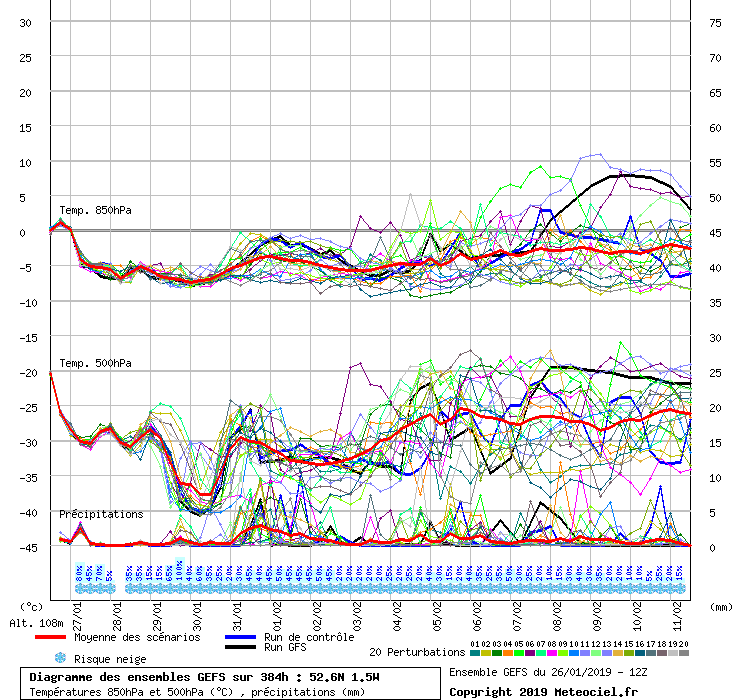
http://www.meteociel.com/modeles/gfse_cartes.php
Big changes from around T+120 on 12Z GFS backed up by latest UKMO as trough approaching UK slips south giving lower heights to S of the UK as weak ridge tries to build to the N/NE. Seem to remember that the recent cold spell appeared out of the blue at around T+96.
-
http://mp1.met.psu.edu/~fxg1/ECMWF_0z/hgtcomp.html
Latest 8-10 day 500mb charts continue to show low heights in the eastern Med and Azores preventing the Azores high from assuming its normal position. ECM has the axis of the ridge extending from mid Atlantic to Russia slightly further north with respect to the UK compared to yesterday. GFS has the upper high cell over Scandinavia further to the NE than yesterday. The upper ridge and associated surface high will have difficulty sinking too far south while low heights continue to be modelled from the Med to the Azores.
-
http://www.meteociel.fr/modeles/gfse_cartes.php?ech=186&code=code&mode=0&mode3h=0&runpara=0&carte=1
An omega block in the vicinity of the UK by around T+174. It could do with being a bit further north but nevertheless a rare sight.


.gif.c4f7ff1489cb3cb69fba8a25bbd4961a.gif)


Model discussion - Warm spell ending as Spring begins
in Forecast Model Discussion
Posted
Meteociel - Cartes du modèle numérique GFS pour l'Europe
GFS still showing extreme cold to our NW over next few days.
Apologies if chart doesn't appear..not yet fathomed how to upload charts from my tablet!