


Vikos
-
Posts
839 -
Joined
-
Last visited
Content Type
Forums
Blogs
Gallery
Events
Learn About Weather and Meteorology
Community guides
Posts posted by Vikos
-
-
EC Scenarios 12z

Each scenario, defined at 500 hPa, is associated to one of 4 pre-defined large scale climatological regimes. The frame colour of each plot represents the association to the climatological regimes. Scenario with a red frame indicates that its large scale features resembles the ones represented by the blocking, blue indicates association with Positive NAO pattern, green indicates association with negative NAO and violet with the Atlantic ridge pattern.
So, needed blocking is with one weaker cluster around month change... bit of hope...but... mrn (more runs needed)
-
 3
3
-
-
Maybe it's the new variation (mutant)
Stay safe
(will be deleted soon I think)
-
1
-
-
Yep, this is the way to go
-
1
-
-
Yep, those background signals... along with the EC charts of 30hpa.
-
2
-
-
8 minutes ago, IDO said:
I am up to about d12 before FI starts!
Well, that's way out of my understanding range, but ok, if you think so, why not. You must have your reasons for that. I won't crawl throu 10 pages back now of postings to find them.
That the overall patterns show a milder interlude, that's safe, but I wouldn't bank anythink after next weekend. Things can change fast, it's still very dynamic with a lot of powerful fluxes.
-
5
-
-
1 hour ago, IDO said:
No, did not see that. Looks a bit more interesting, a bit of tweaking and it would not be a bad synoptic. However the AO and NAO indices are not heading in the right direction as we head into Feb:
NAO and AO are direct outputs of GFS main runs. As we now, those are swinging like a donkeys tail... don't even bother about those is my hint.
FU Berlin is what one should look at, I did post the charts in the morning, the DISPLACED Vortex is changing its axis into a more favourable condition...
-
7
-
-
1 minute ago, syed2878 said:
sadly those back ground signal supposed to be good since winter 2019 however so far they have failed to deliver so forgive me if I don’t put all my eggs in the background signals.
Sorry, dude, but this isn't the moan thread. Synoptics is the prediction of an outcome, not the hope for an special outcome. That's the game! If hope on a certain weather pattern is your goal, than mid-to-long-term synoptics is maybe the wrong hobby to do.
For me, every thrilling synoptic outlook is favourable. Let it be heavy rain, strong storms in autum, snowfalls, winter thunderstorms or even blizzards, heat waves in summer and their dramatic ends with huge MSC systems. As long as it isn't boring for ages I am fine with any weather pattern.
-
5
-
-
- Popular Post
- Popular Post
12 minutes ago, northwestsnow said:Really disappointing 00z runs ...
Hopefully a lucky few will see some snow later this week...
That aside im struggling to find many positives...
Don't search in determistic outputs. See the background signals. Those look promising
And first of all: Don't lose hope, keep the faith. This applies to alot these days, in GB as in GER and the rest of the continent
Sometimes there are things on earth more important then snow in the backyard...
-
12
-
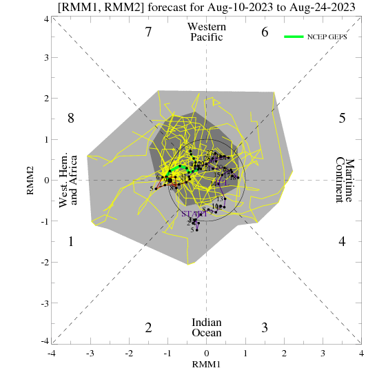
Some MJO forecasts
GFS
EC -
4
-
-
- Popular Post
- Popular Post
Good mornig!
I get a smell of a pattern/flow change.
This is lower strat at 30hpA
10day forecast---> Would take some time for further downstream development, but signal look quite good for some N/Neasterly currents around change of month.
So we have to ride this mild wave, wich is quite common in colder winters. I doubt that we will have to suffer for a prolonged time with mildish westly winds.
-
13
-
 2
2
-
-
8 minutes ago, Mike Poole said:
I think it could link with the previous high, as per:
Which would give a stronger ridge upstream of the UK, less sure re your location!
Ok... more runs needed
And south GB shares the same latitude with Germany (around 50°N)
But bluearmy pointed out something very good, indeed....
12 minutes ago, bluearmy said:The strat has been rock solid on the ridge establishing around the n Atlantic sector from the north in week 2 ....perhaps the 12z runs are beginning to sniff that imprinting onto the trop ..... let’s see how many eps members drift that way - mwb has indicated that this isn’t a completely left field option ...
Lets wait for the clusters....
-
5
-
-
8 minutes ago, Mike Poole said:
And there is the next amplification as per GFS on ECM too at T240, lets hope for better luck with this one!
Far too weak I would say, gets overrun easly. But Didi-land, anyways....
-
2
-
-
Wont bother you guys, but I think I have a major problem
-
4
-
-
2 minutes ago, winterof79 said:
Its not for todays run though lol
Come on...
-
3
-
-
Don't get too over excited over a good GFSop run...
Charts has been updated
-
From a german outlook site:
On January 17th, 2021, GFS expects that the polar vortex of Greenland at a height of around 16km (100 hPa, left) will join the main vortex over Siberia as a European trough by January 21st, 2021 (middle), thus turning the high-altitude current over Western and Central Europe on SW and there is temporary mitigation. With the further shift of the European trough to the east (right), the current turns back to NW directions and it will be wintry again on the weekend of January 23/24, 2021.
-
6
-
1
-
-
After a bit of time, EC has more than one scenario in end of mid-term range
Yesterdays 12z
Minor warming is getting "warmer"
Yersterdays 06 ---> EC @ 5hpA
+12°C
This downwells to 10hpa with -15°C in 10hpa, so it matches GFS at day10
-
2
-
2
-
-
13 minutes ago, sundog said:
Well there are those of us who think that feb could be the month that delivers so I wouldn't be surprised if perhaps it could start picking up on something.
I am one of those who belives in Feb and a bit of March, since I tend to say that seasons have shifted a bit, so autum is going almost up to late december (with first cold spells around end of Nov), while summer epsiodes start quite early.
Even with that SSWE in mind, my fear is that we get stucked in some colderly patterns for at least 2 months ongoing and at the end warmer spells will be a reliev we wish for...
-
4
-
1
-
-
1 minute ago, Cold Winter Night said:
Thanks. If anything shows the effect of the SSW, it is this.
Not the amplified pattern, the Greenland High, or an Easterly from Russia to Canada.
The models are losing their grip on the situation.We are only just getting started with the effects of the SSW.
The current amplified pattern that is shown in the output is not necessarily the result of the SSW, even if it is consistent with it. So if there is a High Latitude Block (HLB) in the output, there is no way anyone can say with certainty that it was the result of the SSW. Nature doesn't do labelling for the convenience of scientists.
We have not seen, as it sometimes happens, a sudden switch from a tight zonal pattern to an amplified pattern that was obviously the result of the SSW. This season we already were in an amplified pattern beforehand. Any further amplified/blocked patterns we get to see in the output (or perhaps the lack thereof) can only be ascribed to the SSW with terms like: 'possibly', 'likely', 'consistent with' etc. So everyone be careful with those oneliners accompanied by charts, "SSW clearly shows its hand"/"Rubbish SSW, did not work in our favour".We barely passed the 10 day mark after the SSW, the effects are going to be trickling in slowly, in a waxing and waning manner, over the next few weeks, or even months. The article that @sebastiaan1973 shared in this thread several times claims that an SSW of the European blocking type has its strongest influence after about 35 days, so that would take us to the middle of February.
Now that does not say anything about cold in our part of the world, but it does say something about the reliability of, for example, ensemble means in deep FI. They might very well be the last ones to pick it up if something changes. The real setup of patterns might very well sit outside the current spread.True words, needs to be pinned! Thank you!
-
2
-
-
1 minute ago, General Cluster said:
I know it's a wee bit early in the season, but charts like these make me drool in anticipation, of the mouthwatering aroma of real jerk chicken. With some lovely background real reggae, of course!
-
2
-
-
Just now, bluearmy said:
I suspect the gem day 10 recent return is missing rather than below 0!
clear evidence that the reversal has had an effect on the stats ....will be interesting to see if there is a sustained recovery second half jan or whether the ongoing weak strat flow and further potential drops later in the month affect the nwp.
GEM just failed.
Second, atm no need to look at GFS/op outputs after +144h
-
1
-
-
- Popular Post
- Popular Post
GFS op =
-
9
-
1
-
16 minutes ago, Don said:
How potentially unlucky are we this winter?!
Right now, 10 out of 10
That's why I am waiting for that massive low as a gamechanger (hopefully) which can break up those structures. Hope and keep the faith
-
2
-
1
-


 EC
EC 
 10day forecast--->


 Yersterdays 06 --->


Stratosphere and Polar Vortex Watch 2020
in Spring Weather Discussion
Posted
Looking good for a Split upstairs. But still needs to reach troposphere. Downwelling will take some time, no signals on a PVS in troposphere, yet
10hPa
30hPa
in 50hPa winds slow down, but no negatives, but patterns seem to follow upper levels.
In 150hPa (Strat-2-Tropo layer) still looking quite zonal, winds remain all positive
Regarding those zonal winds, well....
From to---->
Wait and see. Honestly, atm I see a patt situation, outcome unknown. GFS looks good, though.