


A roundup of current warnings for Rain and Flooding, mainly for England and Wales.
Written Thurs 14th updated Friday 15th
It feels like 2019 could be one of those years that we talk about in flooding terms; haven’t seen it this bad since..., remember Autumn 2019 when it never stopped raining. The ground is sodden, river levels are high, flood or weather warnings seem to be issued or in force every single day.
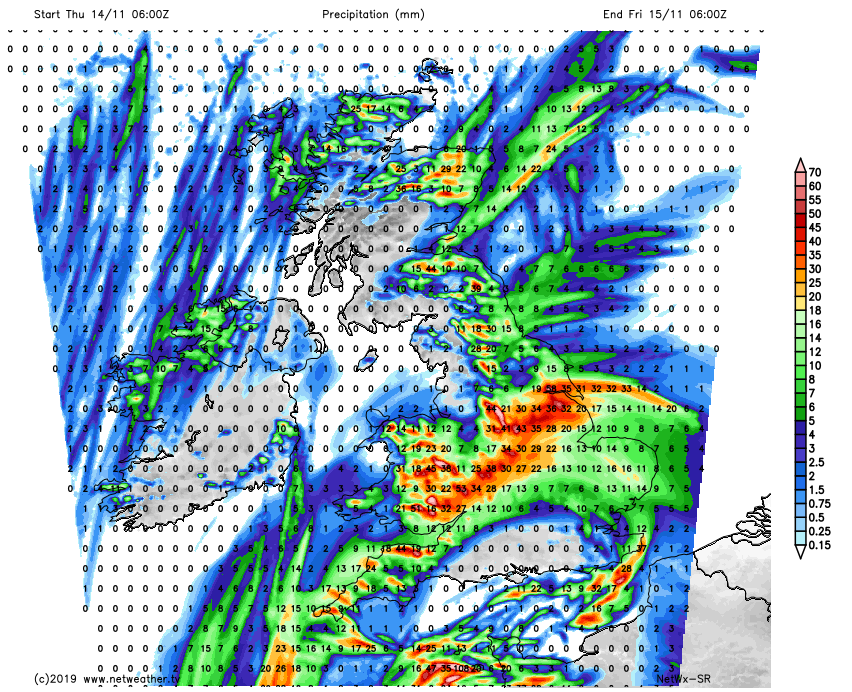
With more rain on Thursday 14th parts of England and inland Wales have heightened flood concerns.
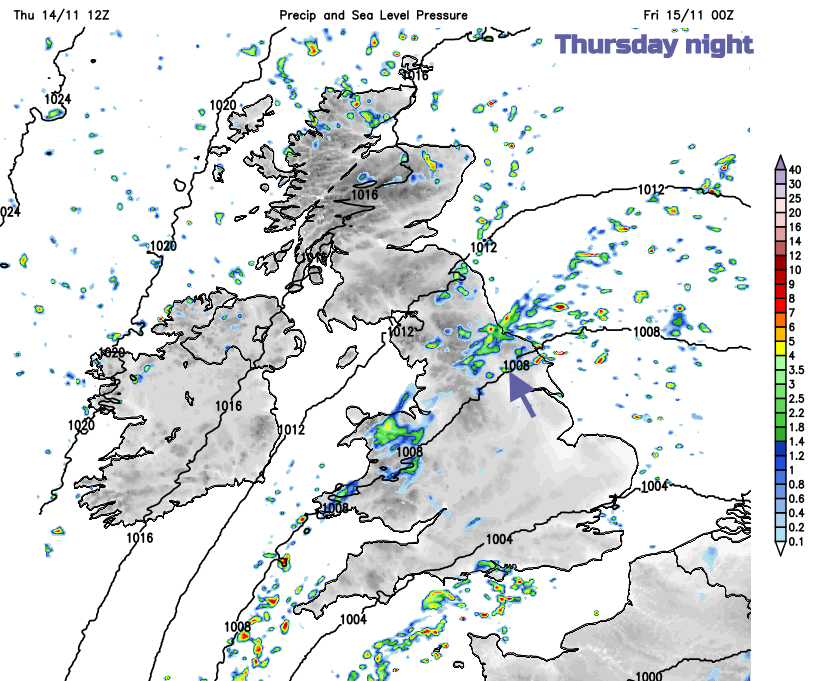
A frontal band is rotating around a low pressure and bringing rain in from the North Sea near the Humber down to the Bristol Channel. Usually, rain bands get stuck over NW England or Wales with eastern Britain being the drier side of the UK on average. This week the rainband will continue northwards with the low centre further south and the rain thankfully fades during Thursday night. Although there will be showers feeding in from the east on Friday.
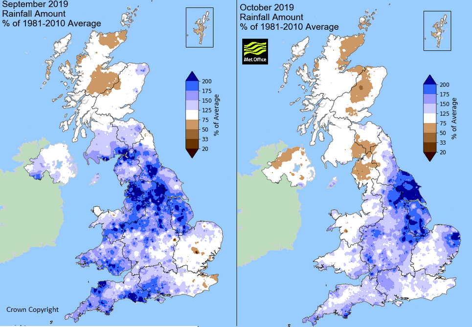
It has been very wet already this autumn mainly for England and Wales, southern parts of Scotland. The Met Office anomaly charts compare data such as temperature, sunshine and rainfall with average time periods. Most recent 1981-2010, back to 1961-1990. They show a percentage above or below average against the time series. The dark blue areas clearly show history of current problems.
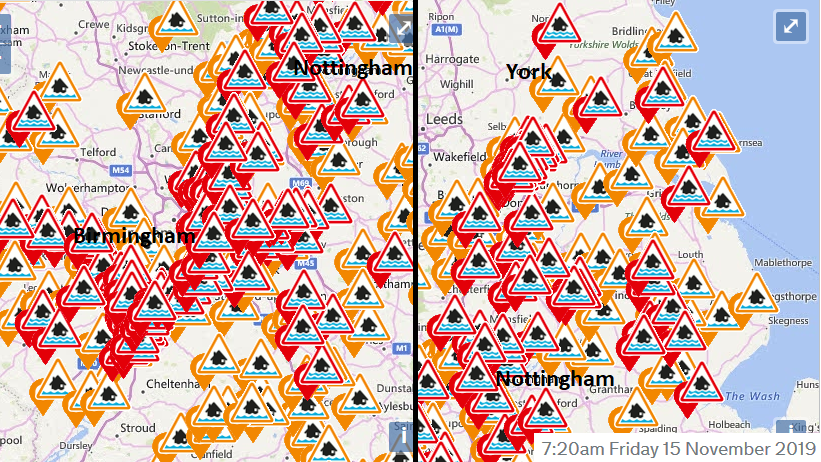
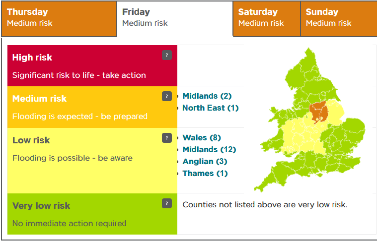
With over 50 flood warnings still in place for England, central Britain has a medium risk of flooding and more of England a low risk. The higher risk is over the area hit by widespread flooding last week and barely recovering even though the River Don is now off Severe Flood warning level.
"River flooding is expected to continue in the Lower River Don washland area of South Yorkshire through to at least Monday, where properties will continue to flood and there will be continued travel disruption. Also, river flooding is probable on Friday for the River Derwent in Derbyshire and the River Trent in Nottinghamshire on Friday. EA"
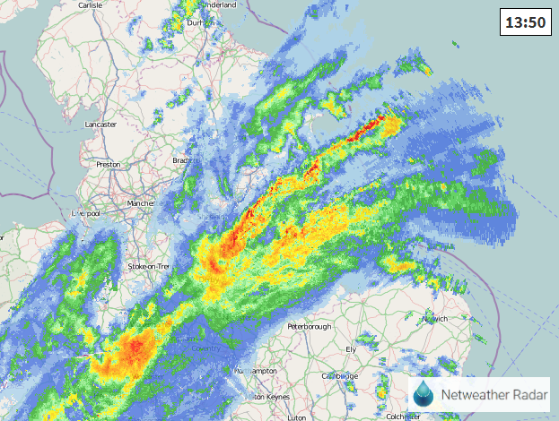
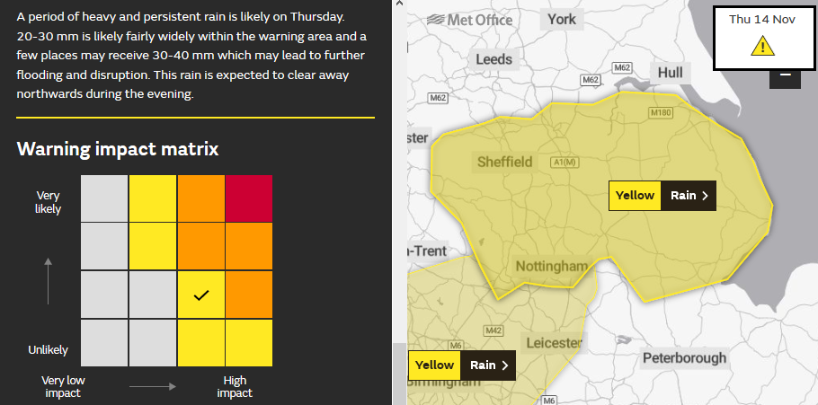
It's raining now over Lincolnshire and South Yorkshire and the East Midlands. These areas have a Yellow warning which had been very unlikely on the Matrix but high impacts. This moved to slightly more likely with medium impacts, keeping it at Yellow. It is now raining quite hard, across a wide area. Sometimes the fitting into the warning matrix appears a bit odd, not weather or impact-driven, more choosing a result and shifting the calculation to fit.
Environment agency: "Given the wet ground conditions, we expect local rivers to respond, rising steadily from late afternoon onwards. It is not expected to reach levels seen last week. Due to the forecast and large amounts of water in the low lying areas of the catchment, warnings will remain in force. We will review this after the rainfall has passed"
EA "River and surface water flooding is possible across parts of the north-east and central England and Wales today with river flooding continuing into Friday. Land, roads and properties may flood and there may be travel disruption.
Local flooding is also possible across other parts of England and Wales today and across the far south-east and east of England today and into Friday."
"Ongoing local river flooding may also continue in parts of South Yorkshire, Lincolnshire and the Midlands over the weekend. Local surface water and river flooding impacts are possible on Sunday over eastern parts of England. Land, roads and some properties may flood and there may be travel disruption." EA


