


This week ends with temperatures in the high teens, it feels like spring. However, a change of airmass signals frost and a colder feel by early next week, especially in the wind.
There will be a change during the weekend to cooler, fresher feeling air and a northerly nip in the air for the start of the next working week. Temperatures will tumble from the high teens for the end of this week down into single figures for Monday and Tuesday. Manchester will be closer to 8C by Monday, feeling more like just 4C, Brighton might record 11C on the thermometer but will feel more like 6C in the rain and strong gusts. Portrush, Co.Derry is having a taste of spring on Thursday in the southerly wind at 16C but by Monday it will feel more like just 4C with 50mph gusts. Earlier next week across the UK, there will be blustery winds and bands of rain, with snow for the mountains and northern hilltops along with hail or icy rain in the showers.
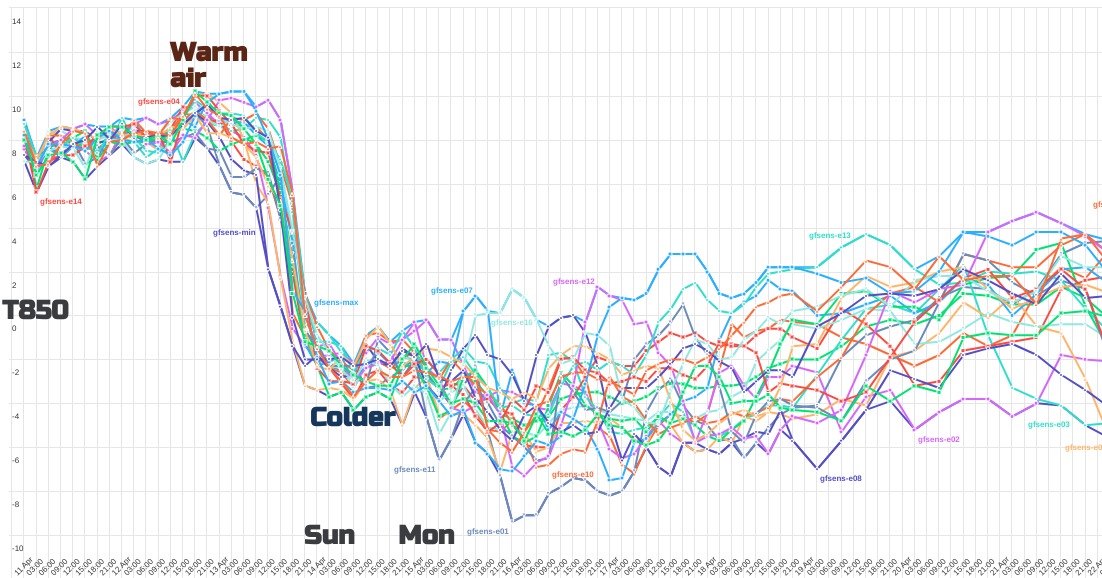 (various outputs from the ensemble model, showing a dramatic change in airmass for the start of the new week)
Just as you begin to enjoy the spring sunshine and a bit of warmth, a cold front barges through mid-weekend, allowing the fresher air from the North Atlantic on Sunday. That is just a first step. By the end of Monday, we will feel a cold northerly flow, coming down from the Arctic, until high pressure builds out west for the middle of next week. This high will interrupt the direct northerly wind but around the eastern side of the high could keep the colder airflow, tucking towards SE Britain and eastern England later next week.
The northerly flow for the start of the working week means that rather than the 17 to 20C maximums of this week, daytime temperatures will more widely be 7 to 12C with some chilly nights. Gardeners do beware of this upcoming colder shift. There will be a risk of frost on the grass, with an air frost for inland northern Scotland. We’ll have to see how the cold flow develops as Thursday night looks potentially chilly across the UK.
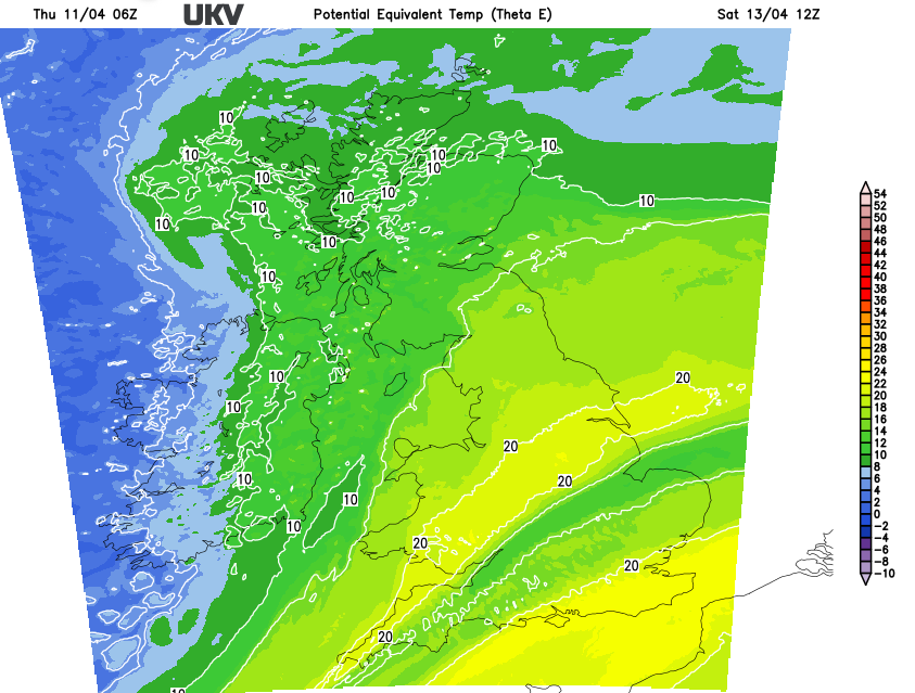 (The colder air waiting to move in from the northwest)
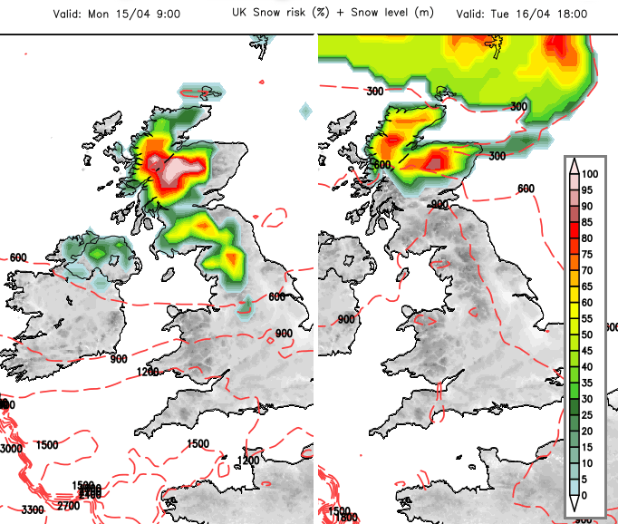
Does this mean snow? Not particularly, unless you are heading to the high ground of Scotland this weekend. It looks like hills and mountains exposed to the westerly flow will see rain and snow. By Monday, there could be a wintry covering for the high ground of northern Britain and more for the Scottish mountains. Later on Tuesday, we could see the focus of any snow shifting to the northeast of Scotland and the Northern Isles. A few wintry showers could clip eastern Britain but the ground is wet and beginning to warm up now, so don't expect much settling by day.
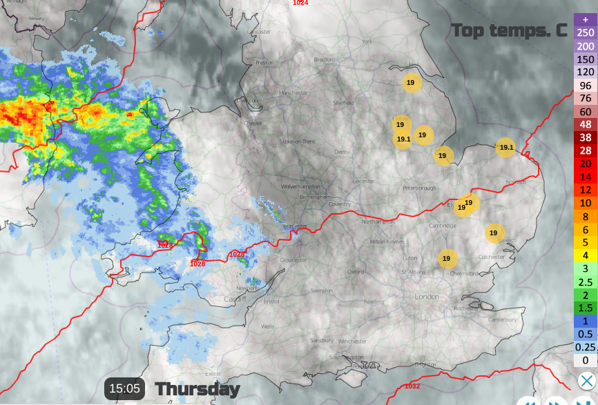
That is about it. In any sheltered sunshine, it could feel quite warm. It's that time of year when it's tricky to know what to wear. In a southerly flow like today (Thursday), it can feel warm in any sheltered sunshine. It’s just the air will become cooler, so that will be noticeable as it goes dark and as bands of rain or blustery showers move by, again it will feel cold. It's the change of airmass that will make a difference. Monday looks windy with gales for exposed parts although the wind does ease down through Tuesday.


