The weather patterns are shifting, back to a more usual setup. Rain for the northwest and warmth with something drier for the southeast. Not as windy as last weekend either.
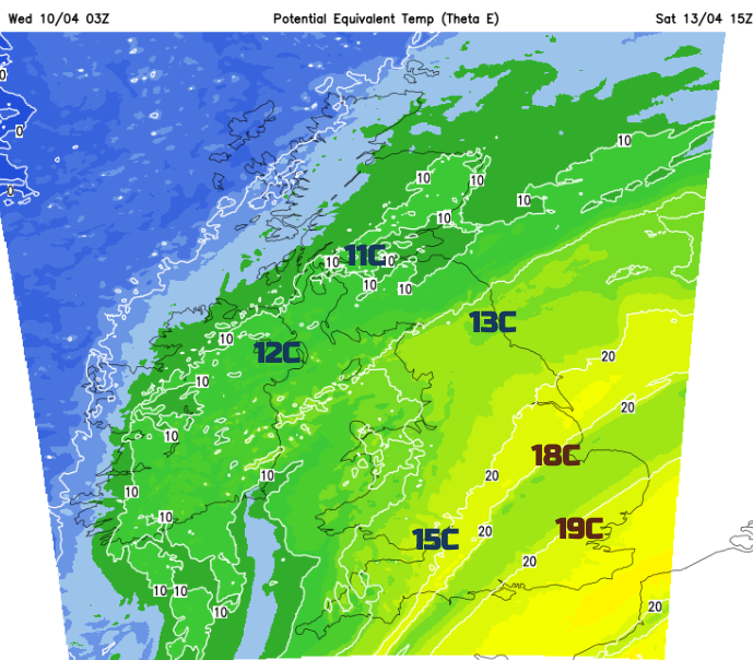
A wish list for the weekend weather; Number one, can it stop raining? And Number two, following Storm Kathleen from last weekend, can it not be as windy? It would be pushing it to expect above-average temperatures, a bit of spring heat but as we head to the middle of April any sheltered sunshine can feel pleasantly warm now. Saturday could see up to 20C for southeastern Britain but a fresher airmass arrives for Sunday. Glasgow will be around 11C this weekend but Cambridge could reach 19C on Saturday.
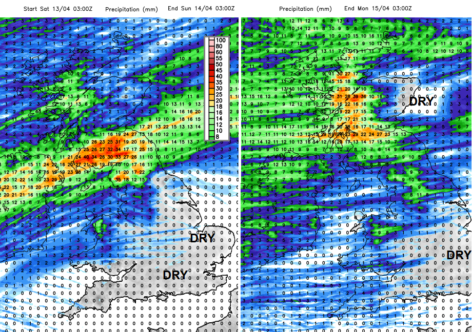
The rain part of the wish list delivers for southern Britain and, at times, for eastern Britain this weekend. There will be a shift in our soggy weather pattern over the next few days with plenty of drier weather on offer. Further north, particularly for western Scotland, Northern Ireland and Cumbria, there will be a good deal of rain with low pressures rolling in from the northern Atlantic.
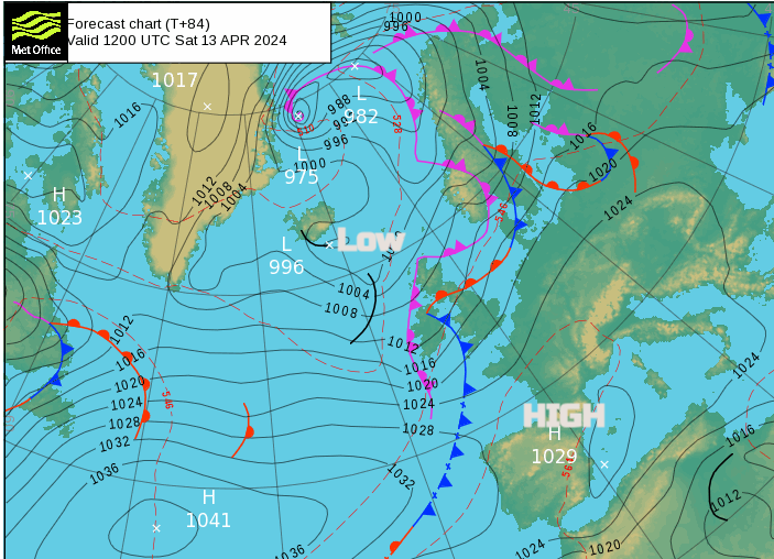
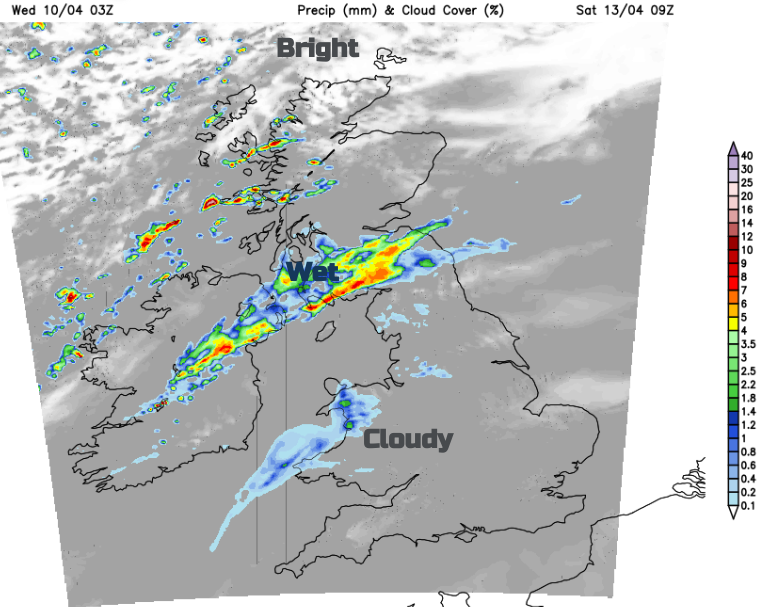
Southeastern Britain didn’t feel the effects of Storm Kathleen too much, but it was wild elsewhere last weekend thanks to the slow-moving low pressure. Meteo France named a different low that brought wet and windy weather through the English Channel on Monday night. The main windy spell of this weekend will be on Saturday night, but nothing exceptional. There has been so much rain this winter and for early spring that trying to go for a walk can feel like heading out into a swamp. We could do with something drier and brighter. The reservoirs in the southwest are full up, so that is good news at least
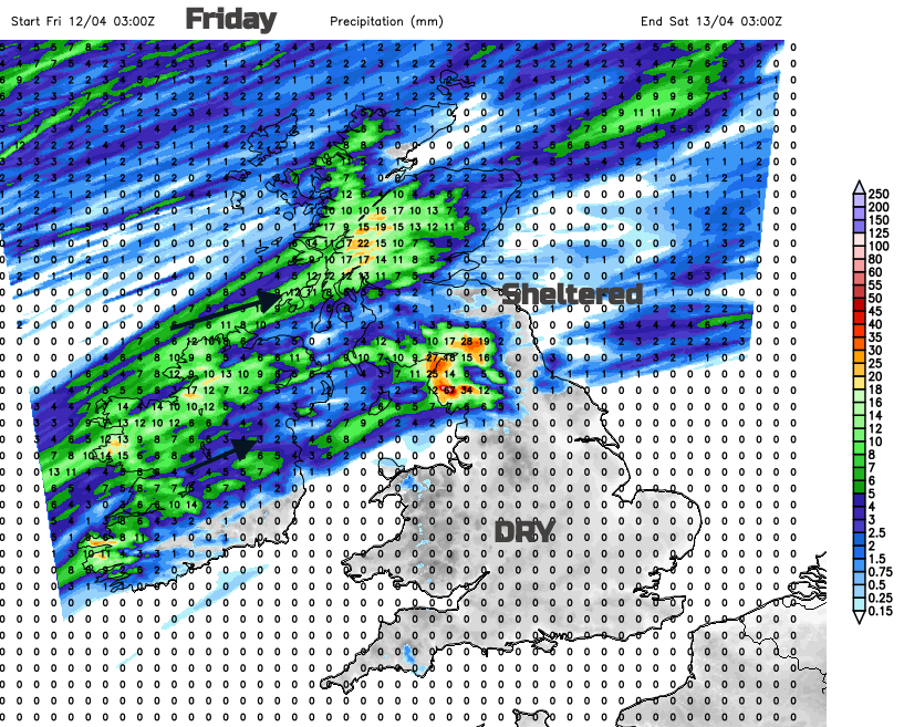
We are back to having frontal bands draped across the UK with high pressure to the south bringing drier, warmer weather. To the north of the frontal rainbands are the low pressure centres, fresher air and often, more showery weather. Under the frontal boundary, there can be heavy and persistent rain, especially for western counties. The focus of the rain for the end of this week is for northern parts of the UK, leaving much of England and Wales with drier, brighter prospects.
If you look at a forecast, the symbols might show sunshine, cloud or rain but keep in mind the fluidity of the frontal bands. They will be rippling across the UK and could end up a bit further north or south. So a bit of uncertainty in the region around the fronts.
By Friday evening, the waving frontal bands look to be across the Irish Sea and a more lively one coming into western Scotland.
For Saturday morning there will be bands of rain, with showers to the north and brighter conditions. To the south, there will be more cloud with damp weather for the coasts of western Wales and NW England. Where breaks in the cloud appear, it will be bright, even sunny and warm but the onshore flow could keep things rather grey in the west.
During Saturday afternoon there will be sharp showers for Northern Ireland and Scotland, and by evening into northern England. They will be mixed with sunny spells but also the risk of hail and thunder and by Sunday morning, sleet and snow over the Scottish mountains.
For many Sunday will start fine, bright but feeling fresher. The showers get going through the day with a rash developing for Northern Ireland and Scotland, although the northeast looks more sheltered. Elsewhere they are lighter and more scattered with a fair day for many.
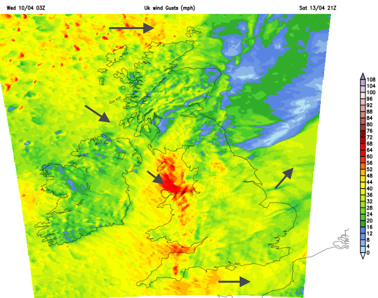
Saturday will become breezy through the day, with lee gusts for north Wales, between Bangor and Llandudno. Also for County Durham and the A1 to the east of the Pennines. For southern Britain there will be a light southwesterly flow for Saturday which freshens by the evening. As fronts pass by, there will be gusts over 50mph through the Irish Sea, for exposed coasts and hills of western Wales and the Bristol Channel as the wind veers to the northwest for a time. Wales and then England will experience this windier spell during Saturday night, but for most, it will be whilst tucked up in bed. It might sound more lively than it is, with bands of heavy showers for Wales and northern England.
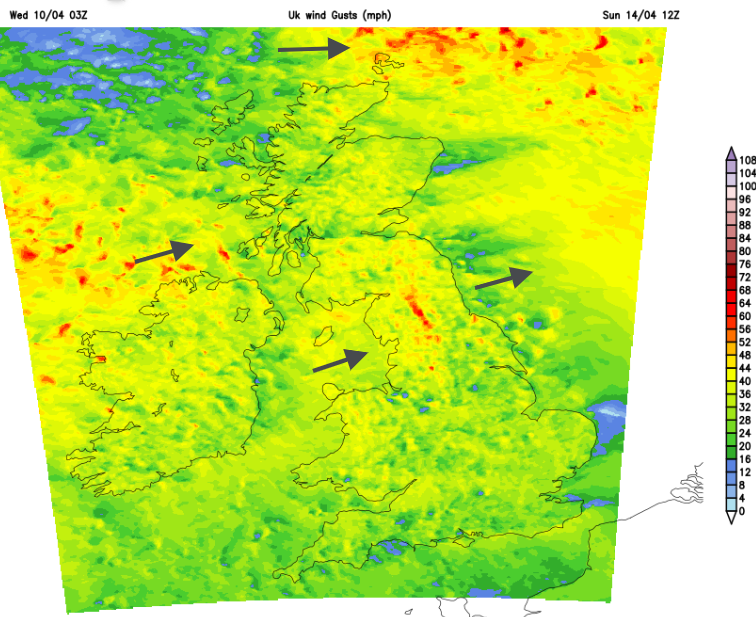
For Scotland and Northern Ireland, Saturday will see light winds but more breezy for the Islands. The winds will pick up during Saturday night with a blustery westerly by Sunday morning with gales and gusts over 50mph for the Northern Isles. These will pass with a calm end to the weekend for the far north.
Temperatures
Friday will feel warm for much of England, eastern Wales and northeastern Scotland with light winds and temperatures in the mid to high teens. Cool air will edge in overnight but Saturday will be warm for parts of England especially when the sunshine appears. Temperatures in the southeast or eastern England could reach 19 or 20C.
The colder air follows the frontal bands of Saturday night with a frost for inland Scotland. It will feel fresher everywhere on Sunday, noticeably so for the areas that felt warm in the sunshine the day before.