A mixed week but with more fine bright weather than rain overall. Windy at times but often with mild air from the southwest until Friday.
The week ahead will bring fine, bright times when you can feel that spring is in the air but outbreaks of rain will continue to appear.
The weekend was certainly mixed, clear skies and a frost after heavy and persistent rain. Bright skies before more rain then early mist and much milder air making it feel a bit close in any sunshine on Sunday. Exeter airport reached 17.3C. For the working week, it stays mild in the south but next weekend looks cooler everywhere. For most, that puts temperatures back to where they should be at this time of year. Northern Scotland might see snow showers in the northerly flow to end the week
“Local flooding is possible but not expected from surface water and rivers in parts of Wales on Wednesday”
This week, there will be more rain but it’s more patchy and focused on western counties. Western Scotland looks very wet by Friday.
No weather warnings for the next few days although the Environment Agency in England highlights the already saturated ground conditions.
“Local flooding is probable from groundwater during the next five days in parts of the South of England.” Env Agency
There is a complex set of low pressures. One anchored west of Iceland but another centre brushing past the Western Isles overnight. The warm, cold and occluded fronts all move through overnight turning more showery on their way. The southerly winds will freshen tonight for Ireland and western Britain, reaching gale force for exposed parts of western Scotland with high gusts over the mountains as one low centre passes by. It won’t be cold tonight as clear skies come and go but there will be a windy start for the Northern Isles.
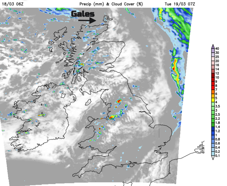
There will be a scattering of showers on Tuesday but for most, it will be a fine, bright day. The northern half of the UK will see more sunshine and the southern half, more cloud in a mild southwesterly breeze.
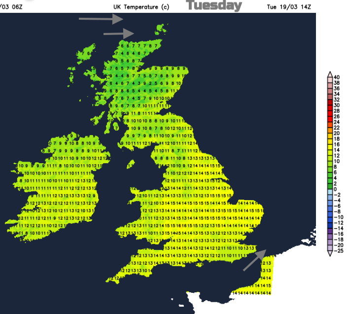
The winds fall light everywhere overnight with a colder night for Scotland before the flow turns to the north on Wednesday. Rain will have already reached Northern Ireland and Wales on Tuesday night and this will spread over more of England, even southern Scotland on Wednesday. There will be more cloud here and mild air but to the northwest it will be sunny but in the cooler air.
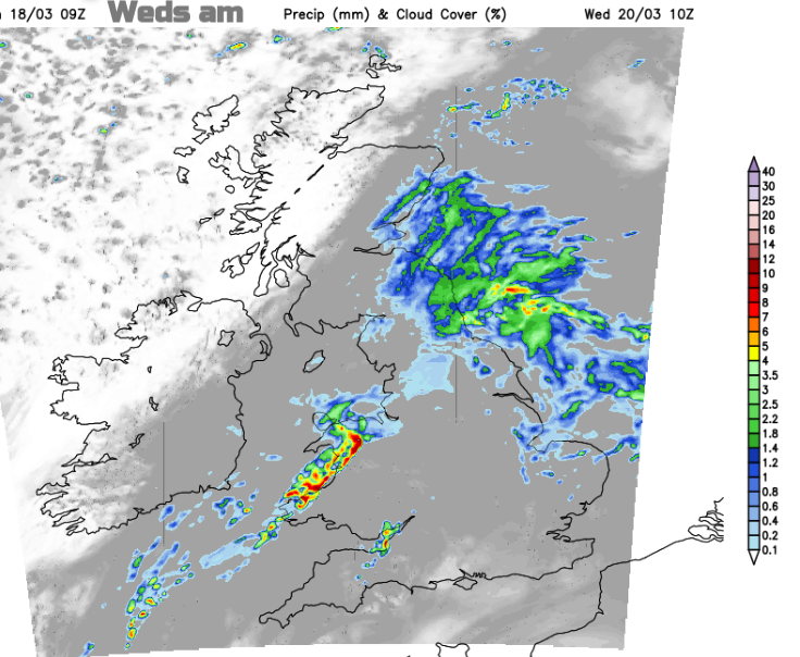
The rain does glide eastwards on Wednesday but still, it is falling on areas that are already sodden. Temperatures might reach 17C in southern England, but it could take until the evening for the main showery rain to reach the Home Counties and London.
For Thursday the next frontal bands will be further north ahead of a new low pressure heading in for Friday. The southwesterly winds will freshen over Northern Ireland and Scotland on Thursday bringing milder air but rain to the far northwest. Friday looks to be a blustery day with bands of rain from the northwest but not much reaching southern or southeastern England. Behind Friday’s cold front, it will feel nippy as the mild air disappears.
That leaves temperatures closer to 9 or 10C at the weekend.