More wet weather is on the way, affecting much of the country until Wednesday. Though temperatures remain mild for now, a short-lived colder spell next weekend could bring frost risks and perhaps even some snow.
Spring 2024 has begun with close to average temperatures for most, meaning that March so far has been rather cooler than the exceptionally warm February. However, the pattern of frequent wet weather has continued for much of the country, especially in the west and south. This changeable and, at times, wet weather will continue until next Wednesday for much of the country, and Wednesday, in particular, looks like a wet day for many.
It is looking probable that we will have a short-lived northerly blast next weekend, which will bring some colder and drier weather for a few days, with the potential for some wintry showers on high ground and in the north, followed by overnight frosts, so gardeners and farmers need to beware regarding possible plant and crop damage following faster than usual growth due to the recent mild and moist weather. Some GFS operational runs have been subsequently bringing a cold easterly in, but this is currently looking like just an outside chance, with the more likely scenario seeing relatively warm and changeable weather return from the west after a brief cold snap.
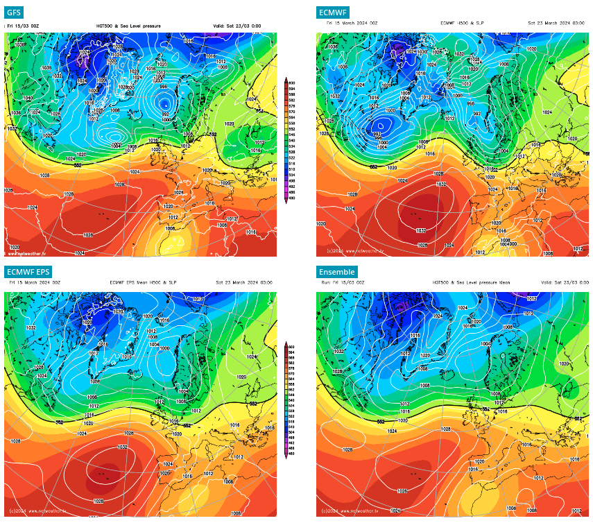 Different scenarios showing on the forecasting models for next weekend
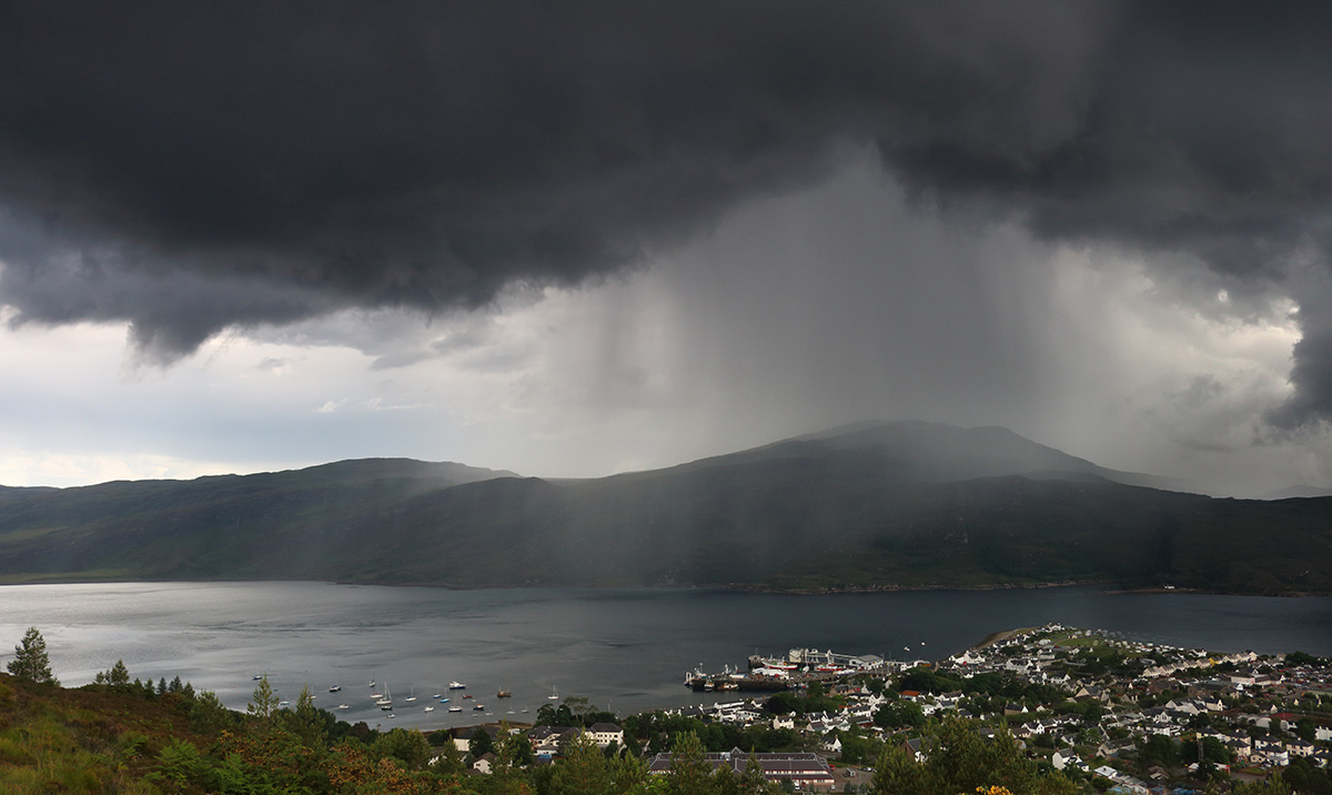
Today's weather will see bands of rain pushing in from the south-west, although much of northern and eastern Britain has started off dry and sunny, and north-east Scotland will hold onto this dry sunny weather until late evening. By midday, the rain will have spread into Northern Ireland, and most of Wales and south-west England. By evening, the rain will have spread through the majority of England and Wales, although amounts in parts of eastern England will be small. Southern and western Scotland will also see the rain moving in during late afternoon and evening. As is often the case when we see rain bands push in, the winds will also strengthen, and it will become windy in western Scotland.
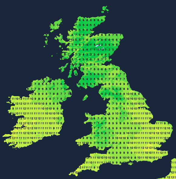
Temperatures will generally be around normal for the time of year, reaching between 8 and 10°C in most parts of Scotland, Northern Ireland and northern England, and peaking at around 13°C in inland parts of south-east England.
Overnight tonight, the band of rain will push north-eastwards through the rest of the UK, with drier, clearer weather following behind to most areas. Still, another band of rain will push into south Wales and the southern half of England, which will be persistent and heavy in many areas. It will generally be a very mild night away from Scotland, with temperatures widely falling no lower than around 7 or 8°C. However, in Scotland, especially to the north of the Central Lowlands, temperatures may fall to between 3 and 5°C.
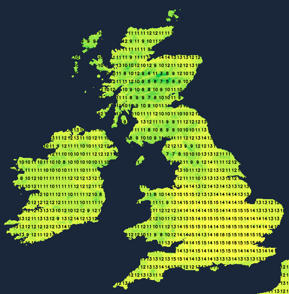
Sunday will be another warm day for the time of year, with south-westerly winds. Temperatures will reach around 16°C widely in the southern half of England, and even in Scotland, highs of 12 to 14°C will be quite widespread. The band of rain that will affect southern Britain overnight will slowly clear from eastern England during the morning, with brighter weather following behind. There will be some scattered showers, though most of southern England will become dry after the rain clears away eastwards in the morning.
Monday will see another band of rain push in from the south-west after a dry and sunny start for many. This will clear away for Tuesday, leaving sunshine and scattered showers. On both days, temperatures will be on the warm side for the time of year, and Tuesday, in particular, looks set to be about as warm as Sunday, with most areas seeing highs of between 13 and 16°C. Wednesday has the potential to be very wet, though there is some uncertainty over this, as some model runs have the heaviest and most persistent rain going out to the west of the British Isles.
Temperatures look set to remain on the warm side for the time of year through Thursday and Friday. Still, into next weekend, as noted earlier, we are expecting to pick up a colder north-to-north-westerly flow, bringing brighter, colder weather, which may bring some wintry showers on high ground and potentially to low levels in the north. It does not look likely to be a particularly potent northerly for the time of year, however. Hence, it looks unlikely that there will be lying snow from it at low levels except possibly in north-east Scotland and even in here any lying snow at low levels will almost certainly be very short-lived. But the potential for one or two substantial frosts, especially in the north, is worth monitoring.