February 2024 is on track to be one of the warmest on record. However, it's also been wet, and further heavy rain is on course for southern England on Sunday and into Monday.
February 2024 has been exceptionally mild despite long-range forecast models predicting a potentially cold February with blocking anticyclones over Greenland. Similarly to a large part of December 2023 and January 2024, this month has seen some Greenland blocking highs, but they have been weak, and in replacement, there has been frequent high pressure around southern Europe. The jet stream has passed in between these two areas of high pressure, bringing frequent mild and wet weather to the British Isles.
The extent of the mild weather has been accentuated by the persistent anomalously high sea surface temperatures in the eastern North Atlantic, which have been making the westerlies warmer than they would normally be. This situation has generally persisted since March 2023, when the westerlies of the second half of that month were unusually warm and cancelled out that month's cold and wintry start. In the Met Office Hadley Centre's continuation of Gordon Manley's Central England Temperature series, which goes back to 1659, February 2024 is looking set to be a strong contender for the warmest February in the series. It will probably end up in the top five, coming in at around 4°C above the old 1961-1990 average.
Temperatures are forecast to be somewhat nearer the long-term normal during the rest of February, which may prevent it from being the outright record mildest February in many areas of the country. However, it still looks unlikely that there will be any substantial cold weather during the last week of February and the first week of March.
More substantial cold outbreaks are possible as we progress further into March. Still, as we head into meteorological spring, the potential window of opportunity for cold and snowy weather is reduced. The Marches of 2013 and 2018 both had notable snow events mid to late month – heavy disruptive snowfalls were widespread around 22 March 2013 and 17–18 March 2018, for example, with maximum temperatures close to freezing in the affected areas. Therefore, it is too early to rule out further snow events for the 2023/24 season. Still, it is currently looking reasonably unlikely that we will see substantial cold, snowy weather during the remainder of the season.
Saturday will bring sunny spells and scattered showers for most of the UK, with many areas starting clear and sunny. Although patchy cloud will develop in most areas during the day, many places will miss the showers altogether and stay dry. The main exception will be near the south coast of England, where a band of cloud and showery rain will move from west to east, primarily affecting the south-west during the morning and the south-east during the afternoon. Temperatures will be lower than in recent days and will be near the long-term average for late February, though with sunshine and light winds for most of us, it may not feel particularly chilly in the sun and out of the wind. Maximum temperatures between 7°C and 9°C will be typical, with the south and east of England seeing the highest values.
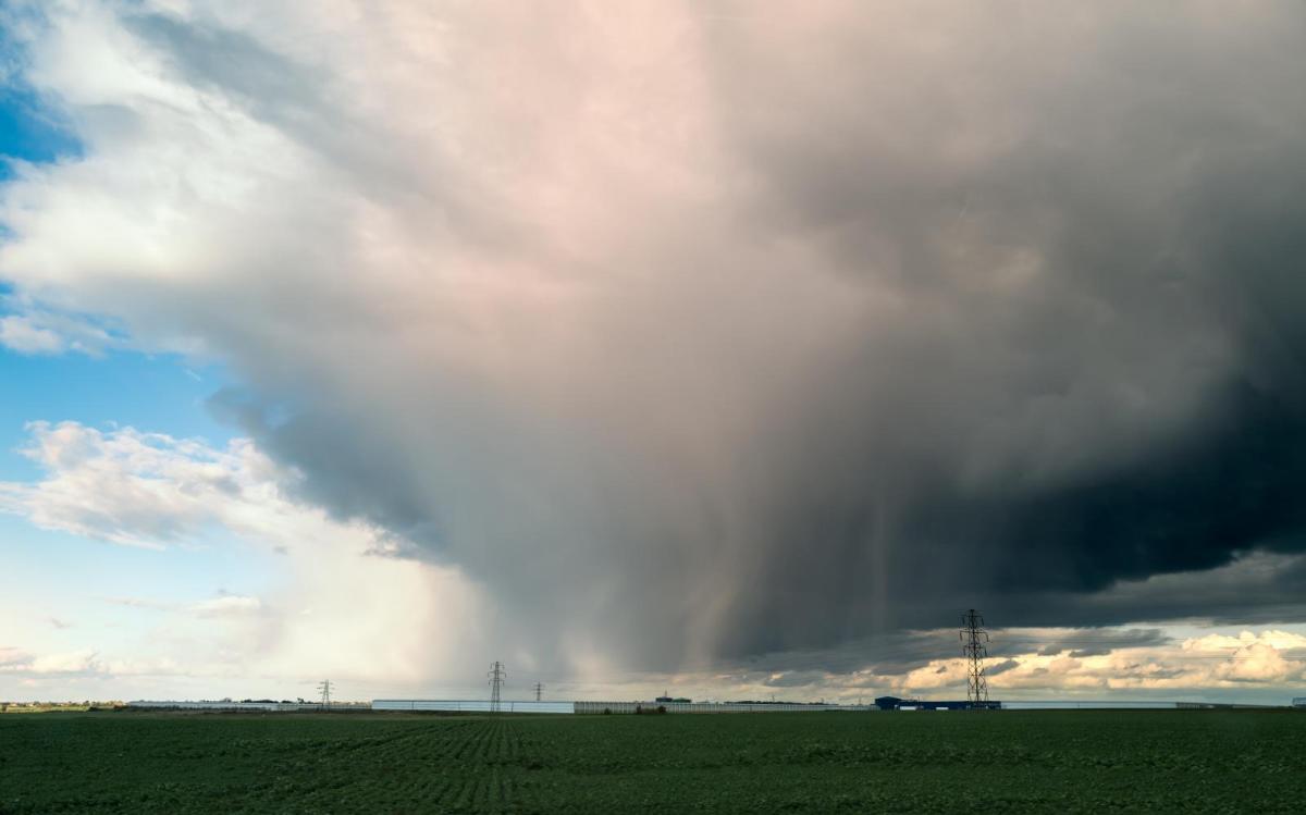
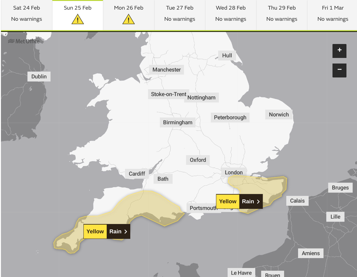
There has been a lot of attention regarding the potential for very wet weather in the southern half of Britain, associated with a deep depression moving into the English Channel and northern France. Currently, this is likely to affect only counties bordering the English Channel but has the potential to produce high rainfall totals in these regions. The Met Office has issued a yellow weather warning for rain for the south coast of England for Sunday and Monday, covering the south of Cornwall, Devon, and Dorset on Sunday and the Home Counties south-east of London on both Sunday and Monday.
As a result, Sunday will be a wet day near the south coast of England. Elsewhere, it will generally be cloudier than on Saturday but with some bright or sunny intervals and scattered showers. However, northern Scotland, away from the frontal system in the far south, will generally be sunny. Temperatures will generally be slightly lower than today's, mostly peaking at between 6°C and 8°C, and it will be cold enough for the showers in Scotland and northern England to be wintry on high ground. It will feel considerably colder in most areas with a stiff easterly wind developing.
On Monday, the rain will clear away from the south-east, and a chilly north-easterly wind will persist for most regions, strongest near North Sea coasts of eastern England but easing during the afternoon and evening. Temperatures will be similar to Sunday's, with sunshine and just a scattering of showers, which will be wintry on high ground.
The weather looks set to be relatively settled and quiet through Tuesday and Wednesday, but it is looking likely that more wet weather will push in from the west towards the end of the week.