A chilly NW flow will bring showers to exposed coasts with a touch of frost by night. Saturday looks bright but dry. Rain starts to appear in the west on Remembrance Sunday.
There are great contrasts in the weather across the UK for the start of Friday. There is a broad area of low pressure with still, clear conditions centred over Scotland. Here temperatures have fallen below zero quite widely with more areas waking to a frost and the first signs that winter will be on its way. The clear skies allowed a stunning view of the crescent moon and Venus to the east.
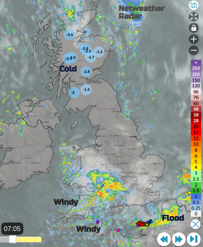
For Wales, SW England down to the English Channel it has been a wet and windy start. A little low centre has brought high gusts and squally rain across southwestern Britain for the start of Friday with lightning strikes heading east along the Channel. So a blustery and showery picture for the Channel Islands as the recovery continues, a week after Storm Ciarán.
The far north of France continues with red flood warnings and a feed of heavy, thundery showers from the west. This area was also hit by Ciarán but has seen ongoing heavy rain.
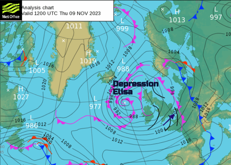
Depression ELISA: "causing very heavy rain in the coastal departments of the north of the country…This bad weather is a continuation of an exceptional rainy period. Significant floods in progress in Charente-Maritime and Hauts-de-France. Risk of exceptional flooding in Pas-de-Calais." Meteo France
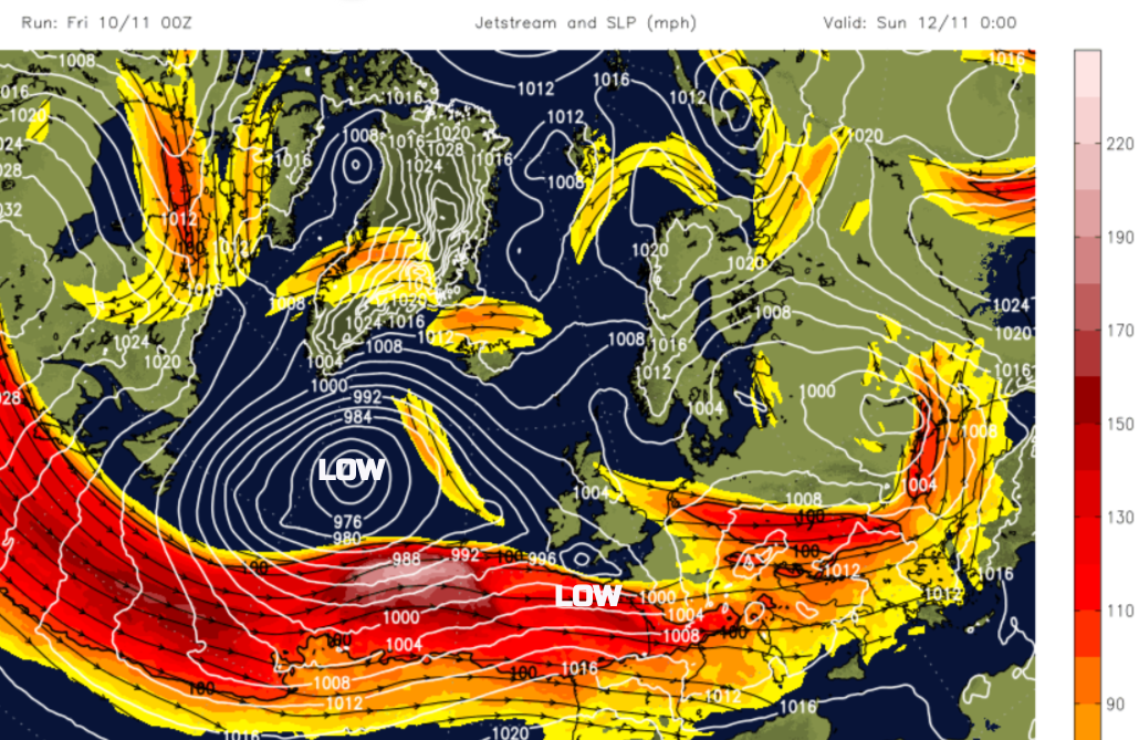
The worst of the November severe weather has just been to the south of the UK. The jet stream has been in a more southerly position but with a large meander helping Elisa on Thursday. It becomes more zonal and strengthens at the weekend but begins to drift northwards next week and could throw a deeper low our way. It is autumn after all. The ongoing signal for the flow to remain from the west to southwesterly is strong.
For Friday, we are in a colder northwesterly flow but there will be a lot of fine, bright weather around. The showery rain in the southwest will become more patchy as it heads along the M4, over London late morning and out into the Channel, to the flood-hit region of France. As the winds veer to a northerly off western Wales, there will be a line of showers dangling from Pembsokreshire into Cornwall for a time. Scattered showers will affect the Western Isles and run into Northern Ireland from the north.
Another little low centre will develop and move into the Moray Firth today. This will throw a band of heavier rain into northern mainland Scotland with snow over the mountains by this evening. The showers will continue for Wales from the northwest and for northern Scotland. Dry and nippy elsewhere. Daytime temperatures will be 7 to 11C.
A cold start for Northern Ireland on Saturday with temperatures just around zero and similar for NW Britain. Most of the UK will be fine and bright for Saturday morning with just the odd shower off the North Sea.
For Armistice Day, it will be dry, the winds will be light and there will be a good deal of sunshine with temperatures around 7 to 9C.
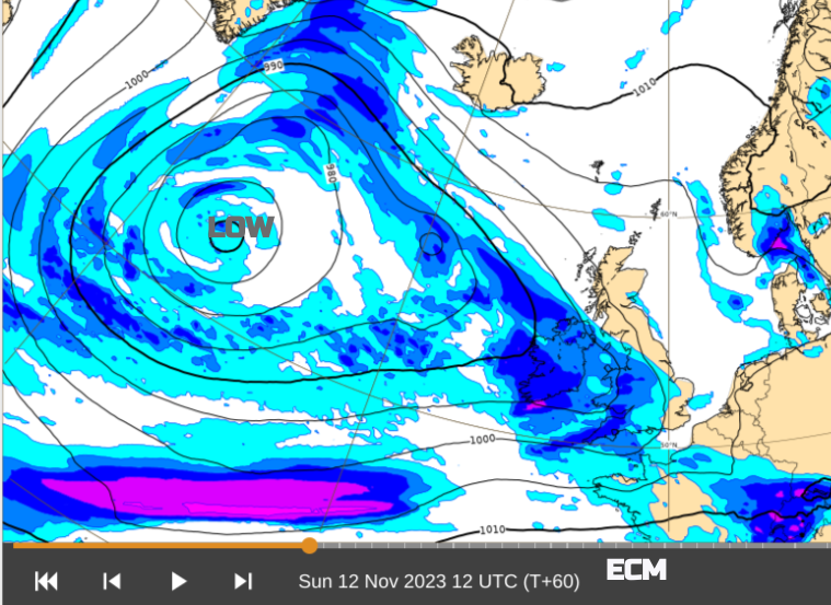
There will be rain from the southwest for Remembrance Sunday. This will be accompanied by blustery winds. The UKV model takes the rain up the Irish Sea with outbreaks for Wales and southwest England by late morning and for Northern Ireland. The ECM model pushes the rain across southern England more. Ahead of this, under clear skies, there will be frost and some fog to start Sunday 12th. It will be a cold start for much of Britain with only light winds, away from the southwest.
This wind and rain look to develop by Monday with stronger winds and more widespread heavy rain across the UK.