Hands up, who's already eaten more mince pies than they ought to have? I've had four today, I need so slow down!
Weather wise, we're seeing some stormy weather this week, but the very mobile Atlantic pattern does look like it may start to ease as we move toward Xmas, potentially leaving space for some more seasonal weather.
Santa Shaker! ⛄
We're now inside three weeks to Christmas Day, so the health warning can start to ease slightly - though there's still plenty of scope for the forecast to evolve. The ECMWF sub-seasonal model is beginning to lock onto patterns with more confidence, but translating those patterns into specific weather for the UK remains a little way off.

The regime chart above continues to show blocking (red) as the most likely outcome for Christmas, holding steady at around 38%. Meanwhile, the mild Atlantic-driven option (blue, NAO+) has dropped to just 18% - its lowest level since we started these updates. The Atlantic Ridge pattern (purple) sits at 16%, with "no regime" uncertainty at 22%.
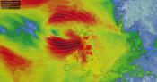
So what does this mean in practice? The pressure chart (below) shows a signal for higher than normal pressure over Scandinavia - slightly more pronounced than in recent runs. On the face of it, that's encouraging for cold weather fans. However, the position matters enormously.

Even if blocking does establish itself, it doesn't automatically mean snow or very cold air. The high could be positioned such that we see drier, brighter and chillier conditions rather than anything wintry. Or it could sit far enough east that Atlantic systems continue to clip western areas with milder, damper air. The devil really is in the detail at this stage.
So where does that leave us? The regime signal for a blocked pattern is as strong as it's been, and the Atlantic-driven mild option continues to lose ground. That's encouraging. But we're not yet at the point where we can say with any confidence whether cold air will reach the UK, let alone whether it brings snow. The next few updates should start to clarify the picture.
Give Santa a shake to find out the current chances of seeing at least a flake of snow in your region, and tune in later this week for the next update.


🎄 Next Update: Friday 12th December 🎅