
|
The Alternative Winter Forecast
During November a competition was launched on the Netweather community forums to find a member to produce the 'official' alternative winter forecast. Once a shortlist had been created by the forecast team, the winner of the public vote to go forward and produce the forecast was Chris Sittington (aka The Watcher), and this is the forecast he has produced: 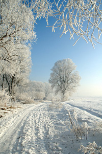 Welcome to the Netweather Alternative Winter forecast for 2008/2009.
Before we begin may I extend my greatest thanks to those who voted
for me in the competition and I sincerely hope you enjoy this forecast
as much as I did creating it.
Welcome to the Netweather Alternative Winter forecast for 2008/2009.
Before we begin may I extend my greatest thanks to those who voted
for me in the competition and I sincerely hope you enjoy this forecast
as much as I did creating it.As Winter 2008/2009 fast approaches I have been gathering data for the last month in preparation for the forecast and before I give you my conclusion let me just guide you through some of the interesting pieces of information I have come across during my research. Method 1 - Winter SST reduction (based on averages since 1971) As Islands the UK and Irelands weather is greatly influenced by the Surface Sea Temperature patterns in the Atlantic. So far this November has seen a quick reduction in SST's which were over the average during Summer and the start of Autumn 2008. As November draws to a close SST's are around 0.5c below normal to our Southwest, around normal to our North, East and West. However further to our West towards the centre of the Atlantic SST's are currently above normal by upto 1.0c. Looking at past SST anomalies for the Autumn season this time of year usually sees our SST's being slightly above Normal to our South and West, this year has been topsy turvy at the most times and as we head into Winter things look to remain slightly below normal in terms of Sea Surface Temperature. Method 2 - Jetstream Irregularities/Fluctuations "The jestream" another very influential part of our climate, prolonged spells of unsettled, dry, warm or cold weather depends on where it is located and how strong it is. The jetsream has remained either to our South or directly overhead on the run up to winter. This has helped enforce a block of High Pressure to our West forcing Low Pressure to its North on its Western flank and South on its Eastern side. This is favourable for cooler conditions as the last weeks of November have shown, but will it last. My conclusion will reveal more. Method 3 - Continental Cooling There has been alot of concern lately with this matter and many are right to be concerned, there has not of yet been a major cold spell on the near continent and especially further East in Russia, etc. This has an immediate effect on any early Easterly's. Will an Easterly occur early enough in the period of winter before any major cooling takes place?....read conclusion to find out. Method 4 - Sunspot Activity/NAO "Hale Winter" will be the phrase alot of members have heard or said lately and the big questions are what does this mean for winter 08/09 and what exactly is a "Hale Winter"? Put simply a Hale winter is the end of 2 sunspot activitys which reduces UV radiation in our atmosphere to a Solar minimum, this has immediate effect on the flow of the Jetstream due to inducing the reform of Ozone and in turn kicks the NAO into a more negative state, thus making winter cooler than normal. So far as we approach winter the signs are very strong for this to be on prospectus this year, NAO has been dipping negative more often than not and sunspot activity is indeed at Solar minimum. Hale winter indeed. Method 5 - Recent Winter Patterns and Averages Although recent winter patterns and averages are of no immediate effect on this winter it gives an idea of the extremes that can be produced during potent cold spells and therefore is a basis to work on. I feel it necessary to not use the phrase "modern winter" in my forecast nor any other forecast I produce, winter is winter no matter in what context. Looking at my findings it is extraordinary to see that the run up to this winter has produced more cold potential than any other year in the last decade. There is no doubt in my mind that the Autumn has brought alot of extremes to the table compared to many years beforehand, what once seemed to be our usual Autumn rut has change significantly and the bearing this has on winter will be noticeable. The Conclusion
December 1st - 14thWe can expect alot of variation during this period. To start the first week of Winter it will certainly feel wintry to begin with, temperatures will be well below average and at night will fall well into subzero in some inland areas, even during the day most areas will see temperatures only a few degrees above freezing. There is a risk of some dense fog patches early and late for inland areas. Precipitation will be moderate as some frontal systems move across central areas of the country and Ireland and this will be of Sleet or Snow. As we move into the middle of the week a front producing Sleet and Snow on its leading edge will introduce some milder weather from the Atlantic. This can be expected as a result of the Jetstream stabilising from our West which introduces a more Westerly airflow, and so as temperatures begin to climb to a normal or slightly above average state we see a return of atlantic depressions from the West. Rainfall to end the first week will be average to slightly above and this will begin the start to the new week.During the beginning of the second week a transient low will bring a short lived colder and showery spell producing some wintry showers for the Northern half of the country with temperatures poised to stay slightly below average for a couple of days, during the middle of the week this low will be replaced with Higher pressure to our Southwest which will gradually work its way Eastwards leaving the South mostly dry and mild, although Northern areas will be more unsettled and changeable with average rainfall and temperatures fluctuating between slightly above to slightly below average as Low pressure systems pass to the North of Scotland, this will mean some wintry days can be expected for the far North and hills, although these periods will be short lived. December 15th - 31st High Pressure to the South, Low pressure to the North means a divide of weather for the Northern and Southern half. Temperatures in the South will be slightly above average during the day and cold enough for frost at night, it will be mostly dry with variable cloud but some long sunny and clear spells. In the North a more unsettled period as rain bands move in from the NorthWest, some of these producing Sleet and Snow especially for higher ground. Temperatures will be slightly below average during the day but will not reduce much at night due to cloud cover. As we head through to the end of the third week in December the High pressure will begin to move NNE switching the divide to a West/East theme, this means Eastern and Central areas will be drier with temperatures normal for the time of year, but Western areas will see a more showery regime with milder temperatures. Into the new week and the all important Christmas week sees a period of unsettled weather moving East for the whole of the UK, strong winds and rain will sweep across the country to be replaced by cooler conditions during the middle of the week as a showery Northwesterly theme sets in. This means temperatures in the UK overall will be normal for the time of year and any showers will be wintry with snow on higher ground. As we progress a Northerly flow seems likely bringing colder conditions for all. Sleet and Snow will be widespread as we approach the end of the week and the end of December. The last weekend in December will see very cold conditions for Northern, Eastern and Central areas although Western areas will remain normal temperature wise, as will Southern areas. Snowfall can be expected for low levels at times for the North and East and particularly on hills, a wintry mix of showers can be expected for Southern and Western areas. In the last few days of December a band of rain preceded by sleet and snow will move across the country introducing a milder Western air flow behind it. January A mild start to January looks to be in place with an Unsettled theme for all parts of the UK. The first week will have above average rainfall and some windy conditions at times, temperatures will be above average in the South and slightly above average in the North. Low pressure to our West will be the bearer and this means bands of rain will move Northeast across the country and some of these could cause a risk of flooding, especially in the Southwest where they bear the brunt of the rainfall. To end the week the Low will centre itself over Scotland meaning a wet and windy period of weather can be expected with above average temperatures in the East and cooler temperatures in the West. The second week in January will start Unsettled with mild temps for the East and cool temps for the West. Precipitation will begin to turn wintry in the North and West as the Low progresses further Northeastwards. This means a colder North/NorthEasterly wind will bring below average temps for the Northern half and Normal temps for the Southern half. The low will remain to our Northeast for a few days meaning below average temperatures and some snowfall for Northeastern areas. Southern and Western areas will be drier but are still at risk of small amounts of wintry precipitation. Heading to the weekend this Low will move off to be replaced by a very deep area of low pressure from the Southwest. This will bring mild temperatures for the time of year, a very windy spell of weather especially for Southern and Western areas and some very wet conditions again introducing the risk of flooding for Southern and Western areas of the UK. As the centre of the low passes to the South of the UK Southern areas will remain Unsettled to end the week as Northern and Western areas see a High pressure system to our West and building pressure to our Northeast bring drier cooler conditions with frosty nights and sunny but cold days. To start the third week high pressure to the West of the UK will push Southeastwards introducing drier weather to the whole of the UK with the exception of the far North where Low pressure begins to push Southwest.This will mean unsettled weather will be reintroduced to Western and Northern areas with the South and East somewhat drier and more settled. Temperatures in the South and East will be Normal for the time of year and will be slightly above Normal in the North and West. As we push through to the end of the week this theme looks to remain with the North and West remaining unsettled with bands of rain at times and the South and East staying drier with just a few showers. Into the end of January and the settled weather in the South and East will be short lived as a deepening area of low pressure to the West pushes across the country, mild temperatures for all to begin the week with strong winds and exceptional rainfall but as the low pressure pushes through it will become centred on the North Sea meaning a Northerly flow will be well established to end January. This means a potent cold spell is on the cards for several days and widespread snowfall can be expected, although Southern areas will see rain/sleet mostly at lower levels. February A cold and wintry start to February with snow showers in most areas, temperatures will be close to freezing during daytime and well into subzero at night. As we progress high pressure will begin to nudge in from the Southwest bringing cool sunny days and some very cold frosty nights, to the North and East it will be colder with a continuation of wintry showers and more often than not cloud cover. The High pressure will introduce drier weather to the whole of the UK as it moves further East, it will then progress Northeasterly introducing a Southeast/Easterly airflow. This theme will remain for quite a while meaning colder air from the continent will have time to settle. Eastern areas of the country are at risk from some heavy snowfall and as the days progress, this threat will move further West. For more Central and Western areas it will be drier but very cold with some severe frosts early and late. Into the middle of the month we will see milder conditions spread from the West bringing a return of an unsettled and windy theme to the North, South and West. The East will then follow as rain pushes through and a mild Southwest/Westerly air flow will dominate for the next week. This means a barrage of Low Pressure systems will bring wet and sometimes windy conditions to all areas and temperatures will be slightly above normal for the time of year although Northern areas will see transitional periods as the Lows pass through meaning short Northerly blasts will introduce short lived wintriness with wintry showers in strong blowing winds. As we head to the end of the month the Unsettled period looks to continue with again transitional snowfall for Northern areas, although to the very end of the month a Northeasterly airflow will begin to introduce a colder theme to Northern and Eastern areas at first with some significant snowfall for the Northeast of Scotland. This looks to progress Westward and bring some late Winter snowfall to many areas. |


