Plenty of sunshine and warm temperatures into early next week, but it won't last as wet weather arrives by Wednesday
We move into the final full week of July with further varied summer weather on the way. In keeping with the month as a whole, the start of the coming week will provide some pleasant conditions. Bright or sunny spells will develop for many, and it will be pleasantly warm. After that and, yes, you guessed it, the wet weather soon returns from mid-week onwards. In what has been a very ‘topsy turvy’ month for much of the British Isles, this often changeable weather will continue.
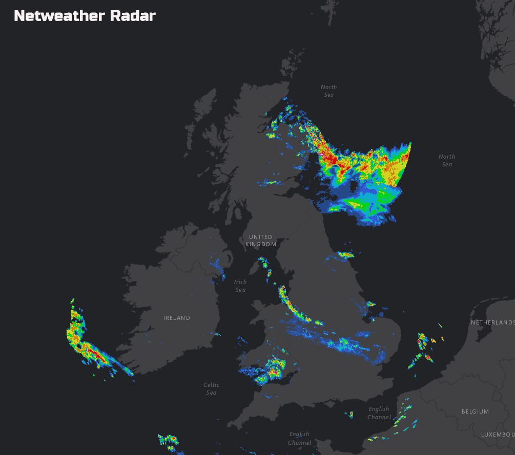
However, back to the here and now and we still have a troublesome low-pressure over the country. The low was responsible for producing some downpours on Saturday, with some localised flooding in places too. There is already some showers across parts of Wales and the Midlands, along with some longer spells of rain approaching the far south-east of Scotland and NE England too.
Today
Through the rest of Sunday and emphasis, for England and Wales, in particular, is on sunshine and showers. The showers will readily develop through the remainder of the morning and into the early afternoon, some of these becoming heavy once again. A few isolated thunderstorms can’t be ruled out either, these perhaps most likely across parts of N England and down into the Midlands around the middle of the afternoon. At the same time, some longer spells of rain will develop across NE England, and this is then filtering down into N England with time, replacing the showers from earlier in the afternoon. As a result, a particularly wet spell of weather will, unfortunately, develop across N England as the day progresses.
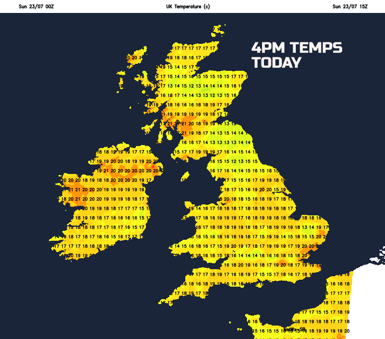
It won’t be wet every mind and for much of northern and western Scotland, along with Ireland, parts of Wales and SW England then some decent spells of sunshine is forecast, while also being relatively dry too. It is across these areas that some of the highest temperatures will be today. W and SW Scotland may well see temperatures up to 21C or 22C, locally, similarly for parts of Ireland. In contrast though, as you’d expect, it will be cooler beneath any showers and particularly beneath the more persistent rain across N England.
Tonight
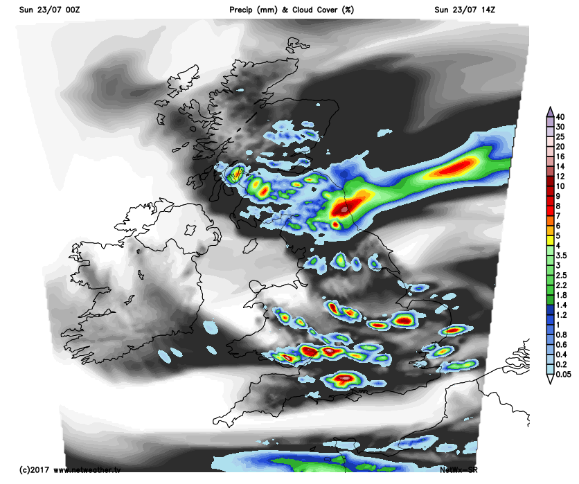
Into Sunday night and the wet weather across N England will slowly move south and east, leading to a cloudy and damp night for many central and eastern areas of England. The intensity of the rain though will ease, with mainly light or locally moderate rain present by the end of the night. A drier and clearer night elsewhere though, locally quite chilly as well across parts of Scotland and Ireland.
Next Week
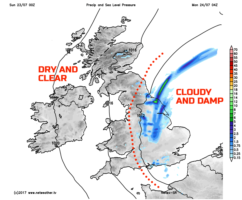
So, we move into the final full week of July, and the good news within the short term is that the start of the week will see increasingly fine and settled conditions develop. However, there will be an ongoing risk of some patchy rain or showers across parts of E England throughout Monday. No heavy rain is forecast, but it will lead to a cloudy and damp start to the week here. Elsewhere Monday will be a pleasant late July day with mainly dry weather dominating along with some bright or sunny spells too, especially across parts of Scotland, Ireland, Wales and SW England.
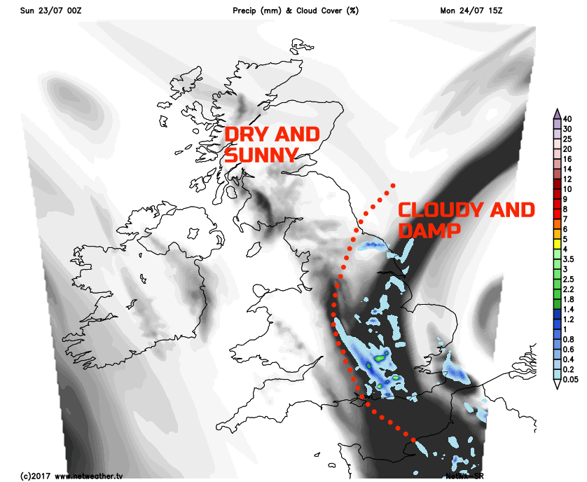
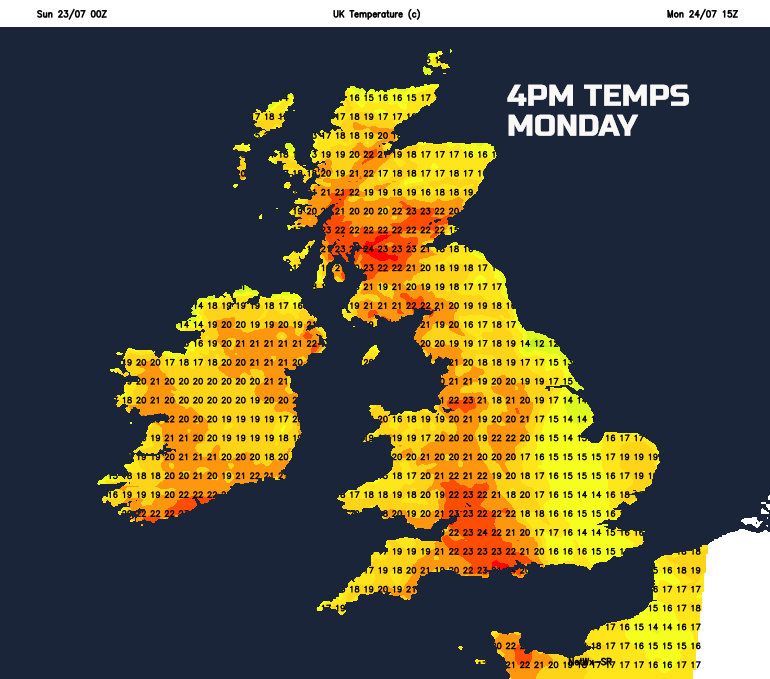
It will, for some areas of the British Isles, be quite a warm start to the week as well. Despite a light or moderate N’ly breeze temperatures across parts of S Scotland and NW England, for example, will rise to near 23C or 24C, so feeling very warm locally. It will, of course, be cooler across more eastern areas of England, beneath the rather cloudy and damp conditions.
As we look further head through next week and a small ridge of high pressure will bring another dry day, for most, during Tuesday. A few scattered light showers may crop up in places through the afternoon, but otherwise, another sunny and warm day will develop. However, like of late, just as the drier, brighter and warmer weather arrives, it is then replaced by more unsettled conditions, and that’s what is forecast to happen by Wednesday. A low-pressure system will move into the British Isles off the Atlantic to spread wind and rain eastwards across many areas mid-week. Some heavy rain is certainly possible, especially across more northern and western areas in particular. This wet weather will also coincide with a drop in temperature and the second half of the week will most certainly be cooler than the opening few days.
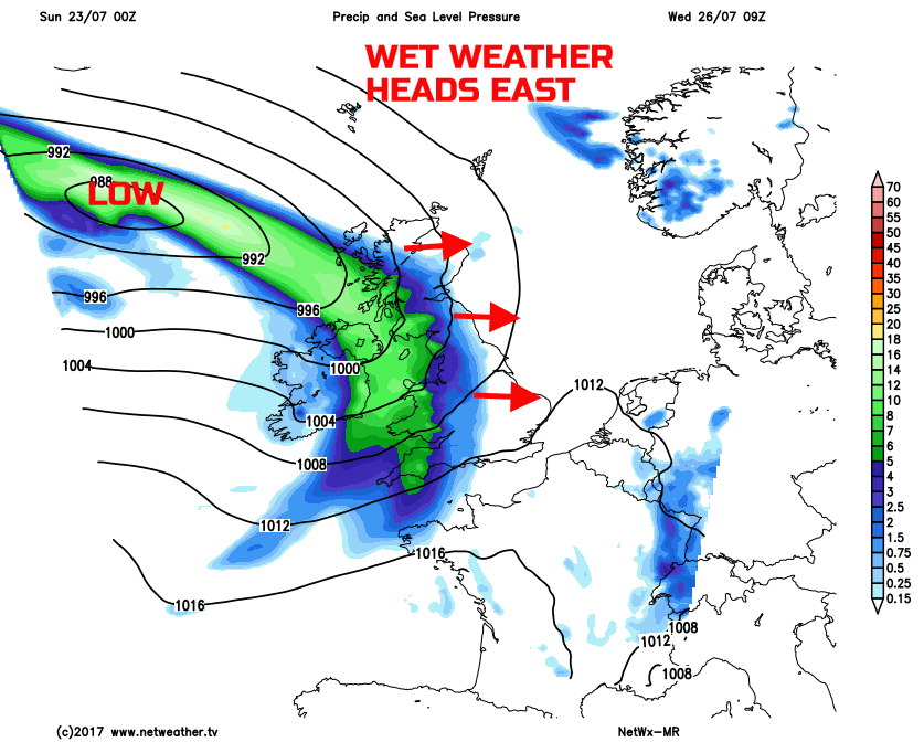
The low pressure responsible for the wet weather mid-week is then forecast to linger and maintain further unsettled weather to end the working week as well. So, with the summer holidays upon us, if you’re looking for some sustained warm and summery weather then, unfortunately, the rest of July is unlikely to deliver. There is, of course, plenty of the summer left to come, but for the foreseeable future, some rather ‘typical’ British summer weather will continue.