
After a cloudy, humid and, in places, wet start in the east, drier, fresher and brighter conditions spreading from the west today. Unsettled with risk of rain Friday and over the weekend, as low pressure takes centre stage.
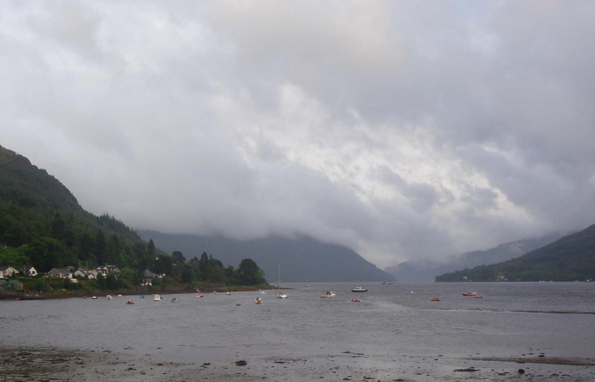
Wednesday was a warm and humid day for many, though it was rather cloudy too, which supressed temperatures from what they could have been if the sun did come out. However, the sun did come out across parts of eastern England, with Cromer in Norfolk reaching 27.8C. It was a different story in the west though, with an area of heavy rain and thunderstorms moving in from the Irish Sea bringing flooding to parts of north Wales, with 40mm falling in Rhyl, before the storms moved on across northern England.
If you don’t like the very warm and humid weather, the good news is that it will turn fresher from the west today across all parts. However, the weather will remain changeable and unsettled at times as we end the week and go through the weekend, as low pressure takes charge. All areas will see spells of rain or sunshine and showers over the coming days and it will be breezy too, so perhaps not the best start to the school summer holidays for many.
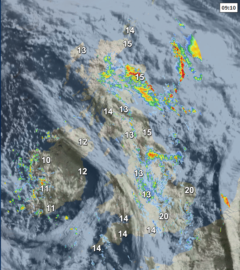
For now, there is contrast from east to west in temperatures and feel, with a humid 20C across SE England – while across parts of Ireland and N. Ireland it’s a fresher 10C. The fresher and brighter conditions moving in across the west this morning will eventually move east across all parts this afternoon. But for now, it’s a cloudy, muggy and damp picture across much of England and eastern Scotland. There are some heavy bursts of rain across central, northern and eastern England along with eastern Scotland, perhaps bringing the odd rumble of thunder in the northeast of Scotland.
The cloud and showery rain across central and eastern areas will eventually clear away later this morning and through the afternoon, replaced by drier and brighter conditions moving in across SW England, Wales and western Scotland this morning. So, most this afternoon will be dry and sunny but it will feel notably fresher in the brisk westerly breeze. The exception will be across N. Ireland, where after a dry and bright start, showers will develop, perhaps turning thundery locally. Scotland could see some scattered showers too and we may still hang on to some thundery rain across the far northeast and Northern Isles.
So, with the fresher conditions moving in, temperatures down on recent days, reaching 14-17C at best across Scotland and N. Ireland, reaching 18-20C across England and Wales, perhaps 22C across SE England and East Anglia.
An area of low pressure will move in across Ireland tonight, bringing windy conditions with frequent showers or longer spells of rain here, N. Ireland and eventually across Wales and western areas of England through the night. Drier across eastern areas of England and much of Scotland, though some rain across the far north of Scotland.
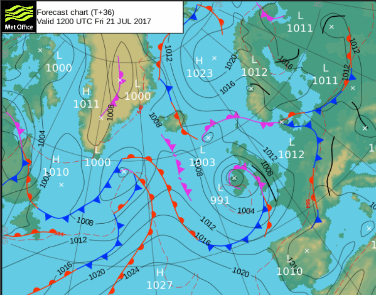
A slow-moving area of low pressure out west will continue to deepen across Ireland on Friday, so it will be a wet and windy day across SW England, Wales, N. Ireland, NW England and southern Scotland. Probably staying mostly dry and bright across eastern England, central and northern Scotland. Temperatures a little higher than today, as winds turn southerly, reaching 19-23C where it stays dry and sunny, 17-18C where we see the rain.
A disappointing start to the weekend, with a fairly deep area of low pressure for the time of year lurking close to the west on Saturday bringing windy conditions with a band of rain spreading north and east across northern and eastern Britain during the morning, followed by brighter but showery conditions from the southwest into the afternoon, some of the showers heavy with thunder. Temperatures reaching 16-19C generally, perhaps 20-21C in the southeast.
Sunday may see some persistent rain affect eastern Scotland, otherwise it looks like it will be a day of sunshine and showers, though probably fewer showers than Saturday and some western parts could escape with a dry day. Winds will be lighter too, so feeling a little warmer perhaps, temperatures reaching 17-20C, perhaps as high as 22C in the southeast.
Early next week looks largely dry and bright bar the odd well-scattered shower, as low pressure moves away to the east and high pressure builds in from the west, though with a cool north or northwesterly flow. Perhaps turning unsettled again from mid-week, as low pressure returns from the Altantic.


