Wet across a good part of England and Wales today, sunshine and sharp showers further north.
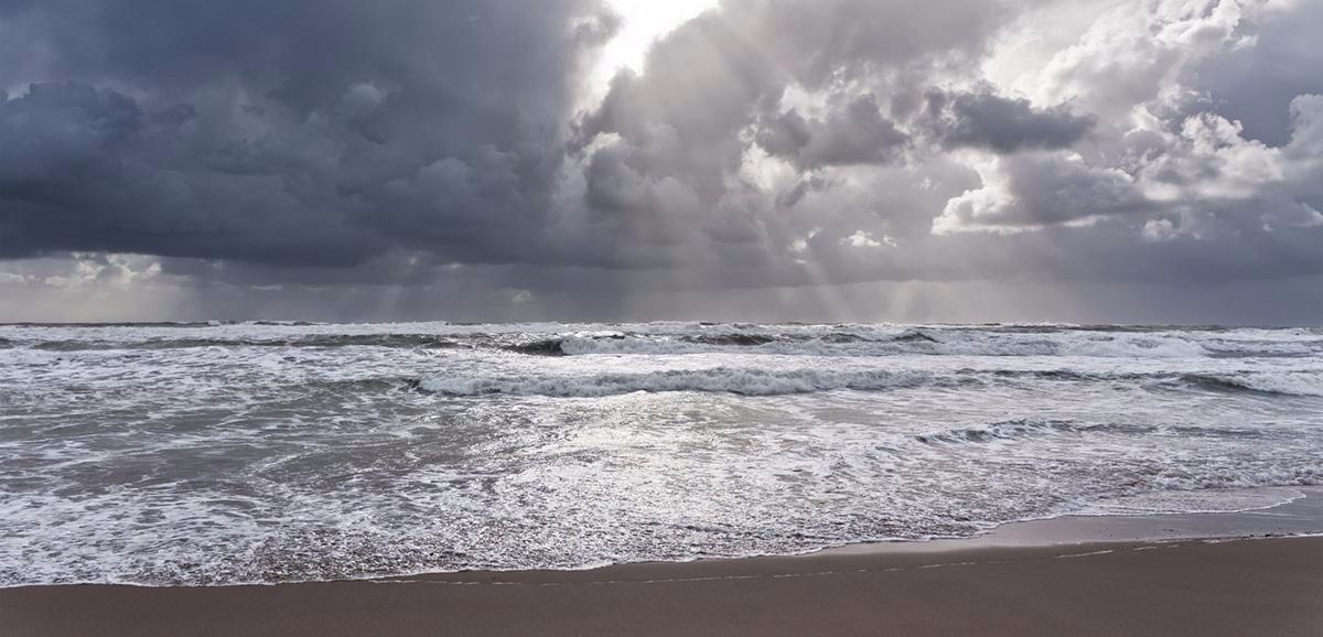
For the first time in a while, we have widespread wet weather affecting a good part of the country today.
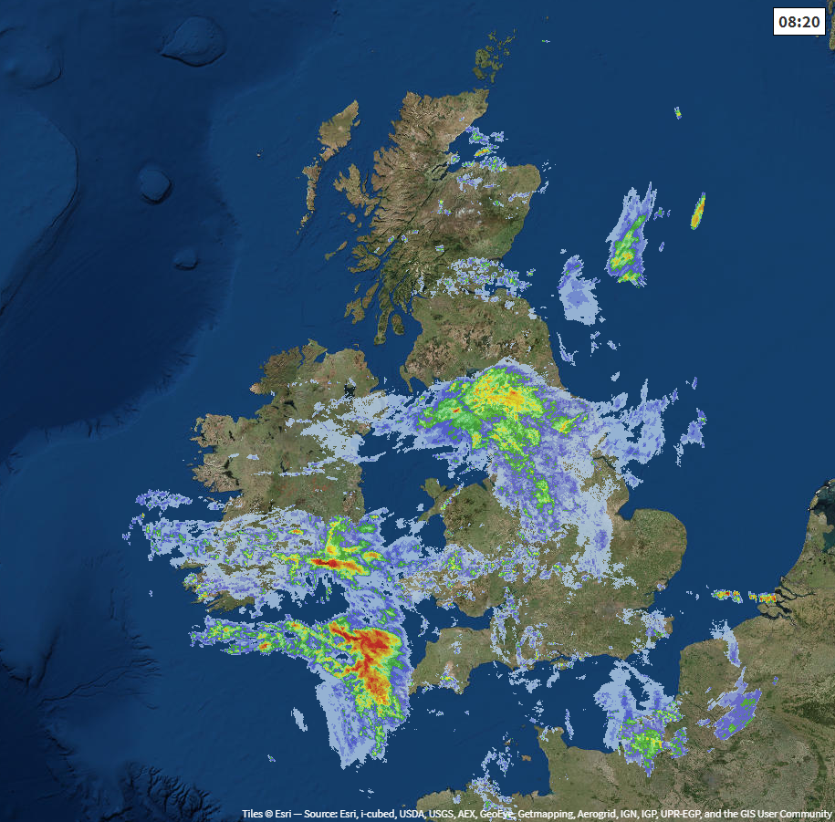
To start the day, it's northern England catching the brunt of it, as you can see on the radar image below. But some heavy, persistent bursts of rain are going to be moving their way in from the west into southern England and Wales.
Stay up to date with the latest radar here.
To the north of the more persistent wet weather, while you're going to see the best of any sunny spells today, you're not going to be getting away scot-free. There'll be some sharp, and at times thundery showers around - not all will catch one, but if you do, it's liable to be quite lively. The same applies to Ireland once the more general rain this morning has moved through.
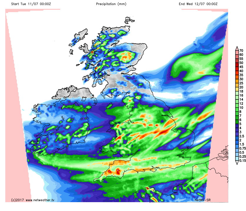
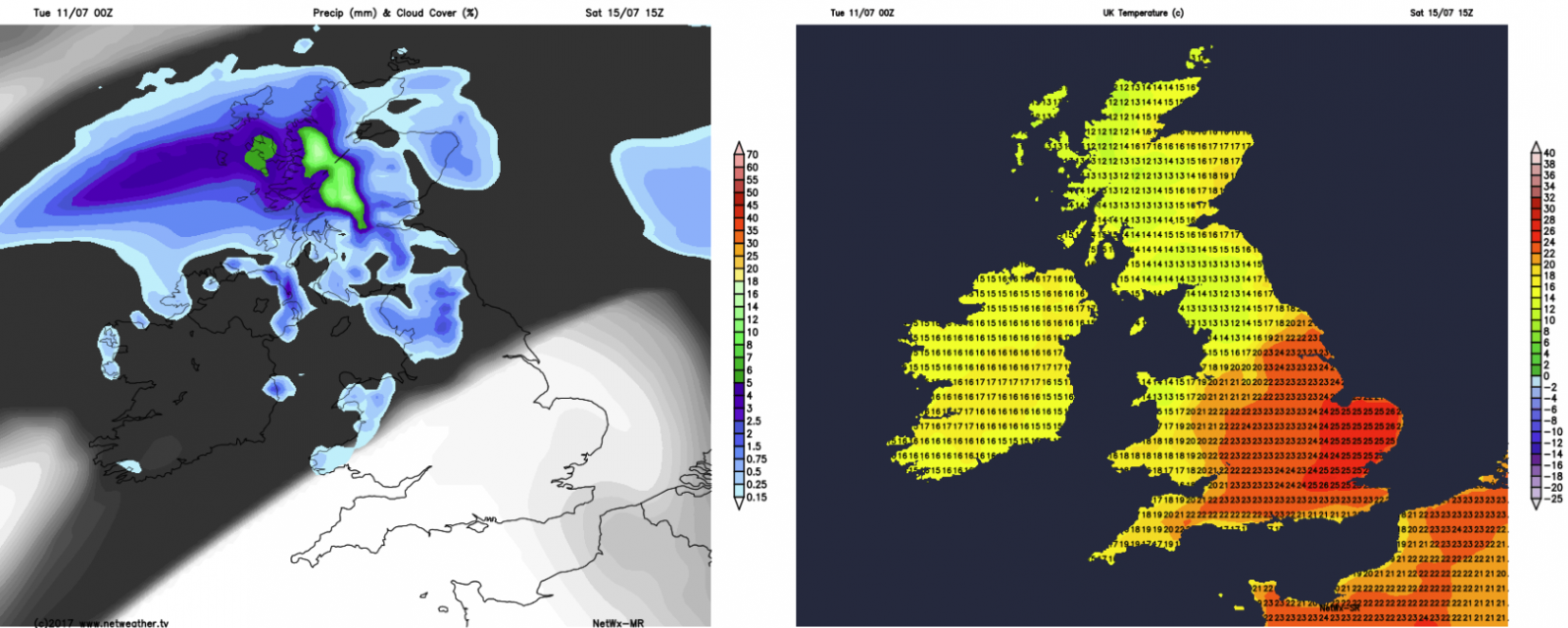
They say a picture says a thousand words, and the rainfall total map for today tells the story nicely. Persistent rain affecting a good part of the southern half of Britain showers more hit and miss elsewhere.
This evening and overnight the showers in the north will clear more quickly than the rain in the south, where it'll take into tomorrow morning to finally be away from the southeast. It'll be a quite chilly night across the northern half of the country as well, with temperatures widely down into single figures, perhaps even low enough for a touch of grass frost in the sheltered glens of Scotland. Further south, under the cloudier skies, it'll stay milder.
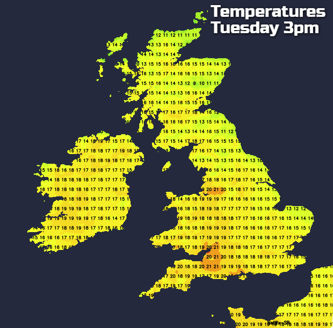
Tomorrow will be a very different day. Once the last of the rain has moved away from the southeast corner, all parts will enjoy some good spells of sunshine with just the odd shower in the north and west. A cool north wind will be noticeable in eastern regions, especially to start the day, but this will ease down as the day wears on. What it will do is keep a lid on temperatures in the east though, with more sheltered western and central regions enjoying the warmest temperatures which'll just sneak into the low-twenties.
A fresh night follows on from that, then into Thursday, it's a similar day with plenty of bright or sunny spells about. There'll be two subtle changes though. Firstly, there'll be some more showers around, though they'll still be fairly well scattered even so. Secondly, it'll be warmer in eastern parts as the wind will have switched to the southwest. For the bulk of the country, temperatures into the high-teens or low-twenties can be expected.
As we close out the week, little changes initially with another day of sunny spells and a few showers. Rain will be making its way into the northwest later though, and that's the start of what'll become a north-south split over the weekend. Further north there'll be cooler conditions, with some rain at times. To the south of that, it's drier, sunnier and increasingly warm, with the mid-high twenties beckoning again for central and southern England.
So after some disruption today, the prospects at Wimbledon will be on the up, with the likelihood of some warm, if not hot sunshine again for finals weekend.